Ministry of Flat Walks 09 : Tilberthwaite and Hodge Close
9 April 2018
To follow this walk on a map, open a new tab on your browser and input this web address: https://bit.ly/2ExDerp.
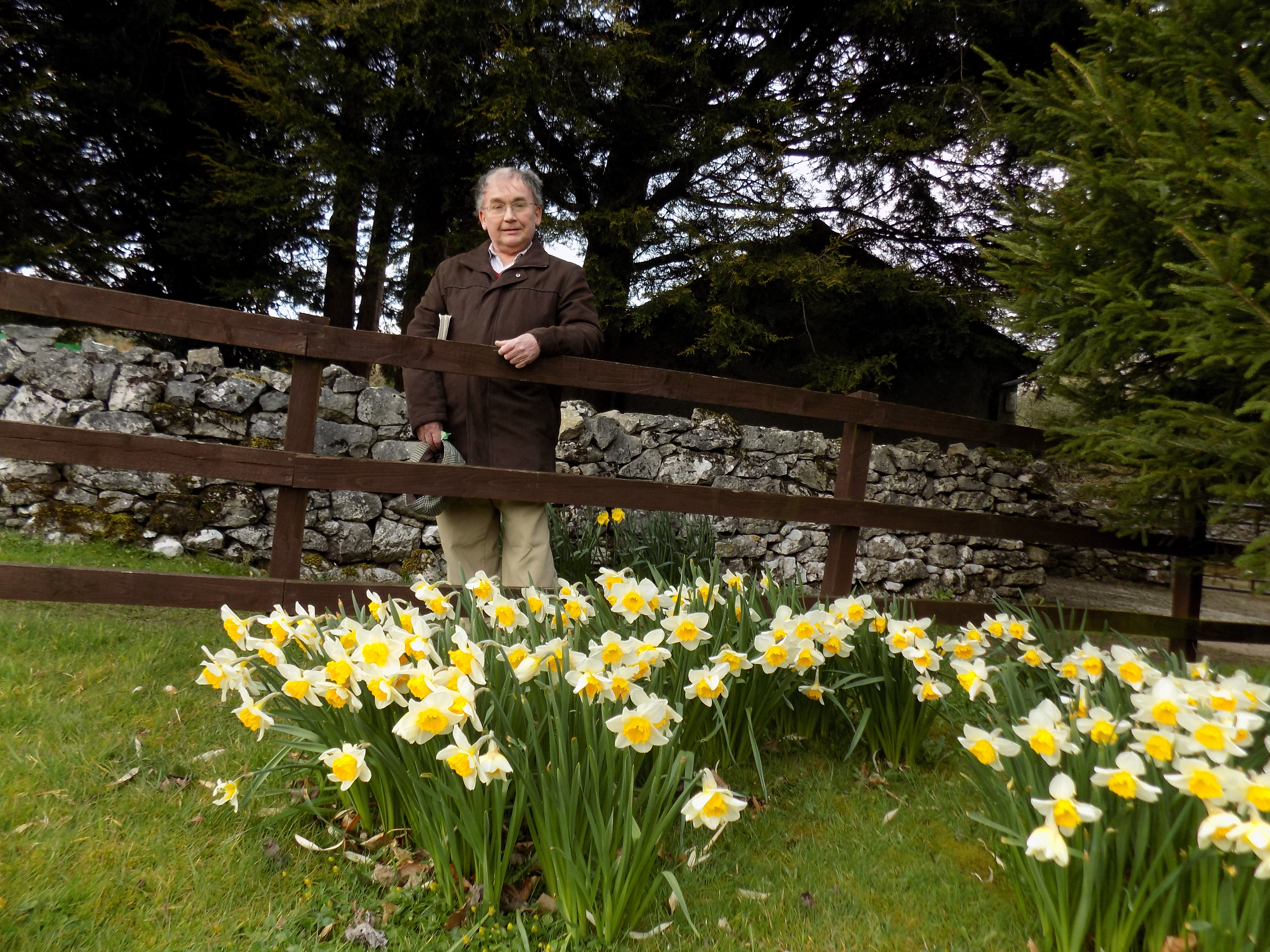
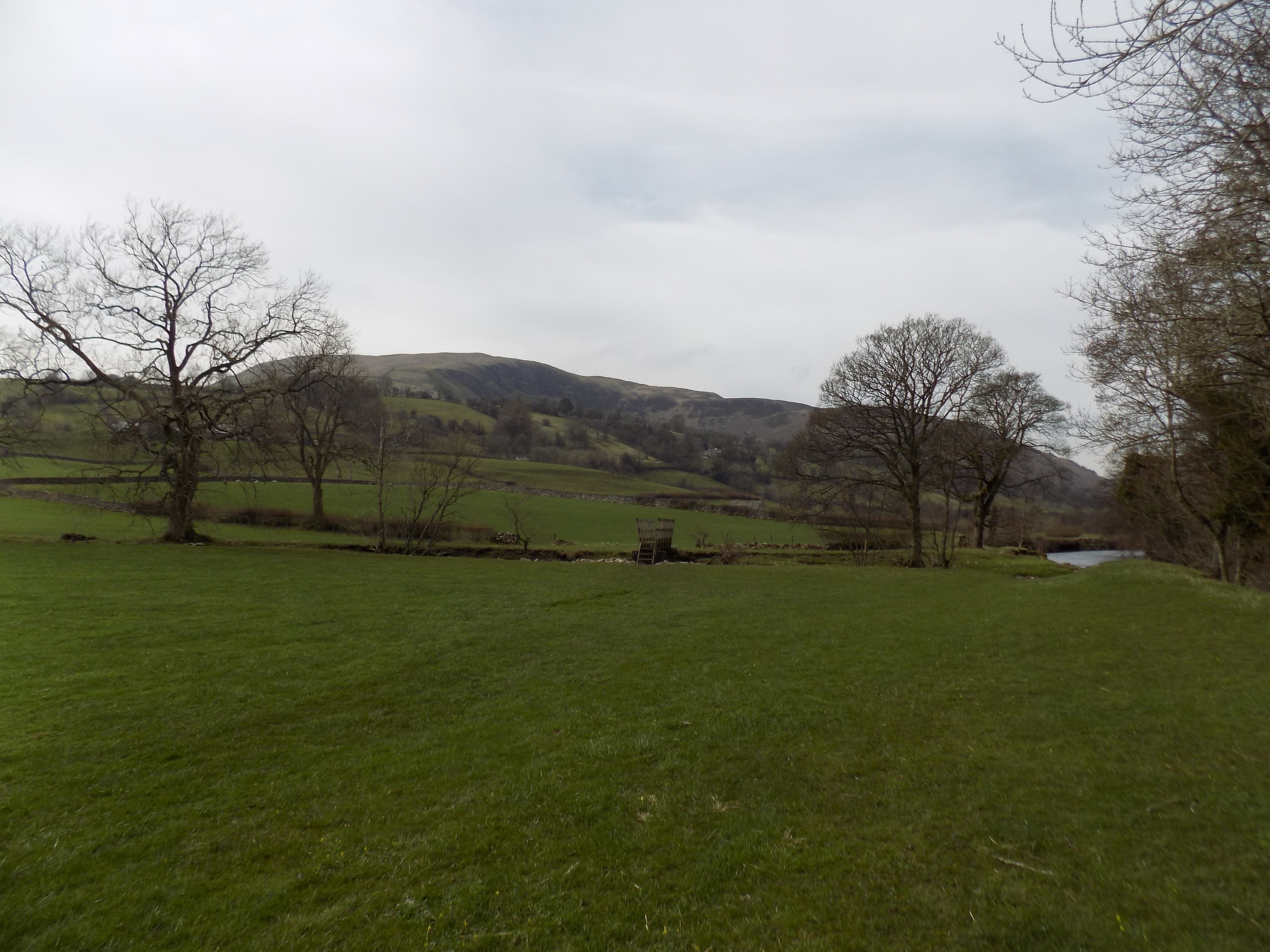
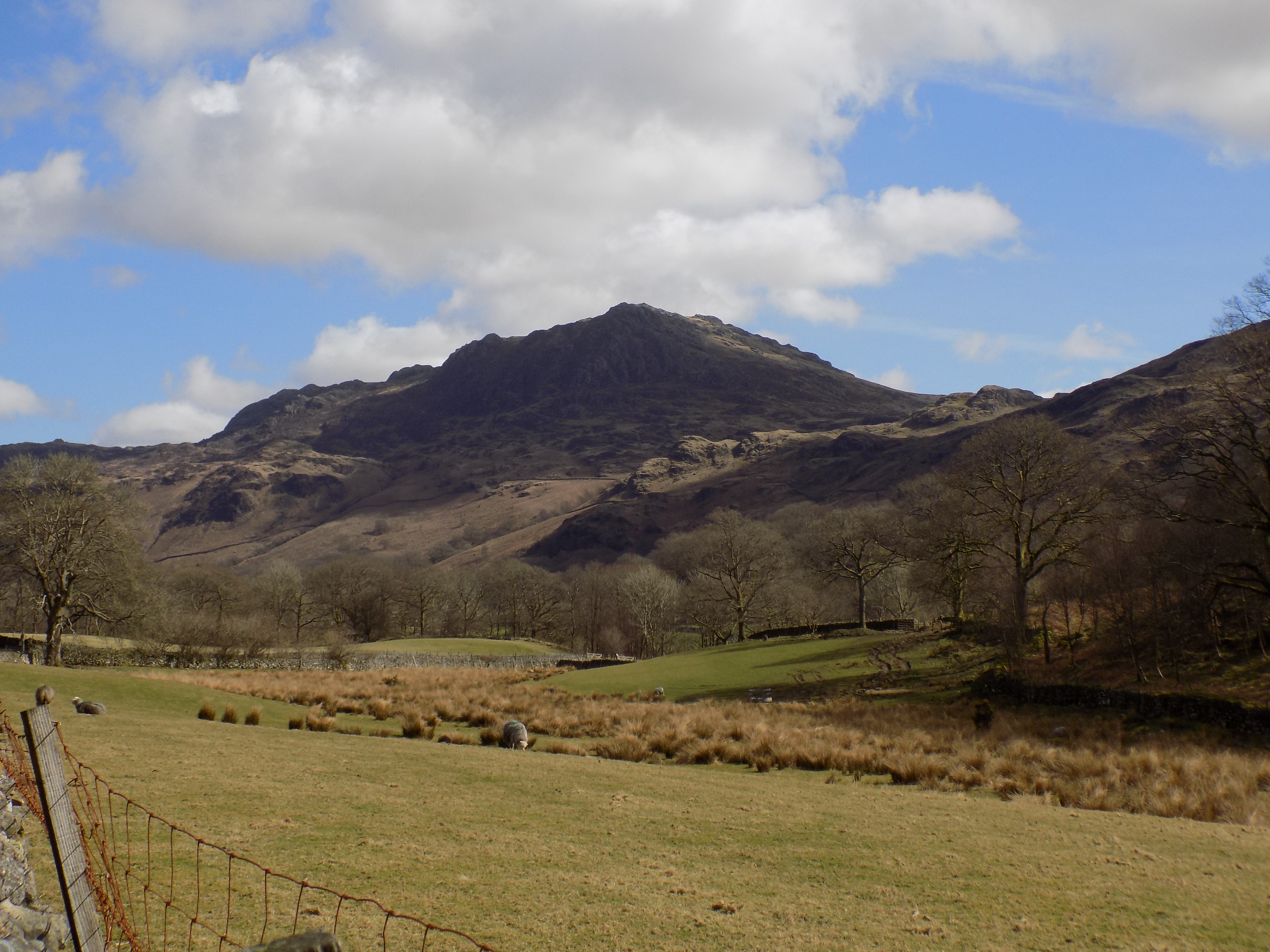
This was the last walk of a successful week’s holiday at Cark for John and me. The morning opened dull and wet, but we put our faith in the Met Office’s forecast and once again it was not misplaced: the skies cleared and by mid-afternoon we had watery sunshine. The walk was a favourite of Mum and Dad, and I like it too, as it is right in the heart of the Lake District but in a tucked away corner which the guide books tend to overlook. Just as well. The approach roads are narrow and parking space is restricted.
The main drawback of this walk is that it is not really flat at all. There is one quite strenuous climb which I had to take very gently, and almost the entire route is up and down over the lower ribs of the hills. To make up for this it is quite short, only about three and a half miles, though there are longer options for the masochistic; and the paths are well made, stone and gravel, all the way round. You may well meet cyclists or runners, singly or in groups, though they don’t usually stop to chat.
Tilberthwaite
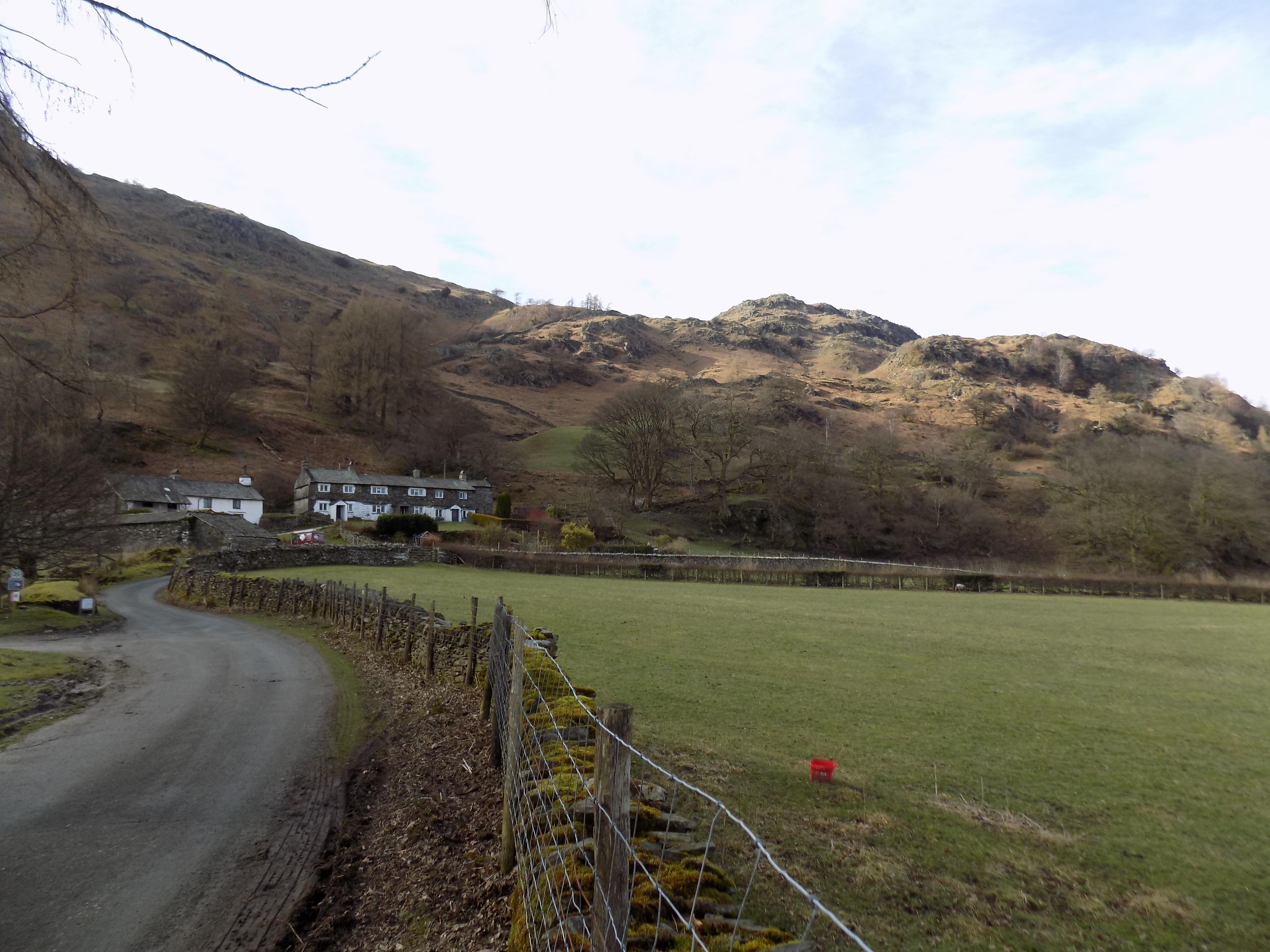
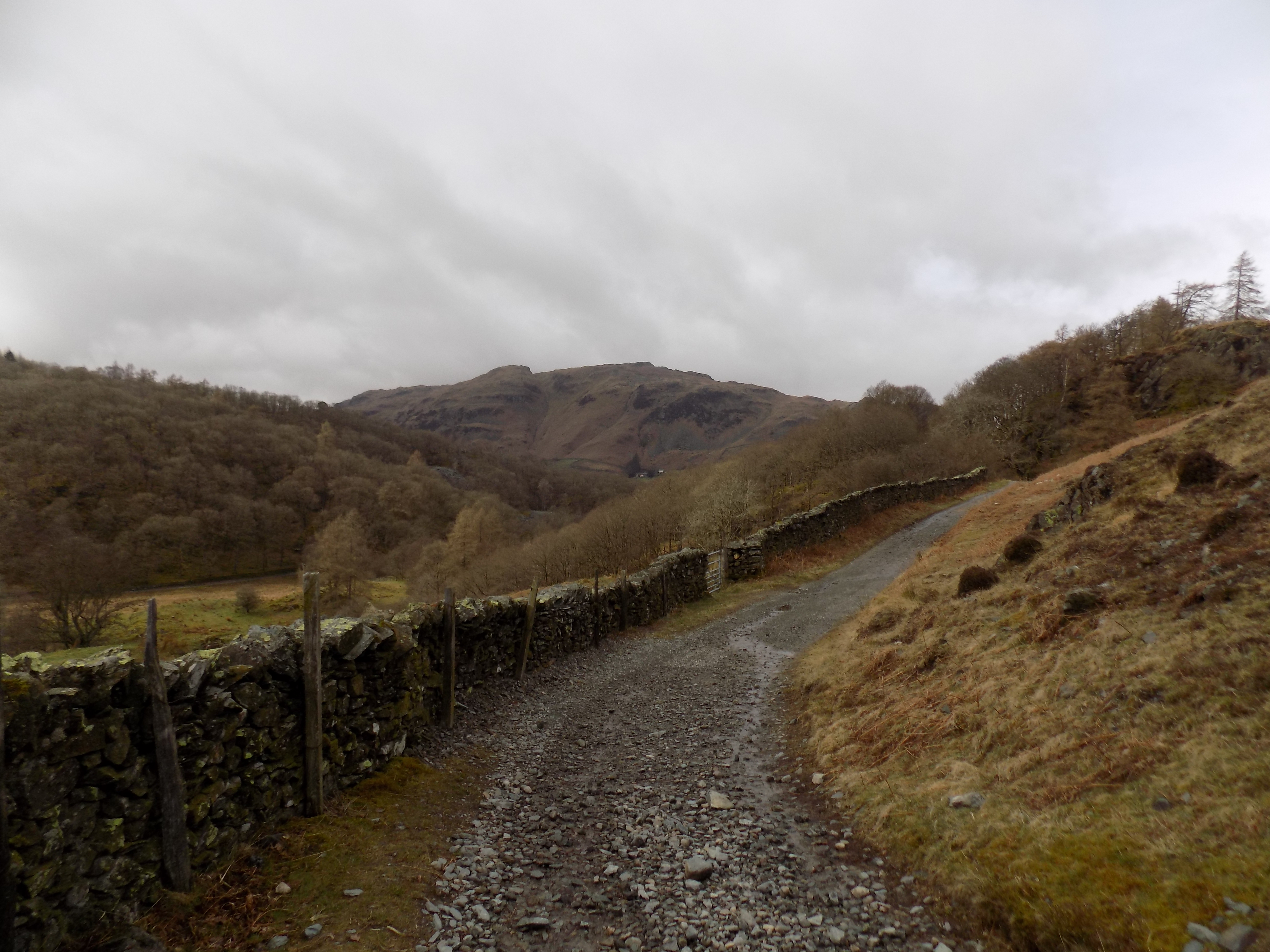
Tilberthwaite is at the head of a minor road which leads off the A593 Coniston to Ambleside route. To see this, scroll the map downwards a bit. Just beyond the Tilberthwaite turning is another which leads up to Hodge Close, and you can in fact do this walk from either place, but the Tilberthwaite road is less difficult and offers a better place to leave your car.
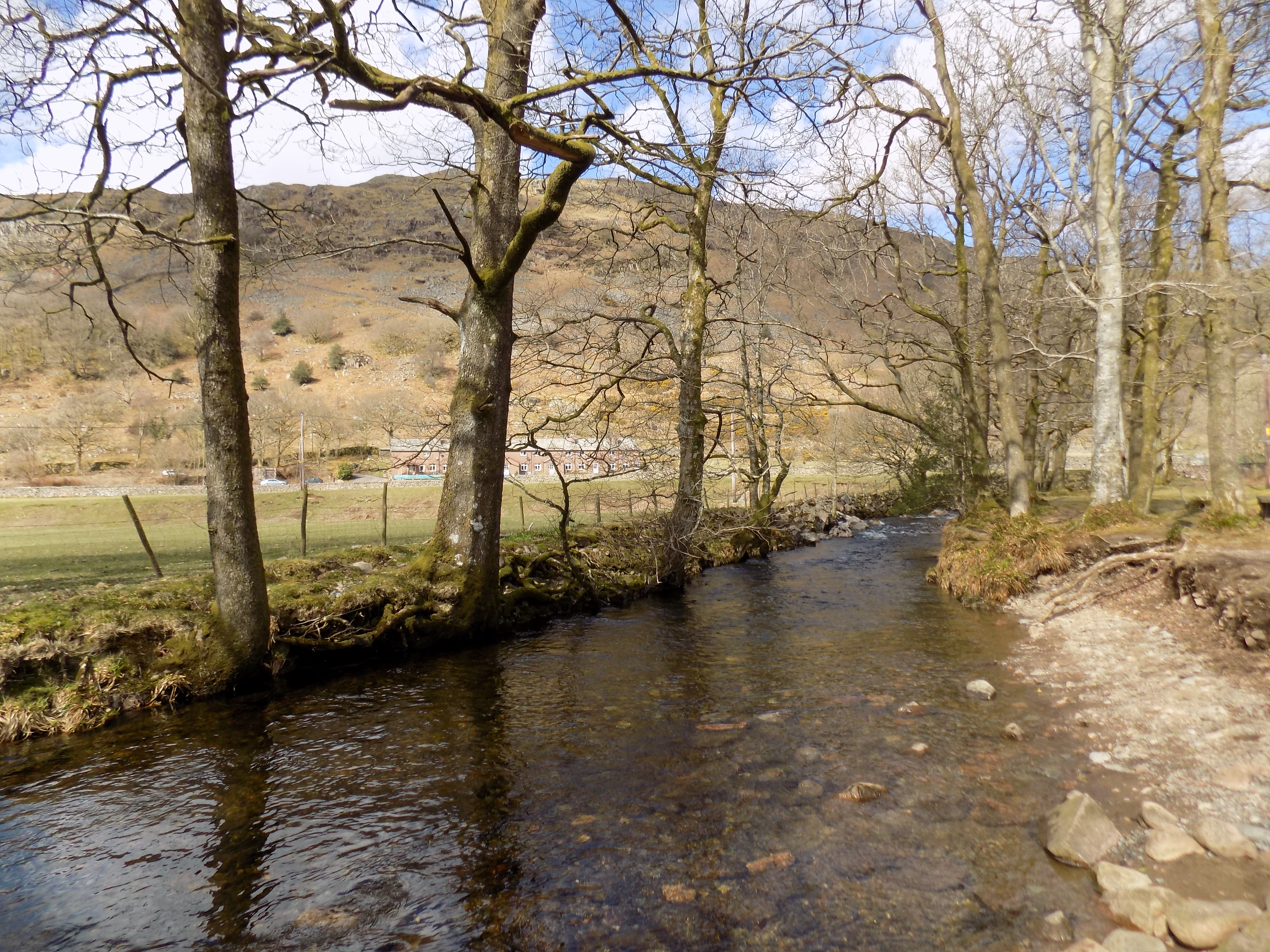
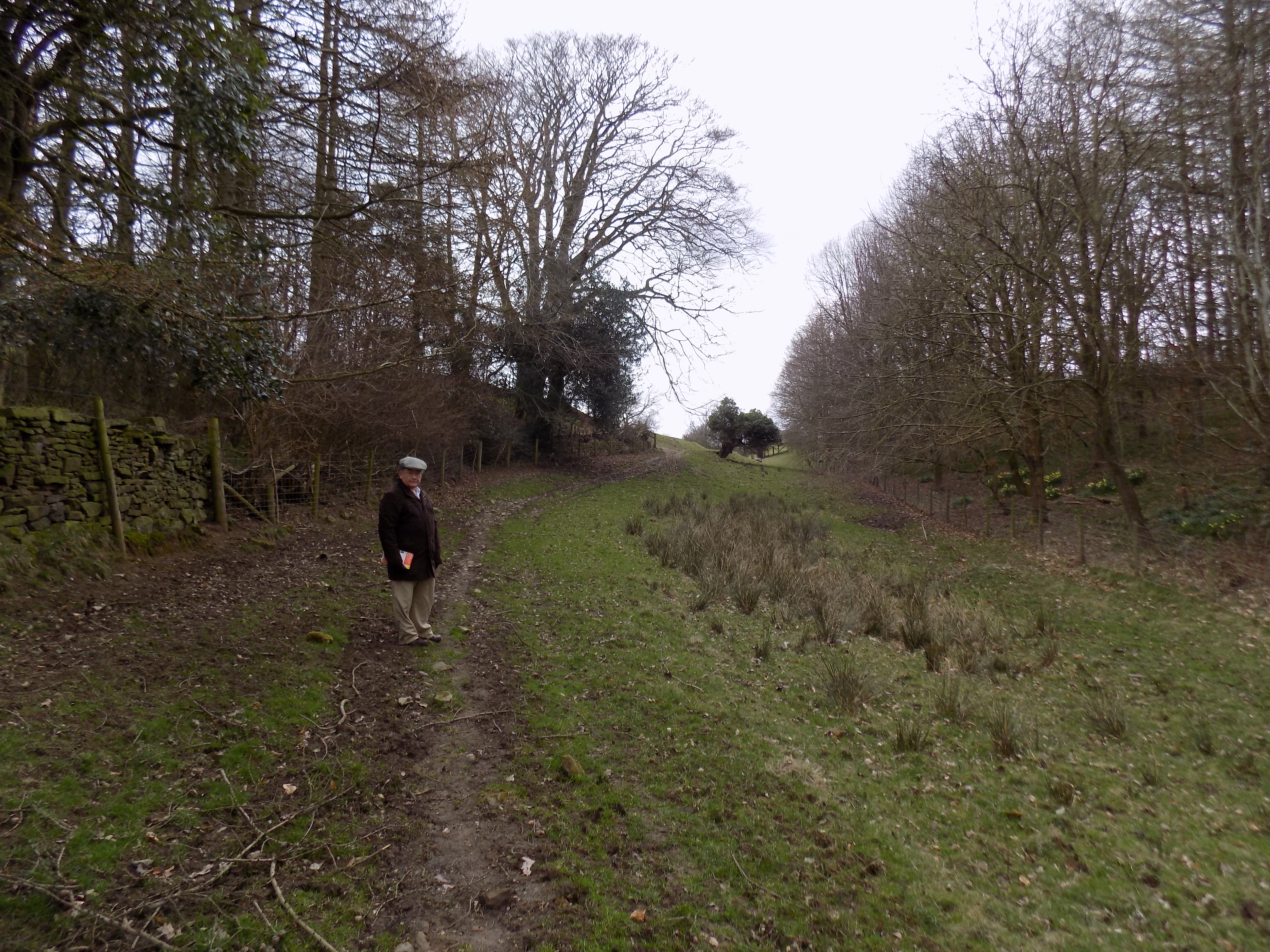
You start from the parking space at Tilberthwaite, marked near the bottom left corner of the map. Follow the road up to High Tilberthwaite farm and go through a gate on to the bridleway (green dashes on the map) which goes to the right of the hill. You will see another path climbing over this hill which John and I once followed, a couple of years ago. It is steep and rough, a hard climb, though the views from the top are good. On that occasion we were astonished on our way down the far side to see some people in an ordinary car, not a 4×4, attempting to follow the track. Goodness knows what damage they did to their vehicle: the surface is rough and deeply pitted in places, so that even a farmer on his tractor might have second thoughts. We didn’t stay to find out.
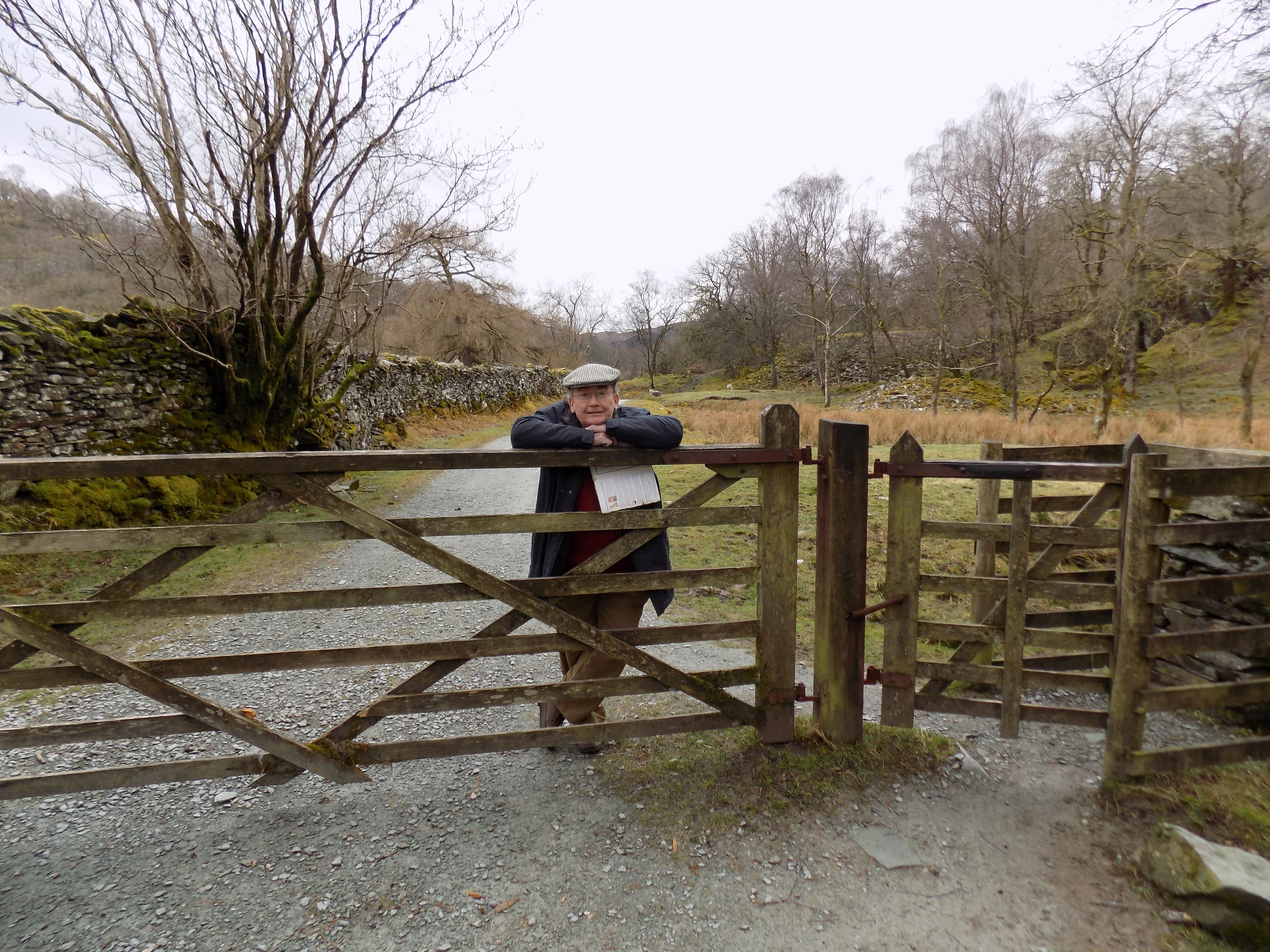 Go that way (on foot!) if you must, but the bridleway is a whole lot easier. About two thirds of a mile beyond the farm you will see another path leading off to the right. Take this path, but don’t be fooled by the fact that it starts downhill. You are crossing to the other side of the valley, and soon enough you will come to the steep section I mentioned earlier. The path leads up to the cluster of buildings at Hodge Close. We noticed one very nice new slate building here, obviously someone’s holiday getaway: modern furniture and fittings clearly visible through the uncurtained windows. No-one at home when we went past. But what a struggle to get there.
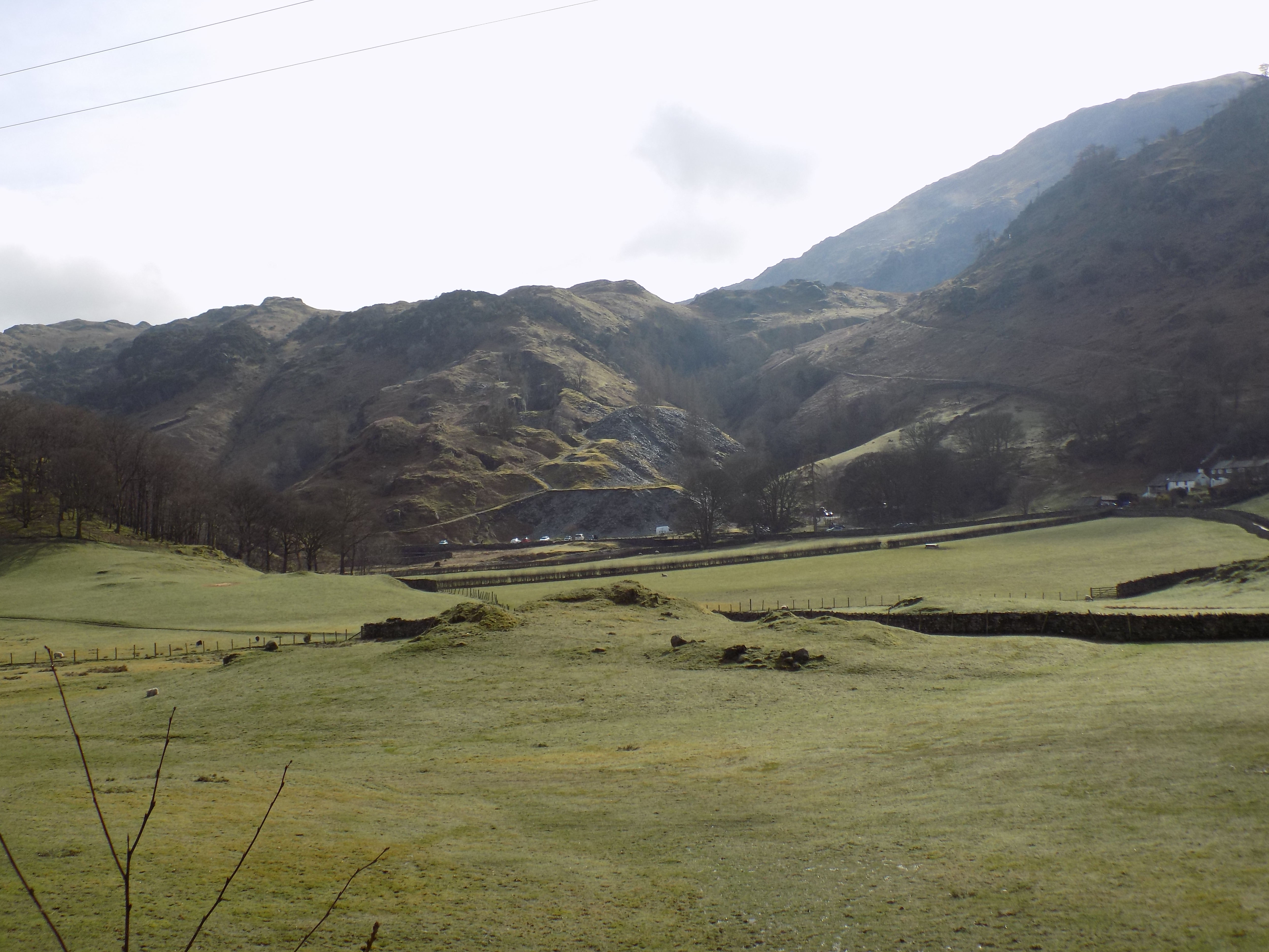
If you were to turn right here and go up the road for a short distance you would come to a kind of plateau overlooking a disused quarry, now a deep, inaccessible and slightly sinister pit. In fact this whole area is full of disused slate quarries. You can see the scars on the landscape everywhere, though nature is gradually reclaiming the spoil heaps, first with a variety of greenish-yellow mosses and then with spindly trees. Judging by a notice we found on a fence post at Hodge Close, and by some trucks we saw on one of the spoil heaps, someone is now taking away some of the waste material, presumably for use in building elsewhere. But you would have to build several housing estates if you wanted to use it all. There is some parking space on the plateau but nowhere else for some distance along this road, which is why we now prefer Tilberthwaite as our starting-point.
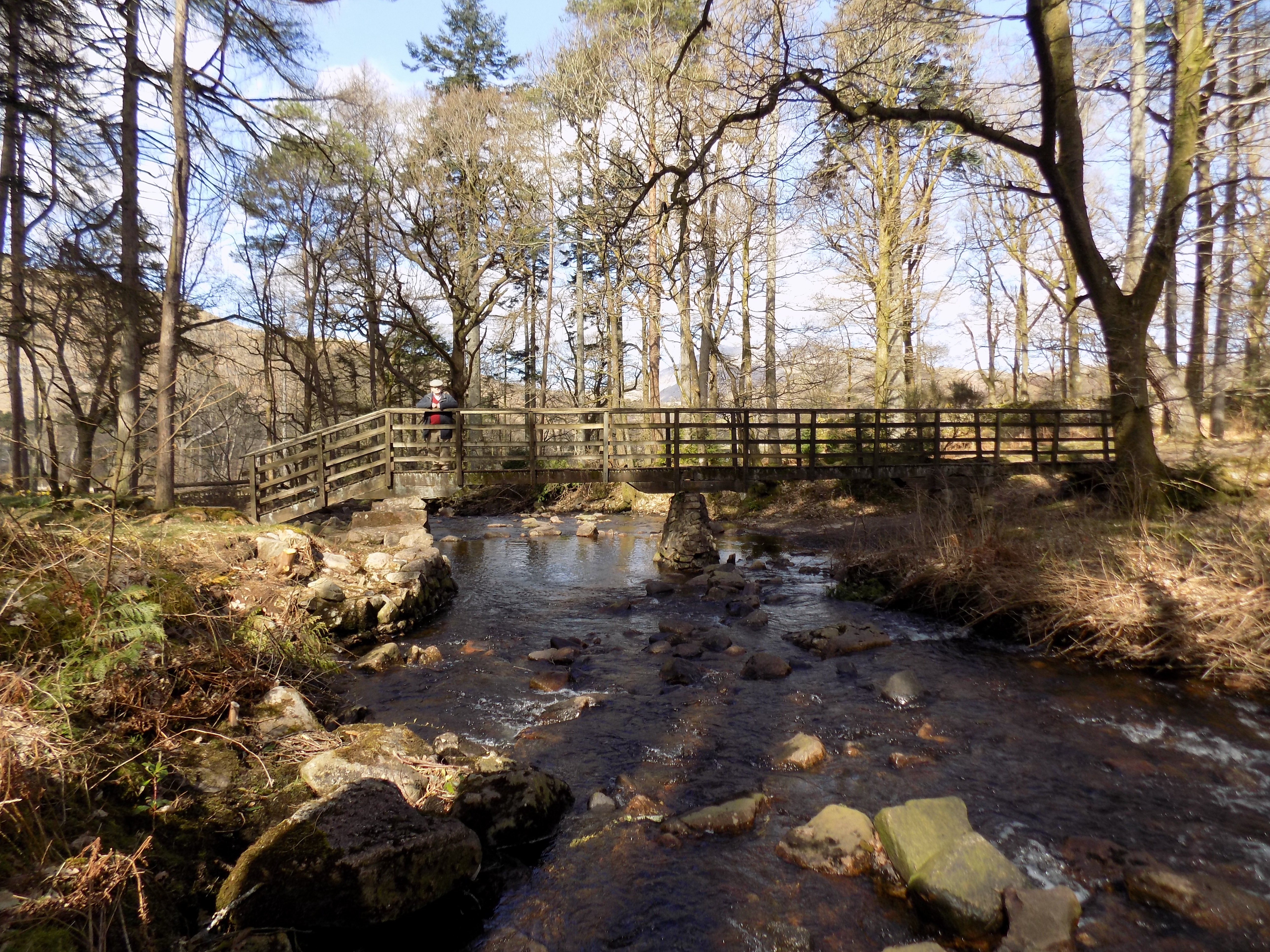
 Instead, turn left at Hodge Close and walk along the track leading towards Stang End and Little Langdale. On the map this track is marked with green crosses. A view gradually opens out to your left, over Little Langdale and the fells. This bit of the walk is up and down, but more down than up. Eventually you come to another group of buildings, at Stang End. Turn left here and follow the path down over a pretty little bridge with an iron railing to where the map shows that there is a ford across the river.
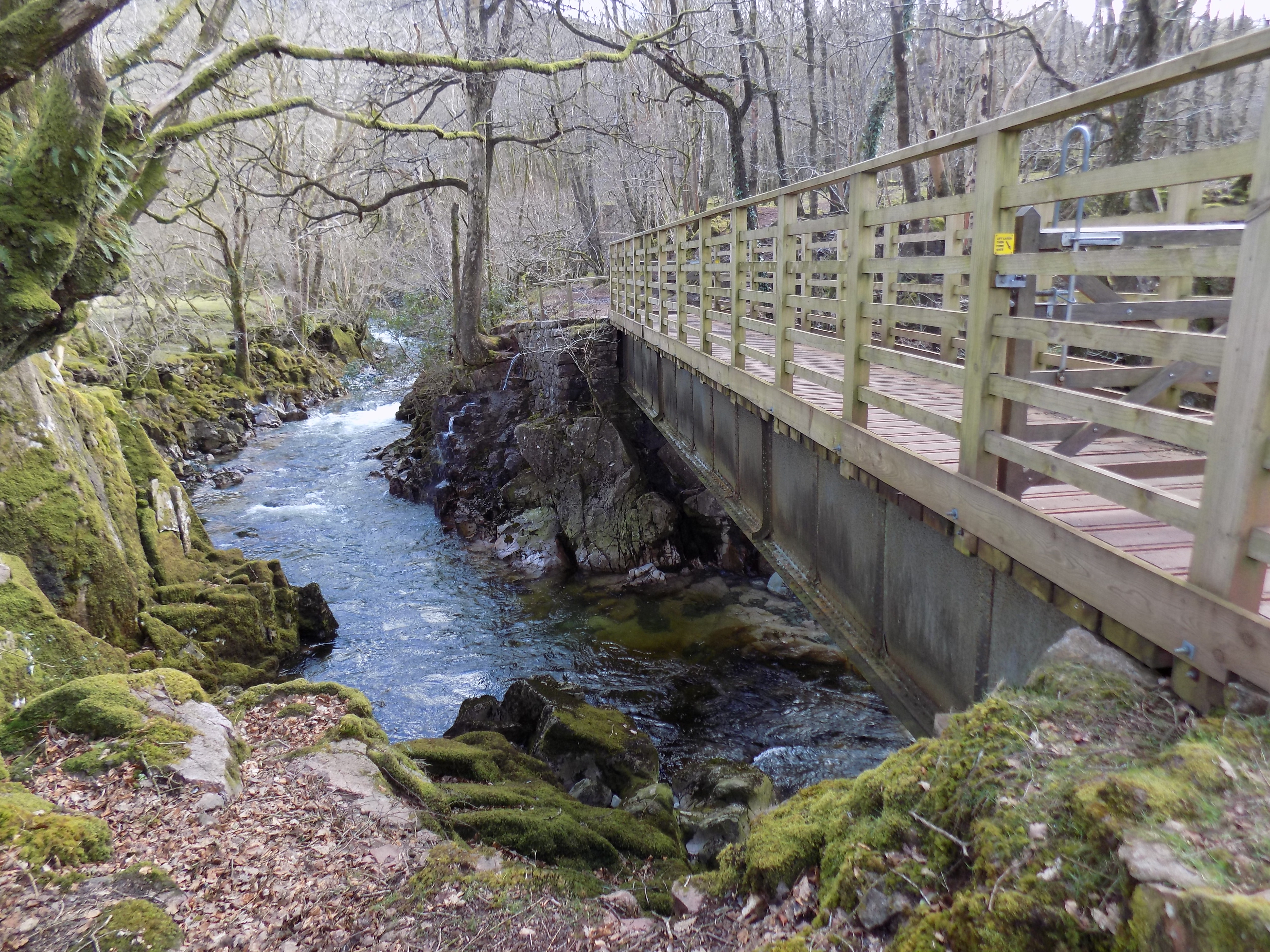
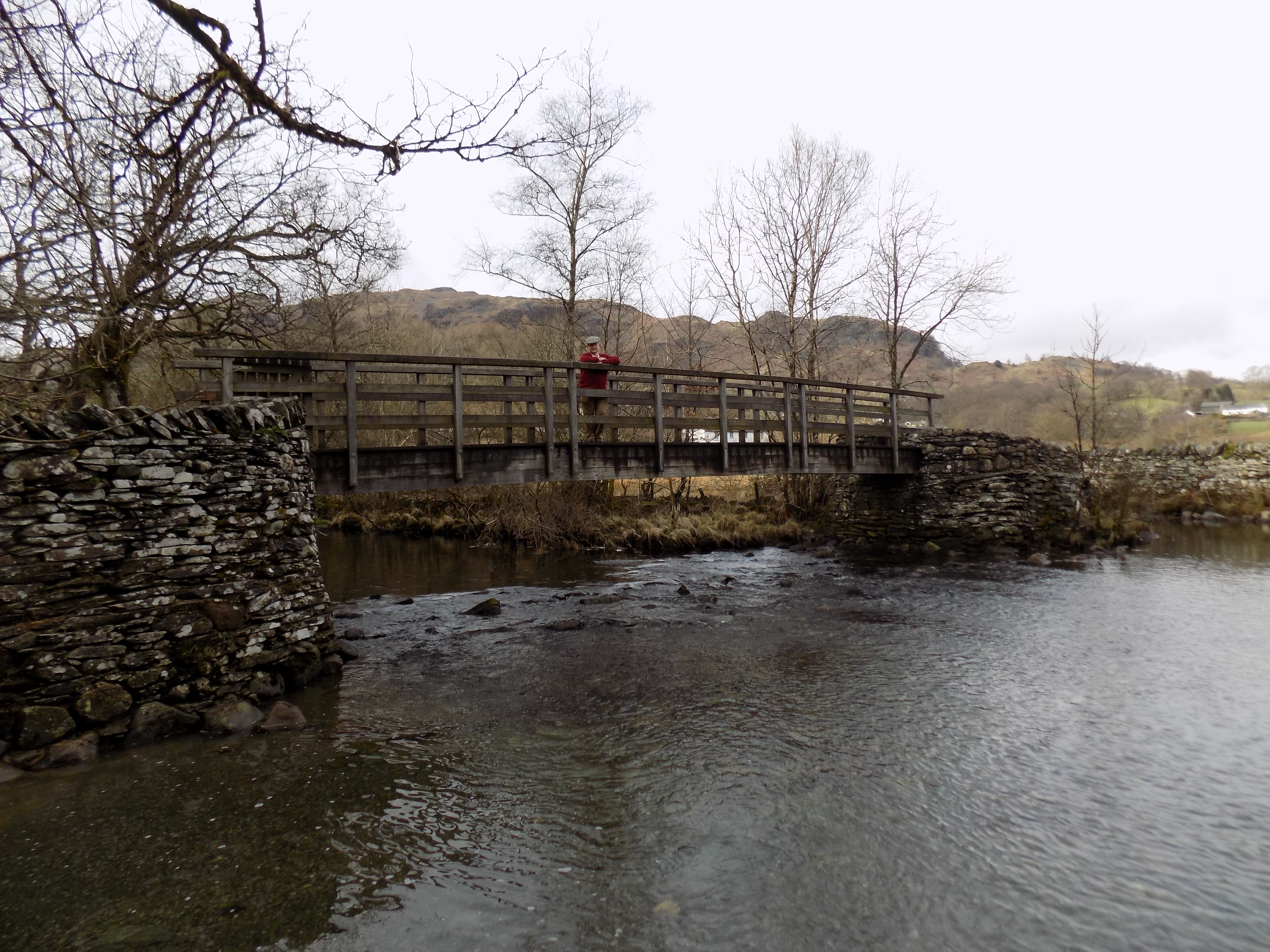 I would not wish to attempt to wade across here even in waterproof knee-length boots. The water is cold and the footing looks treacherous. Fortunately, if you want to cross there is now a footbridge, which (according to a sign posted on the adjacent wall) was erected in 2001. We must have been here before then, but I cannot remember how we crossed the river. Perhaps there were stepping stones, or a cruder plank bridge. Perhaps we didn’t cross at all. We came across a gaggle of cyclists here; two or three of them carefully pushed their bicycles cross the footbridge, and we noticed that no-one attempted the ford.
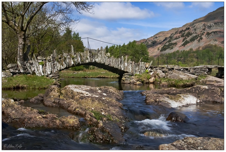
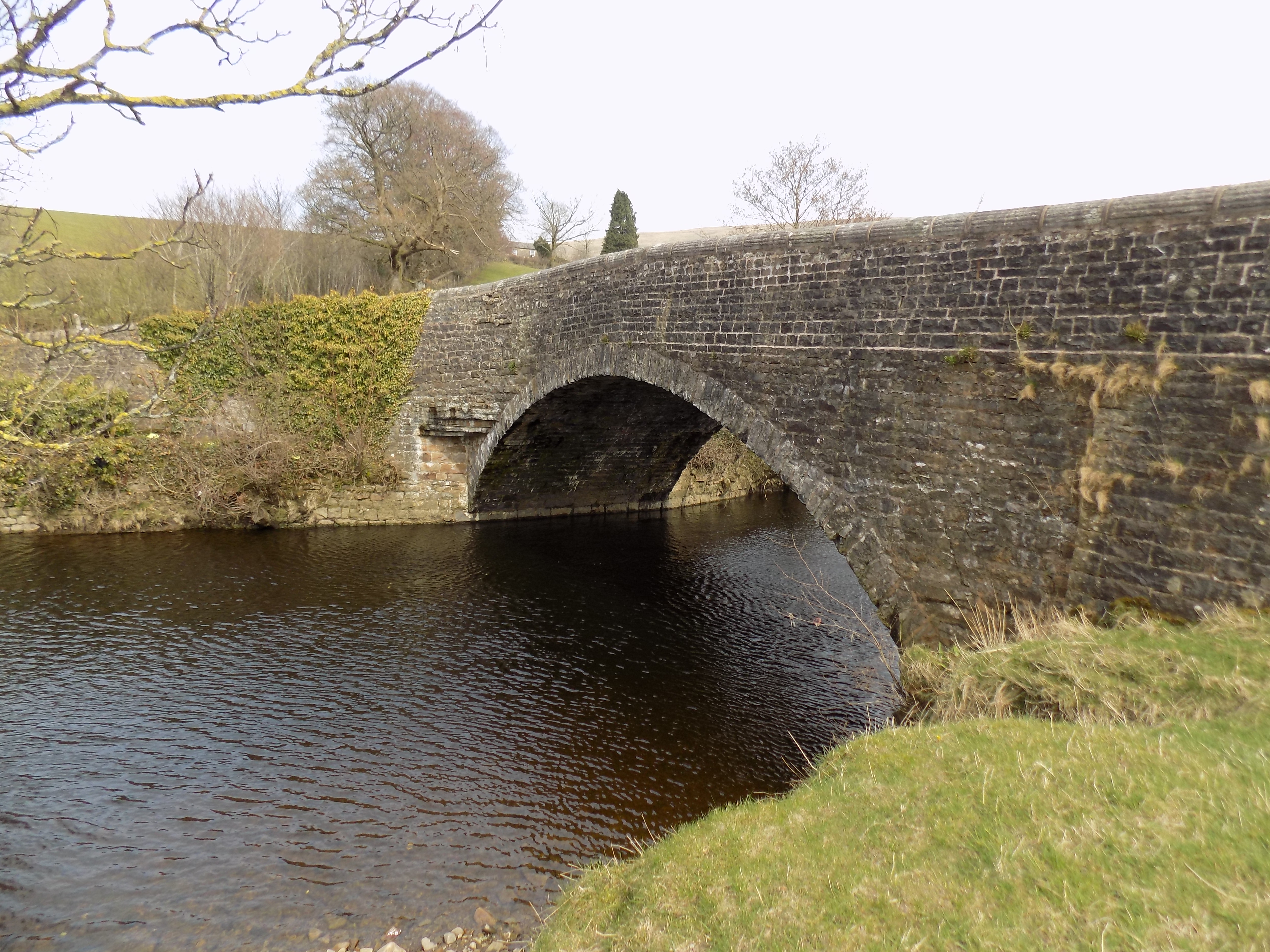
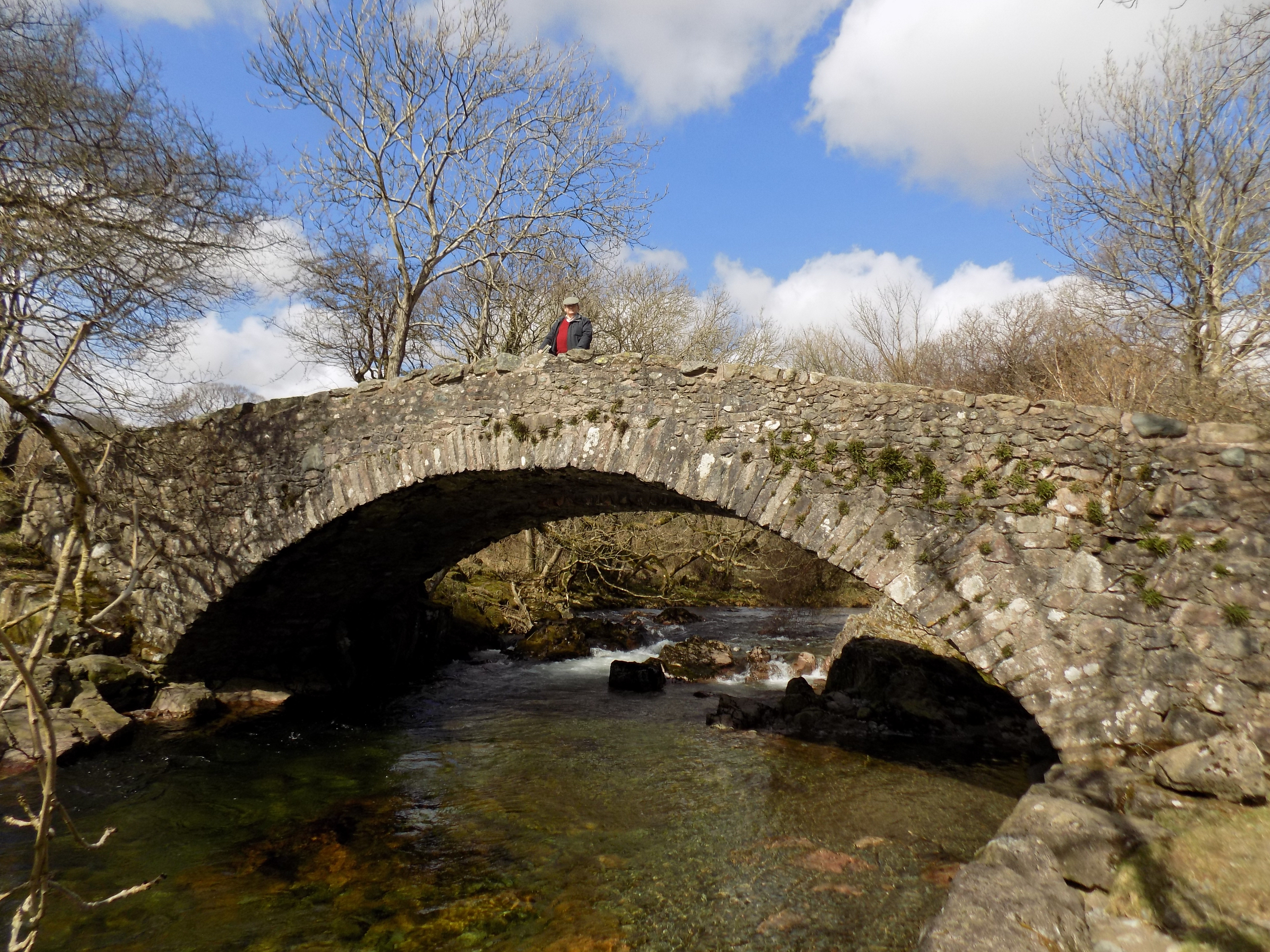
Slater Bridge
If you continue westward from here for a quarter mile or less, you will come to Slater Bridge, a picturesque 17th century packhorse bridge. There is a good view here up Little Langdale, and you can complete a loop across the bridge and back, or around Little Langdale Tarn, over Fell Foot Bridge (which by comparison is a very ordinary affair) and back along the road. But I don’t really recommend this. The road is very narrow and busier than it should be with drivers keen to try the Wrynose Pass, which leads west out of Little Langdale across the fells.
From the ford, turn south along the bridleway and you will eventually arrive back at High Tilberthwaite farm. This part of the walk is fairly easy by comparison with the rest, rising slightly but never stiffly up the valley. In places you can see the way you walked earlier down from Hodge Close. For the last two thirds of the mile you are retracing your steps, which I generally prefer not to do, but is unavoidable here unless you are prepared to climb the hill behind the farm. Sometimes principle has to bend to practicality.
 It isn’t really part of this walk, but I must mention something which happend as we were driving back from Tilberthwaite to Cark. We had chosen to go slightly out of our way, past Mum and Dad’s old house at Woodgate, up the lane (as we always called it) and down the B road into Ulverston. We and they must have walked or driven along that lane literally hundreds of times. Beyond Woodgate the lane is single track, with fences or hedges on either side and meadows beyond. About half a mile after passing Woodgate we were astonished by a female deer which leapt over the fence on our right into the lane, no more than a few yards in front of us, and without a pause over the hedge into the meadow on the far side. If it had been half a second later our car would have knocked it over; a second later and it would have landed on the bonnet or the roof.
We have seen deer in the Lakes before now. There is a small herd at Holker Hall near Cark. Only a few weeks ago I saw a young deer browsing in the grasses on railway land a few yards from the tracks at Kents Bank station near Grange-over-Sands. But in all that time we had never previously seen one in the pastureland around Woodgate. It must, I think, have been a wild animal; certainly the fences and hedges were not enough to confine it. Something else to look out for on our walks.
Thanks to John who provided all the photographs except the one of Slater Bridge.
——————–
Ministry of Flat Walks 08 : Dent
6 April 2018
To follow this walk on a map, open another tab on your browser and input this address: https://bit.ly/2H68u6a. You may find that it does not fit on the screen without scrolling.
Mum and Dad rarely ventured into the Yorkshire Dales from their holiday cottage at Woodgate. John and I, at Cark, are a bit nearer, and over the last few years the roads have been improved, making it possible to reach at least the less remote dales with comfort. This walk, which we undertook today, starts and finishes at Dent, just five miles beyond Sedbergh. We know Sedbergh well. It is home to Westwood’s, a large second-hand bookshop, where we go regularly when the weather is bad. In fact we were there just a couple of days ago: I bought eight books for £31 and there were two or three others which I regretfully left on the shelves.
Dent is roughly an hour’s drive from Cark. We have been there once before and were surprised on that occasion to find the streets thronged with pedestrians and a lot of additional parking space brought into use. We discovered that the Dentdale Run was taking place, a road race over 14 miles in aid of the local school. It is a bit disconcerting when you are out for a leisurely countryside walk in your anorak and boots to find yourself being overtaken by large numbers of young (and not-so-young) men and women running ahead in their shorts and training shoes.
Today, however, Dent was quieter. The noisiest thing was the wind, which blew in gusts down the valley, strong enough to force me to take my hat off. After my adventures at Buttermere (see blog on 3 April) I was taking no chances.
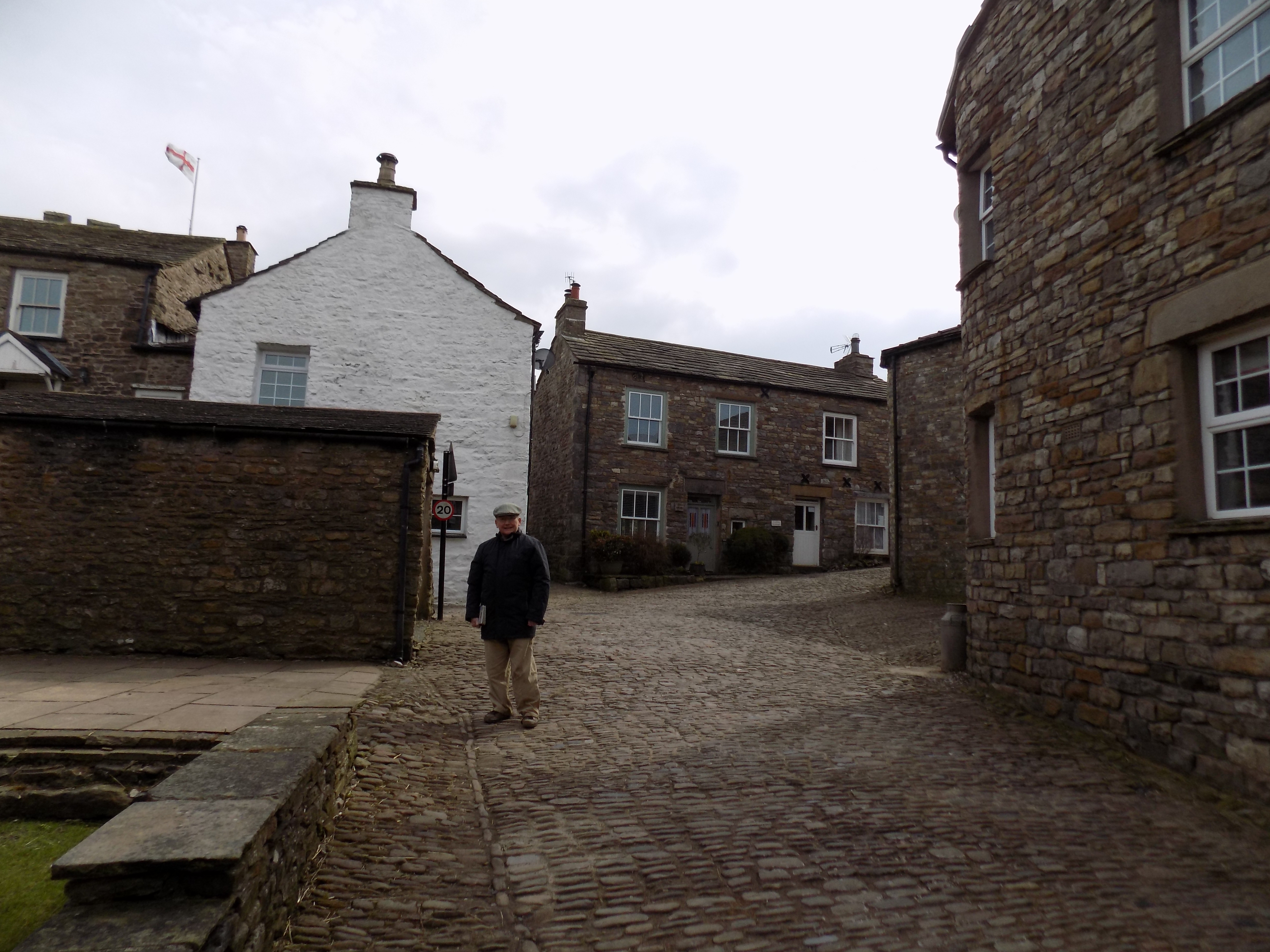 This walk starts at the convenient public car park, next to the information centre which is marked on the map. Turn left (east) out of the car park and head into the centre of the village, across cobbled streets, past rows of whitewashed ancient houses. This part of Dent really feels like somewhere from a bygone age. Loop around the church on your left and follow the road towards the river. Cross the bridge and continue for another 100 yards or so, then turn left into a metalled farm lane, marked with green dots (showing a public right of way) on the map.
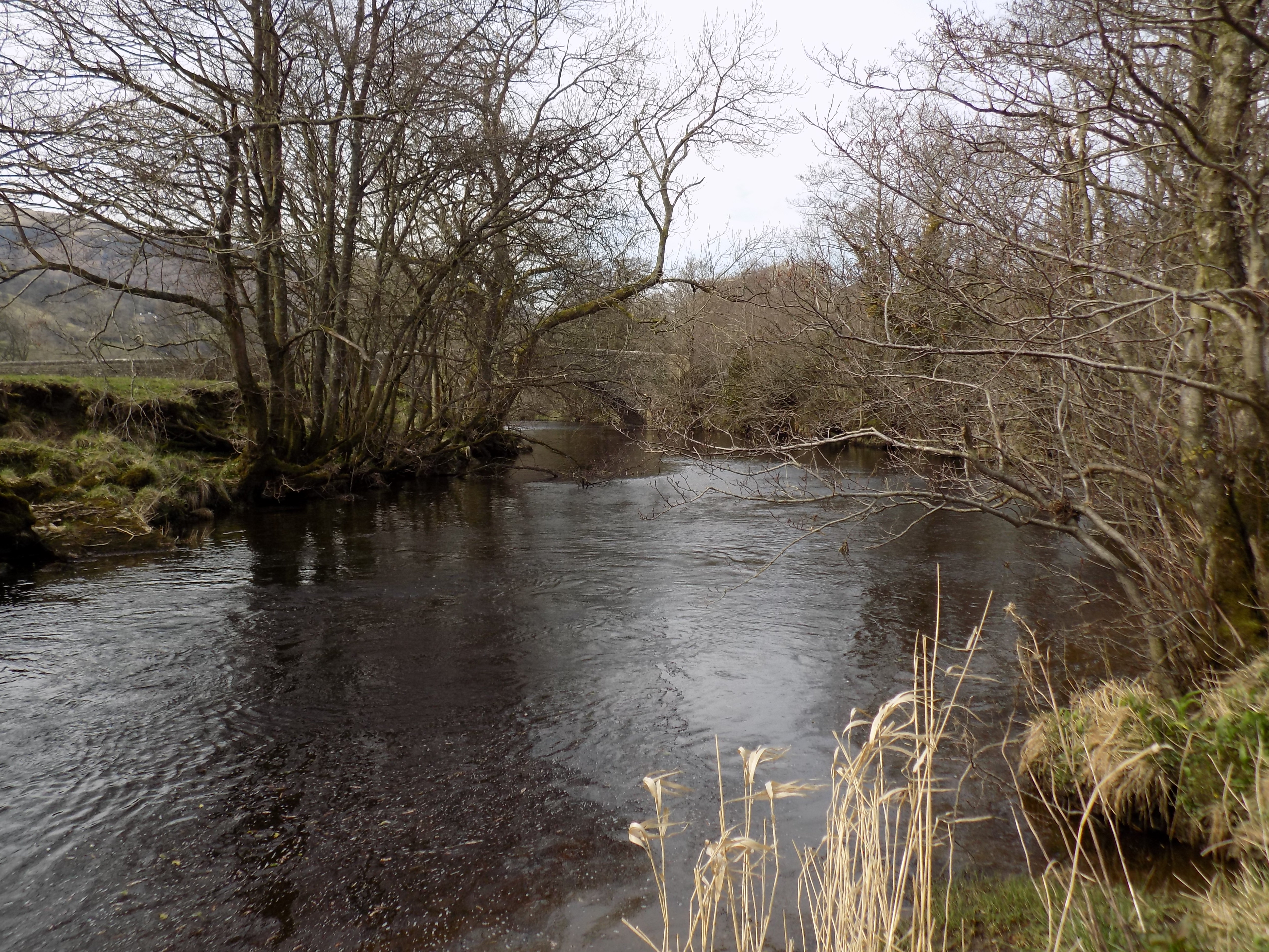 The lane runs parallel to the River Dee (no, not that one) and in places is very close to the water. A permanent sign warns that the lane is subject to flooding, but today it seemed dry enough despite the recent heavy rain. The river, surprisingly to my mind, flows not west to east (as is the case with most of the Dales) but east to west, and eventually meets the Lune just west of Sedbergh. Today it was fast-flowing but not especially full; several banks of pebbles in the curves of the river channel were clear and dry. John amused himself as usual by pitching several stones into the river and annoying the fish.
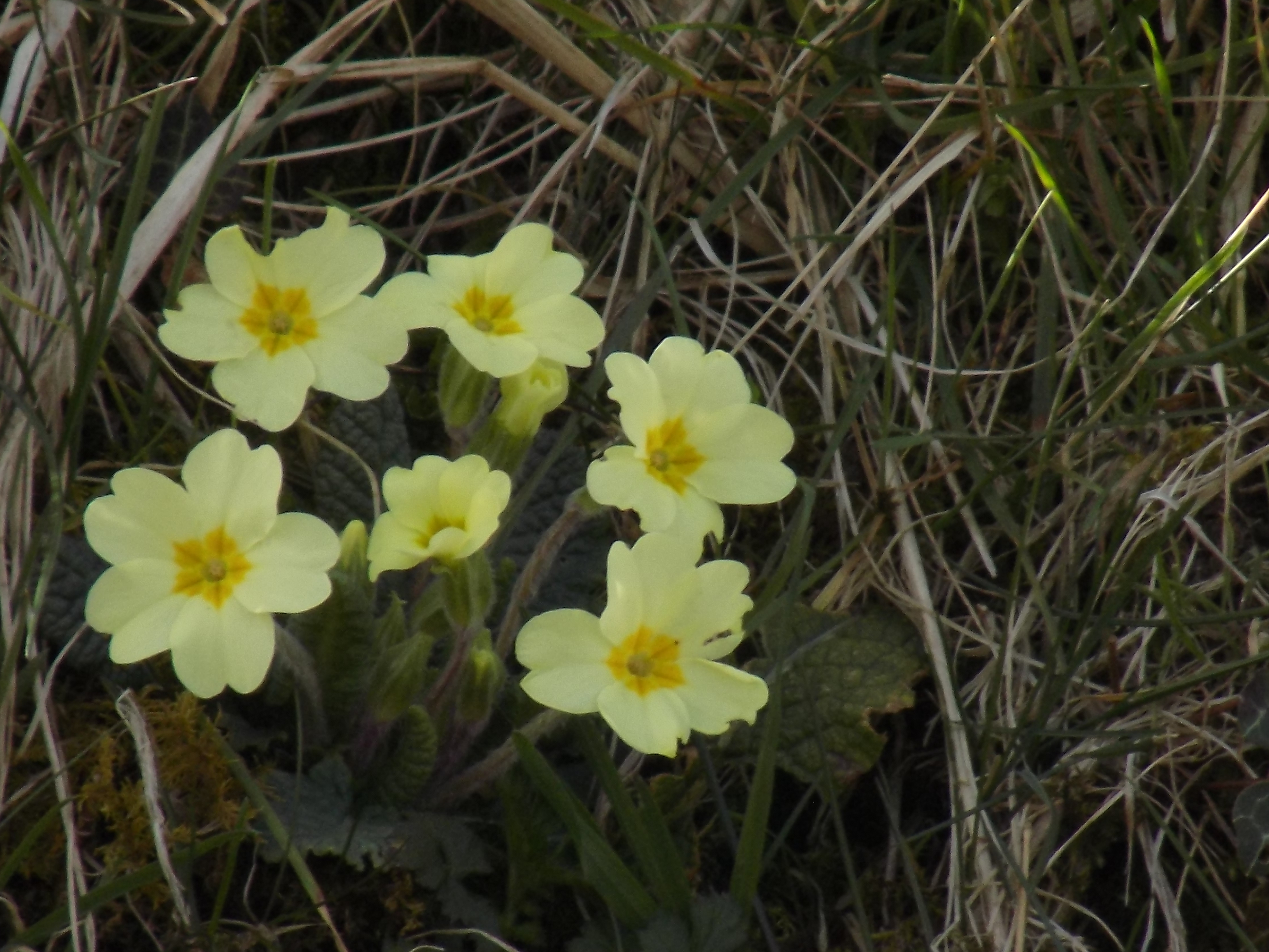
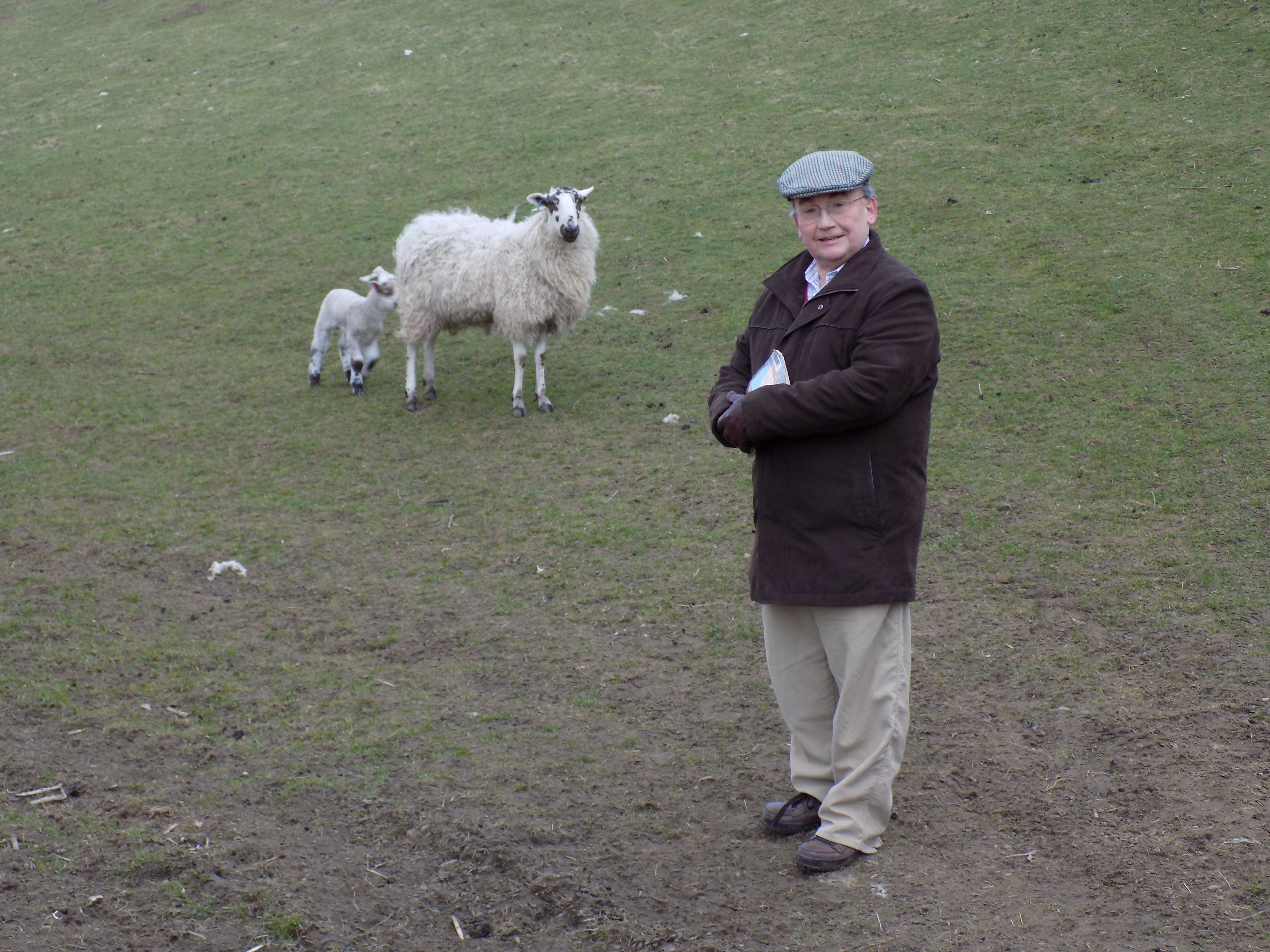
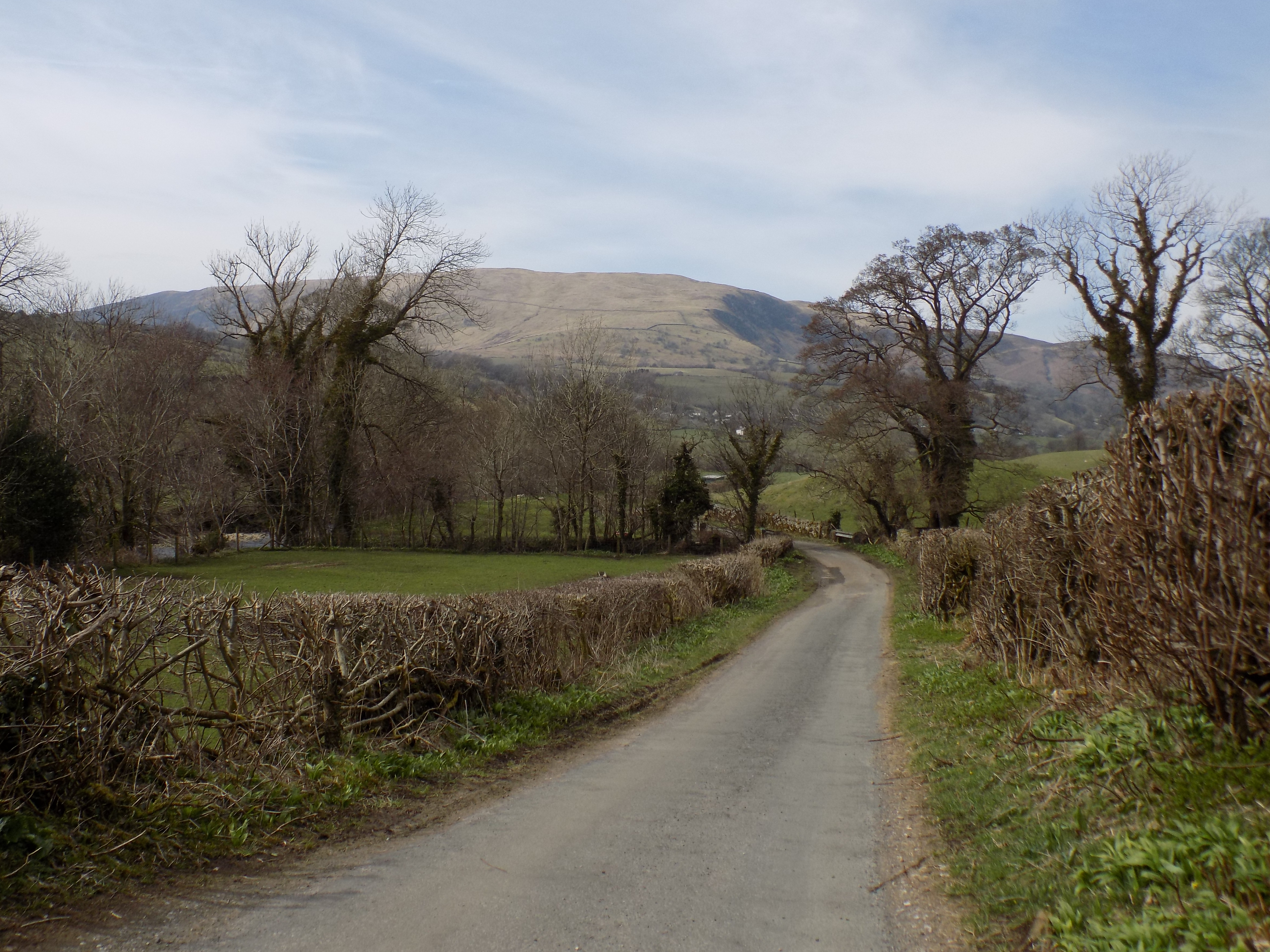 From the lane you have an excellent view up and down Dentdale and across the valley to Dent itself. Today there were lambs in the fields, daffodils and primroses and even the occasional snowdrop in the hedgerows. But few of the trees or hedges are budding just yet. It has been, as we overheard one of the local people saying yesterday, a slow spring.
Continue to the end of the lane where it emerges at Barth Bridge. Like several of the other road bridges in the area, this one is narrow enough not to permit two vehicles to cross, with discouraging stone parapets on both sides. On our previous visit this is as far as we walked before turning back into the village, but this time we decided to extend ourselves.
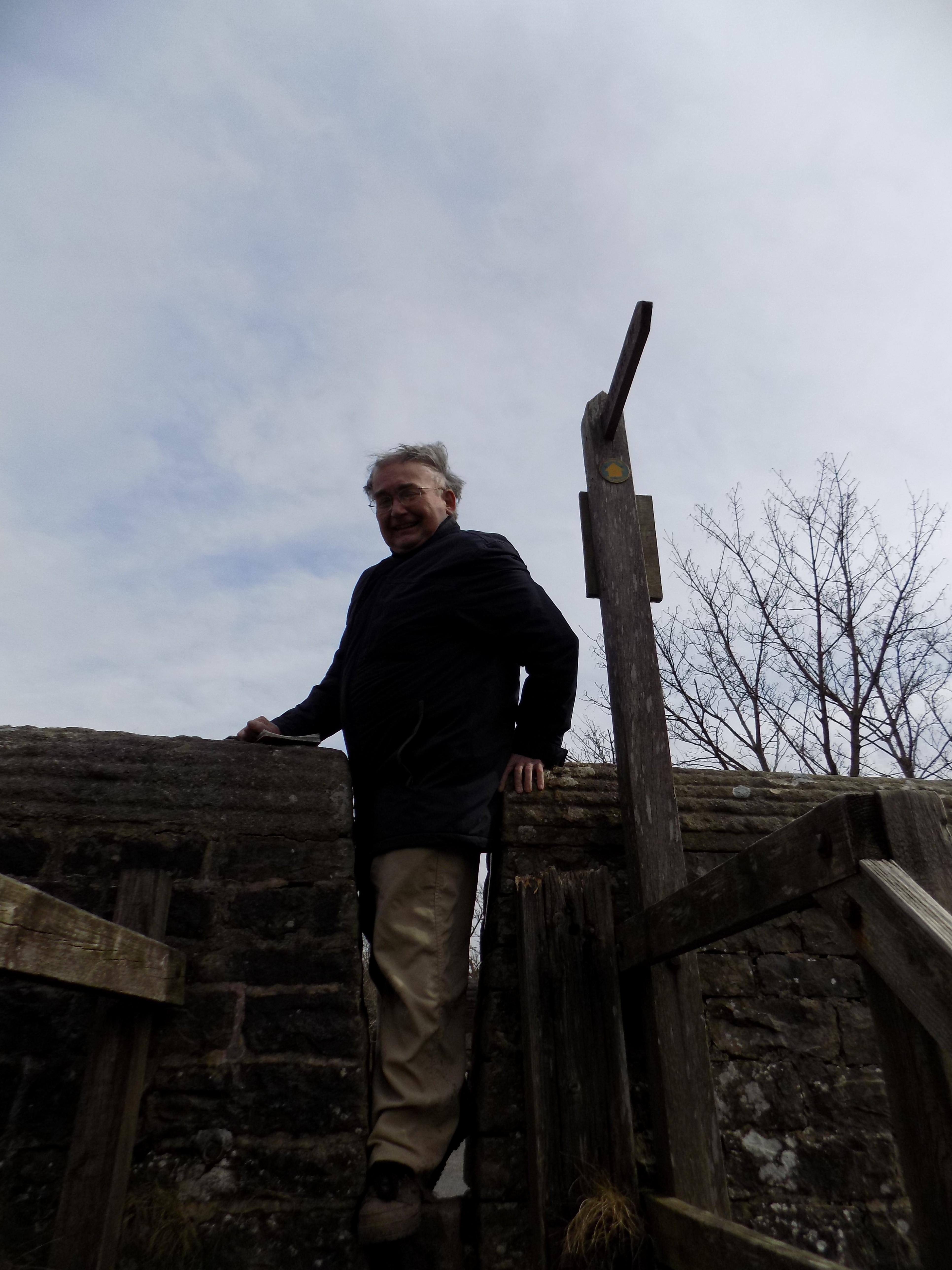 We crossed the bridge and turned right through a narrow gap in the parapet on to the Dales Way footpath. These stiles, with a gap too narrow for livestock but also difficult for some humans, are a bit of a menace. What’s wrong with a good old-fashioned climbing stile, or (even better) a kissing gate?
After returning home I looked up web references for the Dales Way and was surprised to find it is neither an official creation nor a purpose-built footpath, even in sections. Rather, it is a route devised by long distance walkers which follows and connects existing paths and rights of way. This is, apparently, typical of all the country’s long-distance footpaths. Highways authorities (which maintain paths) and landowners whose land is crossed agree to designate the paths as part of a named long-distance route, and the Ordnance Survey marks the route as such on its maps, but no one is responsible for maintaining the route as a whole. So my confidence that the path would be well maintained was wide of the mark.
 In fact this section of the Dales Way is easy to follow from the map and on the ground. Enough walkers have used the path to leave a trace, and there are sensible crossing points for all the hedges, fences and ditches. The walk continues along the bank of the river for another mile and a bit, then turns inland across an old fashioned stile to join a minor road just before it reaches the buildings and footbridge at Ellers (at the extreme left edge of the map). We found that, after all the recent rain, the field as you approached the stile was sodden and marshy, requiring wellington boots if you didn’t want to get your feet wet. Instead we tried following the field to the end and crossing the low fence there, only to meet a drainage ditch, too wide (and slippery) to jump over, which we crossed with some difficulty. And I got my feet wet anyway. So if you follow this walk, be warned and come prepared.
At Ellers cross the footbridge and turn east, back towards Dent but now on the other side of the river. The path runs along an embankment by the side of the river which I think must keep it a bit drier than the adjacent field, and is easy to follow until you come to the road, where you have to climb a short hill and some steps to reach the tarmac. This is the only climb of any significance on the whole walk; it is short and easily managed. Now follow the road (which is quite busy, with some corners where you may be invisible to passing drivers, so take care) back down to Barth Bridge.
 Cross the bridge again, but this time turn through the gap in the parapet on the left and down a few steps into another meadow. The path here is less clearly marked but its route is quite clear from the map and from the traces of other walkers. There are more gates and stiles, around which the ground today was very muddy. The path effectively cuts a corner on the road and leads back almost into Dent village.
We took a fraction over three hours to complete the walk, including 25 minutes for our picnic lunch which we took just after crossing Barth Bridge for the first time. It is a nice quiet walk (unless you go on Dentdale Run day) apart from the short section on the road before you reach Barth Bridge a second time. I reckon it at between five and six miles. Dentdale, at least this part of it, does not have the most dramatic scenery, but John was still able to take some good photographs, some of which I have used here. So thanks, yet again, to him for those.
 ——————–
Ministry of Flat Walks 07 : Eskdale
5 April 2018
To follow this walk on a map, open another tab on your browser and input this address: https://bit.ly/2qavLcG. You will need to scroll the map right and then left in order to see the walk in full.
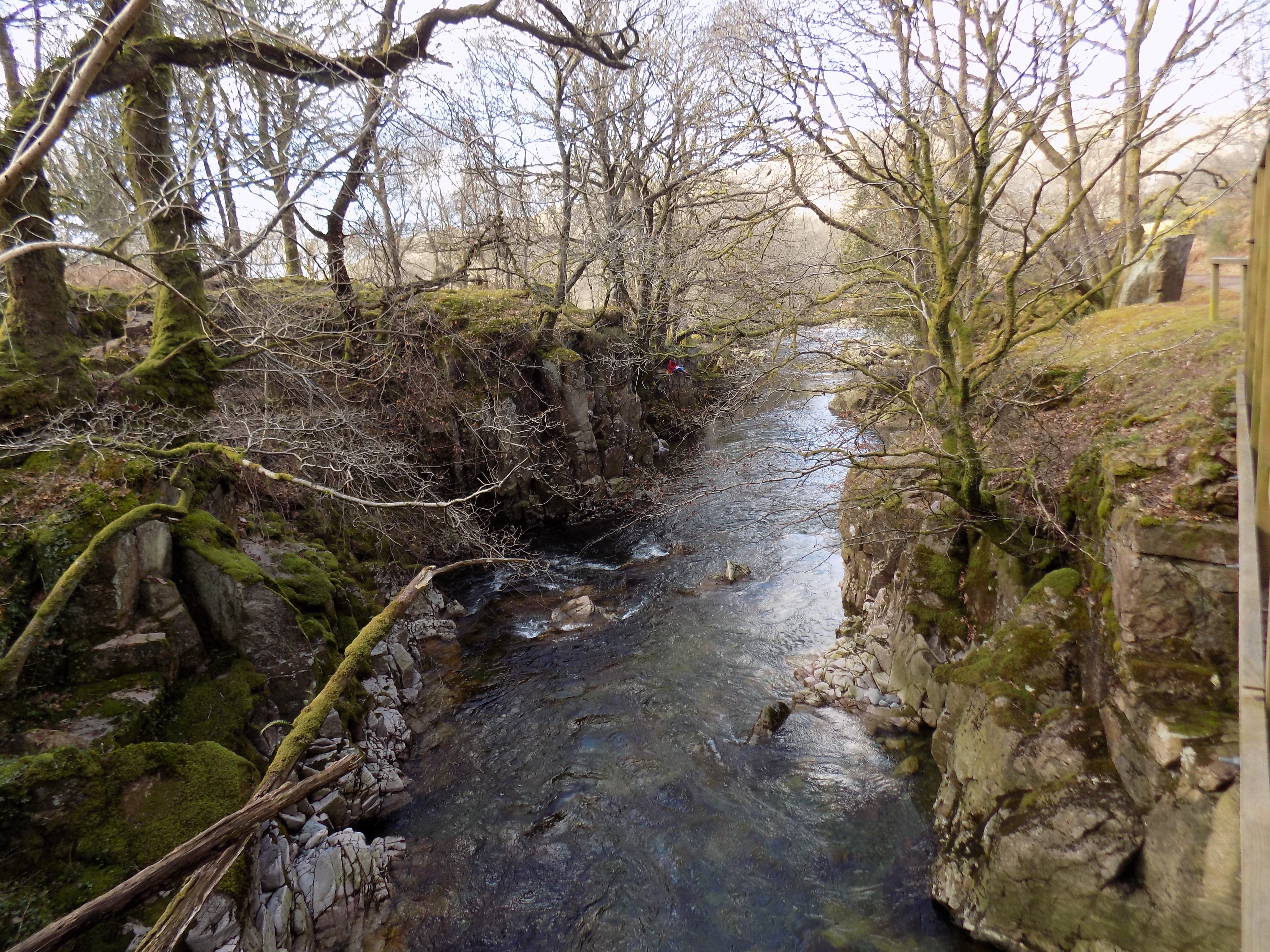
River Esk
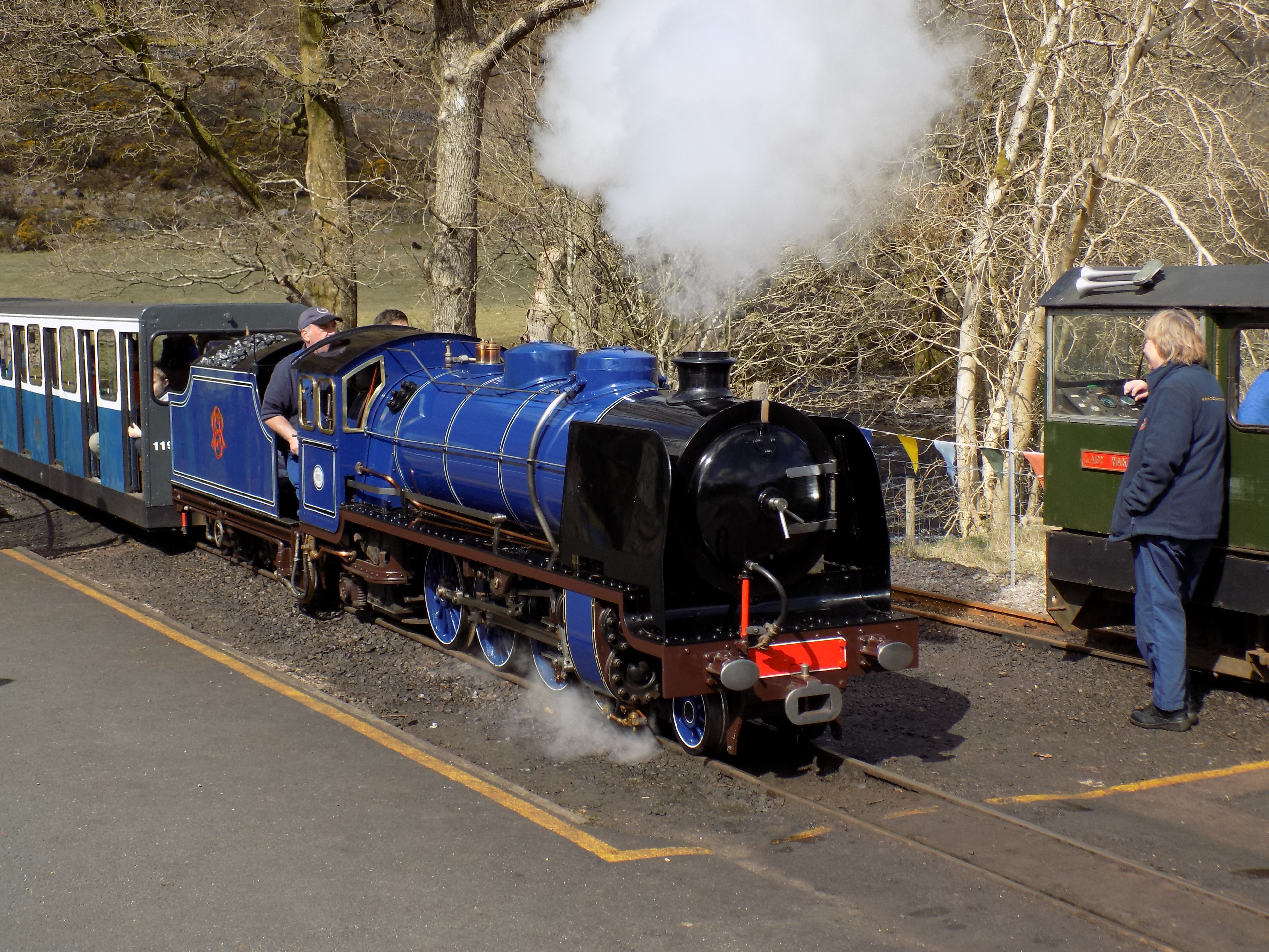
I think this may be my favourite of all the walks in the Lake District. Eskdale is one of the prettiest Lakes valleys – it does not have a lake, but the beautiful River Esk makes up for it. The walk is mostly flat with just a few minor undulations, though in some places the footing can be a bit tricky, especially after rain. Its length can be easily adjusted to taste or capacity or circumstances. And there is the 15-inch gauge Ravenglass and Eskdale Railway to enjoy.
I will describe John’s and my walk from today, but note where variations are possible.
The Whillan Beck at Dalegarth station
You park the car at Dalegarth station, in the centre of the map. There is a good car park here and charges are reasonable, though it can get very full at high holiday time as the railway is very popular, especially with families. A stream runs past the car park and there are picnic tables to one side where you can see the mountains, the stream and the trains. We made use of one of these tables for our lunch.
Pick up a train timetable, which you will need later, at the station. After you have watched the trains for a while and taken advantage of the facilities, turn left (that is, eastwards) on to the road. You can also cross the road and walk directly down the lane opposite which leads towards the church and the river if you want a shorter walk, or to avoid the traffic.
Doctor Bridge
Otherwise, walk along the road for the best part of a mile until you come to a turning on the right, with a metalled lane signed to Penny House Farm. Take this turning down to the river at Doctor Bridge. If you come to the Woolpack Inn you have missed the turning. Alternatively, if you are feeling energetic you can walk further along the road to Whahouse Bridge or even to Jubilee Bridge. But in any event be careful on the road: further east it leads to the Hard Knott and Wrynose passes, which can be a magnet for car owners who fancy themselves as rally drivers and do not always have proper regard for pedestrians.
At Whahouse or Jubilee Bridge turn right off the road on to the path which leads back down the valley on the south side of the river. Eventually you will rejoin the route which John and I followed, the lane to Penny House Farm, which you meet at Doctor Bridge. From here you may walk along either the north bank of the river (muddier) or the south bank (more up-and-down). We chose the north side today, and now need to clean our boots and trousers.
 After a bit less than a mile you come to a bend in the river and, just beyond it, a wooden footbridge, only recently built, which the map doesn’t show. Previously the only way of crossing the river near this point was via the stepping stones, which I seriously do not recommend unless the water is low and the stones are dry. The river isn’t very deep here, but it is fast-flowing and cold. Cross the bridge if necessary: you need to be on the south bank unless you plan to return directly to Dalegarth station. You may also want to have a quick look at St Catherine’s church, on the north bank next to the stepping stones. It is shown on the map as + but not named. The VisitCumbria website has a nice picture and a brief description at https://bit.ly/2GVY5dr.
Apart from omitting the footbridge, the map also fails to show how the footpath on the south side descends to the edge of the river here past the bridge and the stepping stones. But this should not be too confusing, as the path, mostly gravel with some muddy patches, is impossible to miss.
 Continue along it, using the narrow wooden footbridge to cross the stream which flows down from Stanley Force, and you come to a crossroads. Turn left here to see Stanley Force – I am told it is a bit of a climb, but worth it. Or turn right to cross the river over a pretty stone bridge on a minor road and return to Dalegarth. Or you may continue, as we did, straight ahead, along the path down Eskdale.
From here on the walking is pretty easy. The path is a proper bridleway – you may meet someone on a horse or a cycle, but it is not passable by motor vehicles until you reach the farm buildings at Milkingstead, where to your right there is a suspension footbridge across the river. You can cross the bridge if you like for a short cut back to the road, or continue on, as John and I did, to Forge Bridge.
Next to the road at Forge Bridge is a level plot of waste ground where you will find cars parked. This would be a good alternative parking spot for you too if you resent paying the charges at Dalegarth, but you need to get here early enough in the day to secure a spot. It’s a popular place.
At this point you can turn right, as John and I did, and follow the road. Go straight on at the junction by the King George IV pub (which by the way is rather good, an authentic old-fashioned pub with local regulars), climb over the brow of the hill and down the short access road to Eskdale Green station.
The “Whillan Beck” at Dalegarth station
From here you can catch a train back to Dalegarth. That’s why you need the timetable. Trains go once an hour (at best) and you don’t want just to miss one. John and I were pleased to arrive in time to catch a train hauled by the R&ER’s new locomotive Whillan Beck, named after the stream that flows past Dalegarth station. Whillan Beck is a fine royal blue Pacific locomotive which last saw service in Spain in 1932 and has been rebuilt by the R&ER. A valuable acquisition.
If you miss the train, or are not interested, you can walk back to Dalegarth along the road. It is a pleasant enough walk with a good view ahead, but the road can be busy. Or if you want a longer walk you can go straight on at Forge Bridge instead of turning right. Follow the road to Forge House and turn right there on to another bridleway, across the Esk again, until you come to the buildings at Muncaster Head where you turn right and continue to Irton Road station. This adds about a mile and a half to the distance and from memory (I have only walked this section once) it is not as attractive as the rest of the walk, but you may want the extra exercise. If you do the full walk, from Dalegarth up to Jubilee Bridge and then back to Irton Road via Muncaster Head, it is easily ten miles and a day’s outing. I think the version of the walk which John and I followed gives you all the best bits – the most pleasant, and varied, walking and the most beautiful scenery – and, at five miles or so, is quite enough for me.
The walk can obviously also be done in reverse, starting with the train journey to Eskdale Green or Irton Road and walking up the valley. This arguably gives the better view ahead towards Hard Knott, and gives you just as many options for cutting it short if you get tired or the weather turns bad. You won’t notice any difference in the gradients. But we felt there was something more satisfying about a journey on the little train to round off the day.
Thanks as always to John for his excellent photographs.
 ——————–
Tampering
4 April 2018

Cameron Bancroft – David Warner – Steve Smith
If your head has been in a bucket for the last fortnight or so you may not have heard that three Australian Test cricketers have been suspended for tampering with the condition of the ball, which is against the rules. Perhaps you may be wondering why it matters.
Bowlers in cricket, usually the faster bowlers, often hope to get the ball to swing – that is change its direction through the air – late in its path towards the batsman. No-one really knows why a cricket ball swings, and some balls seem to swing more than others quite by chance, which is generally put down to quirks of manufacture. But it is observably true that a new ball swings more than an old one, so bowlers have often tried to keep the ball in as new a condition as possible by vigorous polishing, often with the aid of their own spittle.
In recent years bowlers have also discovered that the ball can be made to swing if one side is kept as smooth and shiny as possible while the other side is allowed to become rough and uneven. This is known as “reverse” swing.
Cricket’s rules permit only limited interference with the condition of the ball. Drying the ball with a cloth is OK. Spit and polish is OK. Rubbing the ball on the ground used to be OK but is now forbidden. Using your fingernails to roughen one side is not allowed but widely believed to happen – it can be hard to detect, though umpires are allowed to replace the match ball if they think it has been tampered with. Bringing a foreign object on to the field with which to roughen the ball is completely outlawed.
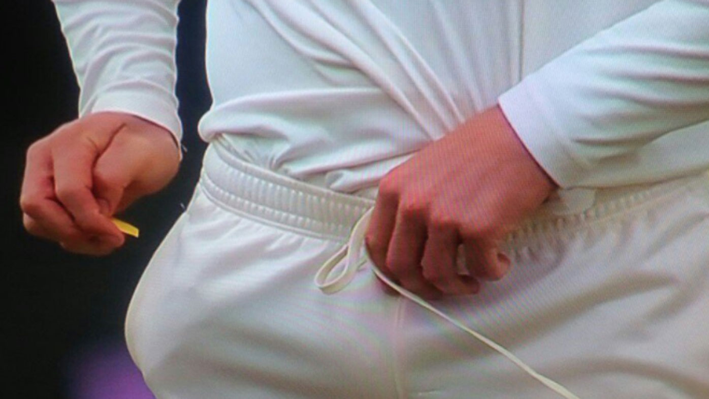
Caught red-handed
This is the offence for which the Australian player Cameron Bancroft has been punished. He was clearly shown on TV applying a piece of yellow paper (later revealed to be sandpaper) to the ball. When the umpires asked what was going on, he stuffed the paper down his trousers and pretended that all they had seen was him using a cloth to dry the ball. After the end of play Bancroft and his captain Steve Smith were taxed with what had been shown. Smith admitted the offence and said the “leadership group” had agreed it should be done, but seemed initially to expect to get away with a slap on the wrist.
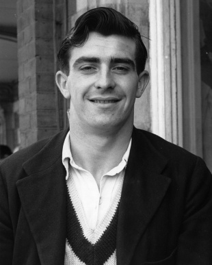 Ball tampering is not a new crime. When I was a boy, the England fast bowler Fred Trueman, who was a pinup boy for Brylcreem (a slick hair product), used to run his fingers through his hair before polishing the ball. This was pushing the rules a long way but was winked at. It would have been difficult to stop: the authorities could scarcely prevent Trueman from wearing Brylcreem or running his fingers through his hair. In more recent times players are known to suck on sugary sweets in the belief that this makes their spittle a more effective polishing agent, though I don’t believe that has ever been proved. That, too, would be difficult to stop.
But Bancroft’s offence was different, and worse. I can think of only one previous instance of a foreign object being used. That involved the New Zealand cricketer Chris Pringle on tour in Pakistan in 1990 when reverse swing was still in its infancy. The full story is related at https://es.pn/2GXJj5Y.
All this said, why was Bancroft’s so bad a case? And why were Smith and his vice captain, David Warner, punished even more severely than Bancroft? There are several reasons.
In the first place, bringing sandpaper on to the pitch in order to scuff one side of the ball is a particularly blatant breach of the rules. Excuses can be made for hair cream and sweets, but not sandpaper.
Second, this was not the rogue action of a single player but a deliberate conspiracy to break the rules in order to gain advantage; that is, to cheat. I think myself that this was the worst of it. Individuals under pressure may sometimes make bad decisions, but conspiracy cannot be explained as the heat of the moment. To make matters worse, the plan was dreamed up by the “leadership group” who then asked the team’s least experienced player, Bancroft, to act on it. That was exploitative and cowardly.
 Third, Bancroft and Smith both attempted by their actions to deceive the umpires and lied to them directly. Only when the TV evidence put it beyond doubt was the offence admitted. As Richard Nixon discovered, the cover-up can have worse consequences than the offence.
Fourth, Smith’s weaselly phrase “leadership group” looked as if he was trying to spread and shift the blame. But he was captain; even if he had known nothing, his players’ behaviour on the field was his responsibility. And he clearly did know. In fact most of the team’s other “leaders” indignantly proclaimed they had known nothing. The group, in this instance, seems to have consisted of just Smith and Warner, with Bancroft as their instrument. Bancroft should have known better and has been punished accordingly. But as a new player keen to do your best for the team, it can be difficult to say no to your captain and vice-captain. Hence he has received some leniency.
When the TV footage was shown, the Australian public up to the Prime Minister rose in anger to condemn it and demand exemplary punishment. Australians assert they expect their sportsmen to play hard but fair, not to cheat. It was not the International Cricket Council which imposed long suspensions on the players, but the Australian Cricket Board, in response to overwhelming public opinion.

Steve Waugh
The cricket world at large has been waiting for the Australian cricket team’s hubris to be punished. Over the last few years the Australians have become known for extreme forms of gamesmanship: taunting opposition players while they are batting, mocking them when they are out. A former Australian captain, Steve Waugh, made this behaviour into a deliberate strategy aimed at causing the “mental disintegration” of opponents. David Warner, in particular, is believed to have descended to a new low, and has been involved in more than one physical confrontation. Naturally, opposing teams have fought fire with fire; it has not been an edifying spectacle.
The team seem to have believed their supporters would continue to be happy with this behaviour so long as they kept winning. There has, of course, been criticism; but they have claimed that they have not crossed “the line” (of acceptability). This line is conveniently undefined – it has seemed to encompass whatever the Australians happened to want to do; but, however lax, it cannot extend to blatant cheating. The effect of this one incident has been to undermine any Australian claim to define what is acceptable, and to cast a harsh, unflattering light on much of what had gone before.
So Smith, Warner and Bancroft may be carrying the can for the past behaviour of others. But that is only unfair if you also think it unfair when a judge imposes an exemplary punishment on a criminal, to mark society’s disapproval and as a deterrent to others. The fact that not all criminals are caught is no argument for leniency.

Darren Lehmann
The one figure in the whole sorry story who seems to have escaped lightly is the Australian team’s coach, Darren Lehmann. You might think that any off-field “leadership group” would be bound to involve the coach; but Lehmann claimed ignorance and there is no evidence to the contrary, so he has not been punished.
Whatever he may have done or known in this specific case, it is under Lehmann that the team has plumbed new depths of poor behaviour in search of an advantage. He has now resigned as coach, but I suspect he may find that his future career is irremediably tainted by association. The three players have at least decided not to appeal against their suspensions, perhaps knowing that to do so would increase the public obloquy in which they are now held. By accepting their punishments they stand a better chance of eventual rehabilitation into the game.
——————–
Northern Lakes
3 April 2018
John and I took a risk today which ultimately paid off, though there were moments during the morning when we doubted.
John has a week off work which we are spending together at Cark. On Saturday and Sunday the weather wasn’t too bad and we went for walks (see Ministry of Flat Walks 05 and 06). Yesterday, however, we had a day of rain, more downpour than drizzle. Of course no-one should expect to spend a week in the Lake District without at least one wet day, but we were hoping for better today.
First thing this morning we opened the blinds to find steady rain falling and the gutters flowing with water. It looked pretty grim. But the Met Office forecast for the afternoon was better: gradually clearing, with sunshine later. So we made a plan which allowed for different choices depending on whether the forecast was correct.
 A few months ago we had stumbled across a farm shop at Low Sizergh Barn which, among other goodies, stocks a dark beer that has become John’s favourite: Ennerdale Darkest. We had not come across it anywhere else and were curious to know more. On consulting the brewery’s website, we found that it lives up to its name. It is located at Rowrah, just downstream from Ennerdale, and about as far from us in the Lake District as you can get. Today seemed like a good day for further investigation.
We drove west past Greenodd and Broughton to Silecroft, where we once played on the beach as children, and then north up the coast road past Bootle, Ravenglass and Gosforth. And it rained. Really hard. We avoided the fell road, which is a useful short cut at other times, as the conditions were so poor, with cloud obscuring the fells and visibility down to a fraction of normal. Only as we reached Egremont, just short of Whitehaven, where we turned inland towards Rowrah, did the rain ease up. This is old industrial country, with long rows of terraced houses, most of them spruce and tidy, many painted in pastel colours with bright window ledges and door frames.  Not how they must have appeared when they were built in the nineteenth century. I do wonder who lives here nowadays, since apart from the nuclear plant at Sellafield there is no longer much industry in the area, and Egremont is surely too far from the big cities to be much of a magnet for second home owners. Before we bought the house at Cark I remember seeing numerous houses for sale in Egremont and Cleator, all at knock-down prices. But they clearly still have attractions for some people.
Rowrah is just a few miles beyond Egremont and when we arrived there the journey from Cark had taken us ninety minutes or so, not as bad as I had feared. The Ennerdale Brewery has what they call a Brewery Tap, a café where food is served and beers can be bought by the crate. We stopped there for lunch. I had what they call a Brewer’s Lunch: evidently brewers have the same sort of appetite as ploughmen, but also like scotch eggs. John had a ciabatta which seemed a bit exotic for Rowrah, and I bought for him a crate (12 bottles) of Ennerdale Darkest which he will no doubt consume over the next couple of months.
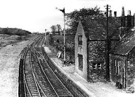
Archive photo of Rowrah station
I think John was as interested in the railway history as the brewery. Rowrah was a junction in the maze of industrial railways that grew up in West Cumbria in the nineteenth century to serve the mines (mostly iron ore). It really was a maze, with several lines that peter out in unlikely places, junctions that seem to point the wrong way, and routes that serve tiny villages but avoid the important towns. Now, of course, the tracks are all gone, but many embankments, cuttings and bridges remain. On the way into Rowrah we saw several of these vestiges of the past.
After lunch we found that the Met Office had been right. The rain had stopped and the clouds were starting to lift. We went to have a quick look in case any of Rowrah station can still be seen, and found the platforms still in place but much overgrown and the station building in use as a private home, but not much else. The railway is too long gone.
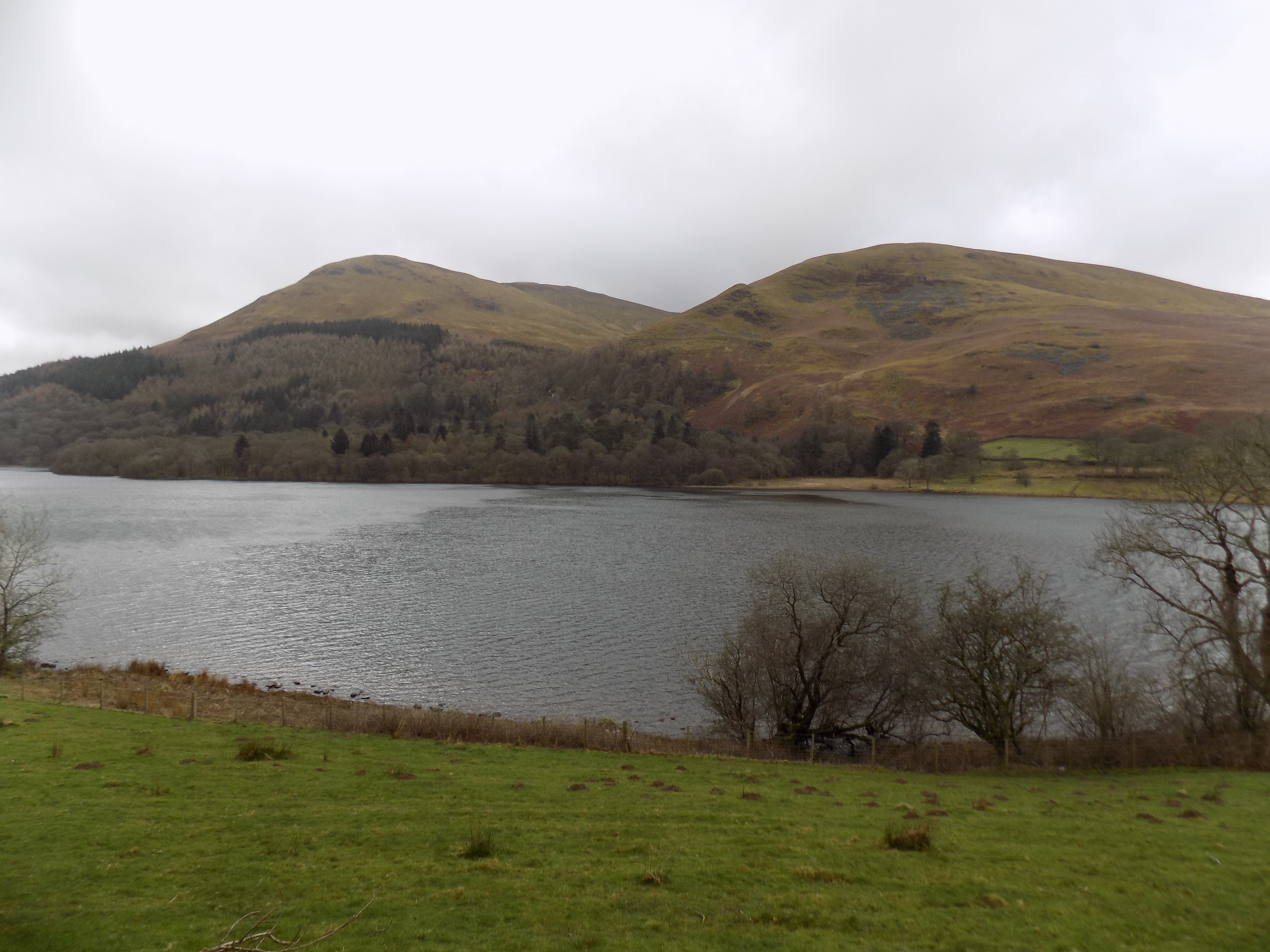
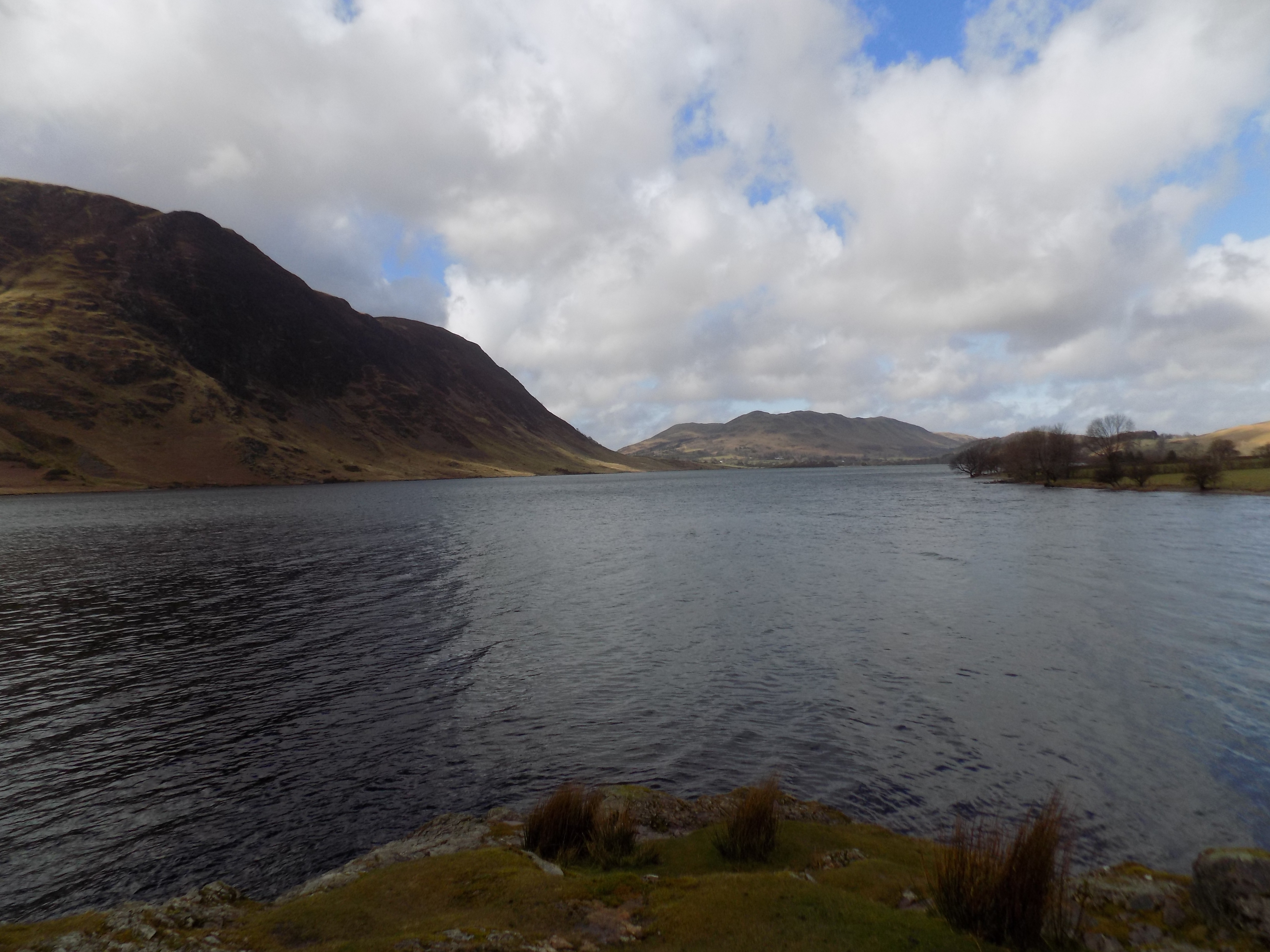
Loweswater
So we drove on into the hills and presently came to Loweswater, which (along with Ennerdale Water) is the lake I know least well. There were few other visitors and it was blustery and cold, but we were rewarded with a very fine view of the lake, with an array of purples and browns among the trees and bushes on the far side. John took some photographs, and I think we will want to return when the weather is a little kinder. There appears to be a path around the lake we could follow.
Just beyond Loweswater is Scale Hill, a name I remember because Mum was fond of reminiscing with my Auntie Con and my cousin Judith about a family holiday they once enjoyed there. John has rescued a few black-and-white photos in the family album he has compiled which I think come from that holiday. Our family’s love of the Lake District clearly goes back a long way. The old farm buildings at Scale Hill now offer self-catering accommodation, but I think that is probably new: more likely Mum and family were in a B&B or something similar.
Crummock Watder
We didn’t stop at Scale Hill but turned back at the next junction on to the road towards Crummock Water and Buttermere. These are two lakes which I know a little better, especially Buttermere where I went walking with Michelle and her family a few years ago, though I may say the weather that day was rather more benign. We parked the car at Buttermere village (which mostly consists of pubs and car parks) and braved the elements to walk round the lake.
The rain had gone, but the wind was blustery and strong, blowing down the valley from the mountains, so in our faces for the first half of the walk. I nearly lost my hat a couple of times and eventually had to take it off. This is a favourite walk for many, even on a day like today, and someone – the National Trust? the National Park? – has seen to it that the path on the far side of the lake is well maintained.
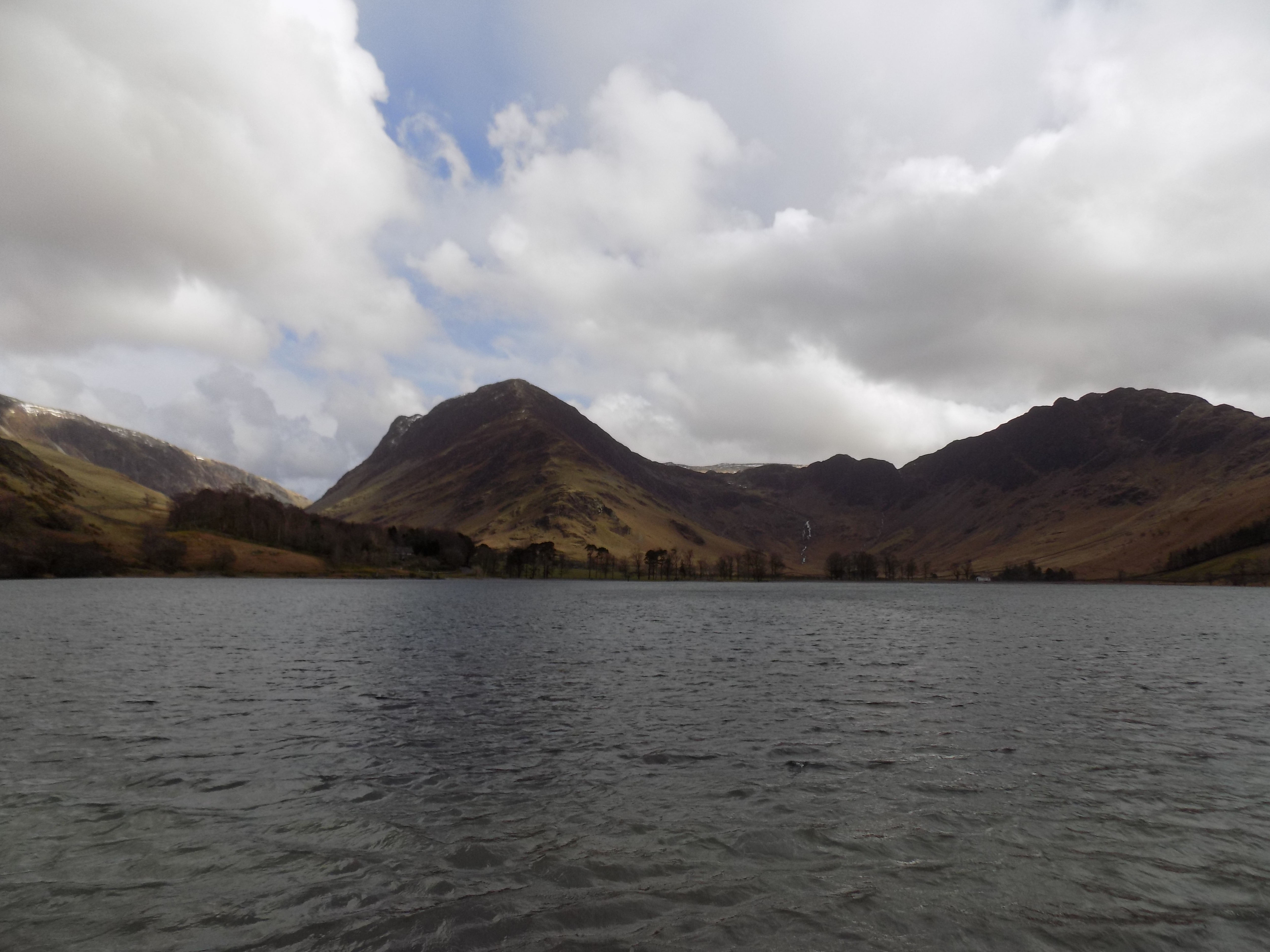
Buttermere
Coming back was a bit harder in places even though the wind was no longer against us, as some sections of the path are bare rock or mud and were dangerously slippery. Ever since I fell and banged my head on another walk a couple of years ago I have been rather more cautious about my footing. But we made it back to the village without mishap. The walk had taken us about two hours and a quarter for 4-5 miles, so we had kept up a good pace. I wish more of the lakes had a path all the way round, as Buttermere does, so that on the near side it isn’t necessary simply to follow the road and dodge the traffic.
So we had a good day despite the unpromising start. At the end we counted seven lakes we had passed: Loweswater, Crummock Water, Buttermere, Thirlmere, Grasmere, Rydal Water and Windermere. The traffic wasn’t too bad and we managed to cram a lot into the day. The one drawback was that we didn’t get dinner until a quarter to nine. Still, the forecast for tomorrow is really poor, so we may have a lie in.
Thanks to John for the photographs of Loweswater, Crummock Water and Buttermere.
——————–
Music Director
3 April 2018
 For the last couple of years I have been the chairman of the Hurst Green Singers, the local choir in which I sing tenor. About a year ago Michael Barlow, our current Music Director, told the Committee that he intended to stand down from the role after our Summer 2018 concert. We would need to find a replacement.
His decision was not entirely unexpected, although it was still a bit of a shock when he told us. Michael had been ill the previous winter and we had had to arrange at short notice for someone else to conduct our Christmas concert. Our usual rehearsal accompanist Gillian Broome and our usual concert accompanist Alec Crowe, both of them highly accomplished musicians and conductors in their own right, kindly helped out and the concert went ahead as planned. But Gillian and Alec both made clear to us that they did not want the job on a permanent basis. We needed to find someone else.
The job of Music Director involves a lot more than conducting our concerts. The MD’s principal responsibility is to lead our rehearsals, coaxing and coaching us up to a standard at which we can sing in public without embarrassment. Conducting the concert is merely the culmination of that work. The MD also decides what music we will sing and recruits the soloists and orchestra for our concerts, so he or she needs a good range of contacts in the local musical world and if possible more widely. Michael filled the role for us for more than thirty years, and we knew it would not be easy to find his successor.
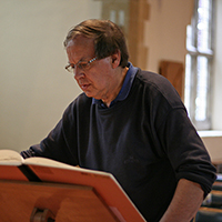
Michael Barlow
No-one on the Committee had any experience of appointing a new MD, but as chairman it fell to me to take a lead. Fortunately I do have some experience of other appointments processes from my time as a civil servant. The first step was to advertise, and as part of that to decide where our advertisements should be placed. There is a national umbrella organisation for local music societies, Making Music, which has a valuable website with advice on process and a classified ads section. There is also the Association of British Choral Directors whose website carries advertisements, and a newer specialist website gerontius.net which bills itself as “the dream site for choirs and lovers of choral music.” In the event it was ABCD which was the most use to us, but we did not know that at the time.
With the help of the Committee I drew up a specification of what we wanted from our new MD: not just the duties I have mentioned, but also the quality of leadership which the choir would expect. Some of our members might say that Michael no longer challenges us enough, but we certainly did not want to swing too far in the other direction. From this specification I drafted an advertisement which the Committee agreed and placed it on all three of the websites, with a closing date of 1 November.
You may ask, why set such an early date for appointing to a post to lead rehearsals which would not start until the following September? Choirs like ours do not buy most of our music. We rent it, ideally from the county library, sometimes through the interlibrary lending service, or from the publishers (who are much more expensive) if we must. Recently Alec Crowe has been helping us to borrow music cheaply from the Royal School of Music’s library, but they obviously have first call on their own resources and in any event are not able to supply everything we want. We needed our new Music Director to be in post as early as possible so he or she can devise the concert programme for Christmas 2018 and we can get on with ordering the music.
The weeks went by and I received exactly one, wholly unsuitable, application from a young man who had evidently mistaken us for a pop choir, and one expression of interest from a serious musician based down in Selsey, beyond Chichester and nearly two hours’ drive away on a good day. He would have been a good candidate, but really it wasn’t practical for him to travel so far, and he eventually decided not to pursue his interest.
I did know, however, from previous experience that many applications are only made at the last minute, and so it proved here. Two worthy candidates eventually put their names forward, one of them actually on the closing date. We also received another suggestion from an unexpected source. Two former members, Steve and Sue, had stayed in touch with the choir, and when they knew we were looking for a successor for Michael they suggested that we should approach a friend of theirs, Jamie, whom they had met in New York. Jamie had recently come to live in Kent with his new British wife and was intending to pursue a freelance career here as a teacher and conductor. We contacted Jamie and invited him to one of our rehearsals with Steve and Sue. (Steve is another tenor and I would very much like to get him back in our choir.) When he came we were immediately impressed, and very pleased when he accepted our invitation to apply.
The next step was to convene an interview panel. Rather to my surprise the Committee agreed without discussion or argument to the two people I suggested should join me on the panel: our librarian Barbara and our publicity secretary Cathy. We convened as a panel to decide what our lines of questioning would be. Barbara and Cathy would work from set lists of questions about the candidates’ approach, while I would devise questions building on the candidates’ individual CVs. As none of us is a professional musician, we also agreed that we would invite Gillian Broome to sit in on all the interviews as our assessor.
By careful negotiation with candidates and panel I managed to set a date for all three interviews just before Christmas, only at the last minute to be forced to cancel because I was unwell. That was a setback: professional musicians’ diaries are often filled for months ahead, and finding a new date to suit everyone might be a challenge. However, we were lucky and I was able to set a revised date to hold all the interviews in mid-February. We had provisionally planned to select the best two candidates who would be invited to come for audition with the choir before we made a final decision. But in the event there was one outstanding candidate, Jamie, while we decided that for different reasons we could not recommend either of the others for appointment.

Jamie Meaders
Jamie came for audition on 13th March and I am pleased to say he was a great success with everyone. In truth, I think he was auditioning us: at any rate he spent quite a lot of time with each section of the choir separately, and I thought he was listening carefully, to judge what challenges might lie ahead for him. But whatever he heard did not put him off, and I’m pleased to say that Jamie Meaders will be our new Music Director from September.
We are very lucky to have found him. You can judge for yourself: see his personal website at http://www.jamesmmeaders.com. He is really too good for us. But the best musicians, of whom Jamie is certainly one, are characteristically willing to spend time and effort sharing their skill and enthusiasm with others. If we keep Jamie for five years, which (at a minimum) I hope we will, I expect he will both introduce us to a whole new range of choral music and help us to improve our standards by several degrees. Interesting, and challenging, times lie ahead.
——————–
Ministry of Flat Walks 06 : Around Borwick
2 April 2018
To follow this walk, open another tab in your browser and input this web address: https://bit.ly/2IiPxdq. John and I made the walk yesterday, Easter Day. I estimate that it is five miles long and took us about two and a half hours.
This is a good walk to choose at times like the Easter weekend or the high holiday season when the more popular spots in the Lake District are crowded. In fact the walk is not in the Lake District at all but in rural northern Lancashire, between the rivers Kent and Lune. The route is not completely flat, but there are no steep sections, though there is some walking over open pastureland which can be muddy and a little strenuous. There are also a couple of awkward stiles, of the type where you have to squeeze through a narrow gap in the wall. Watch your buttons.
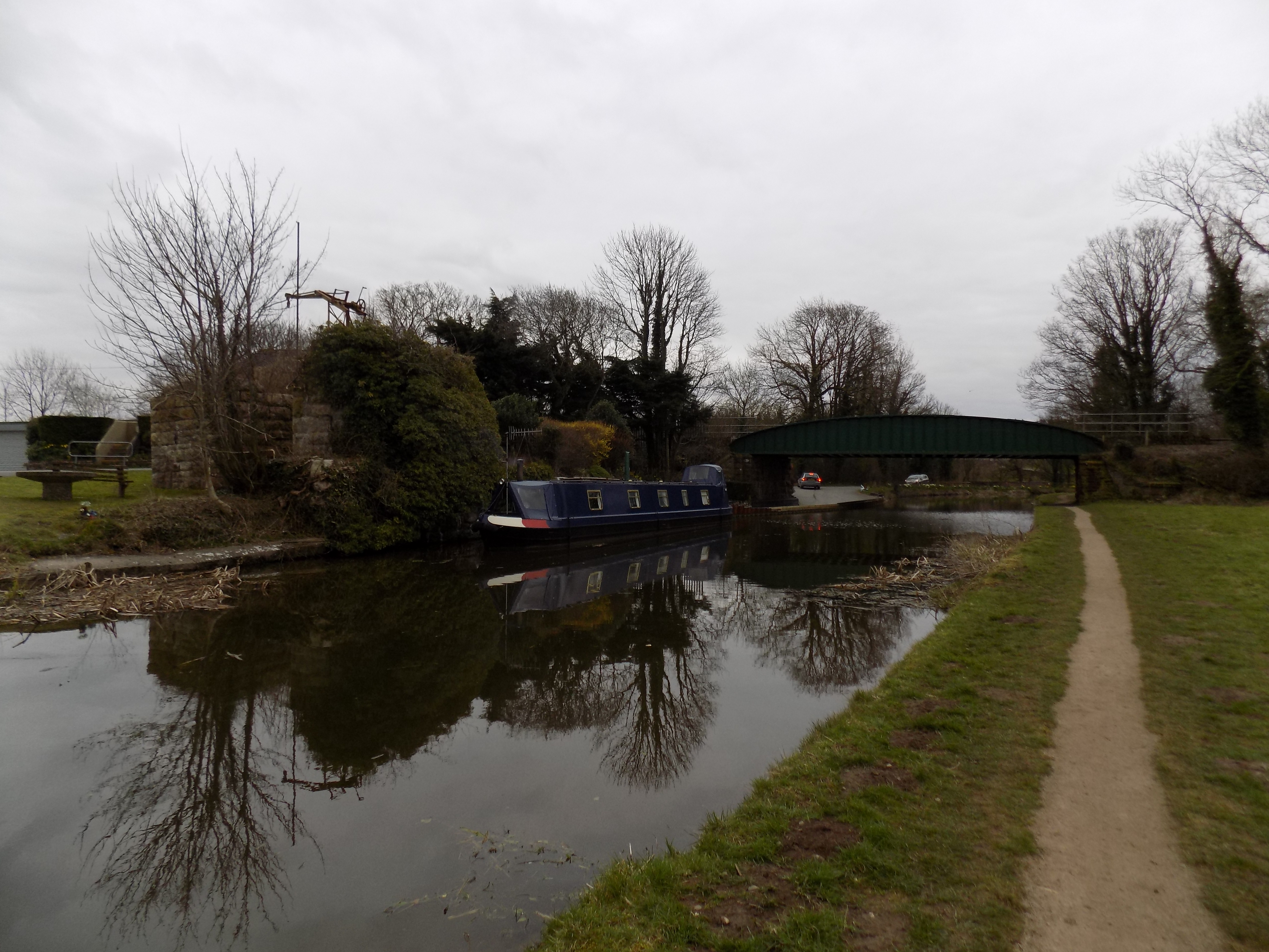
You start the walk at Borwick, parking our car on a lane just west of Borwick village, by the side of the Lancaster Canal. There is some interesting information about the Canal in its Wikipedia entry (https://en.wikipedia.org/wiki/Lancaster_Canal), though it is somewhat out of date, and on the website of the Lancashire Canal Trust (https://www.lctrust.co.uk) which is working slowly to restore the northern end of the canal. The section of the canal at Borwick is fully navigable and at other times we have seen boats of various kinds here, but at Easter it is evidently too cold for people to be out on the water. There are plenty of ducks, though.
 The map does not show it very clearly, but the towpath is well maintained and runs along the western side of the canal. Head north along the towpath and continue, passing under a couple of characteristic canal bridges, for about half a mile to Tewitfield. Here there is another bridge where Kellet Lane crosses the canal north to south. Climb up to the road here and turn right. If you reach the motorway or the marina, you have missed the turning. Cross the bridge on Kellet Lane over the canal and immediately turn right again in front of the chapel into Kirkgate Lane. Both these road names are on the map.
Kirkgate Lane turns away from the canal and heads north east across farmland. The lane is not paved, but hard earth and stone make for easy walking although there is a slight upward gradient. Eventually you reach the shoulder of the hill and get a good view over the fields to the village of Priest Hutton, towards which you are heading. When you come to the end of the lane, turn right into the road.
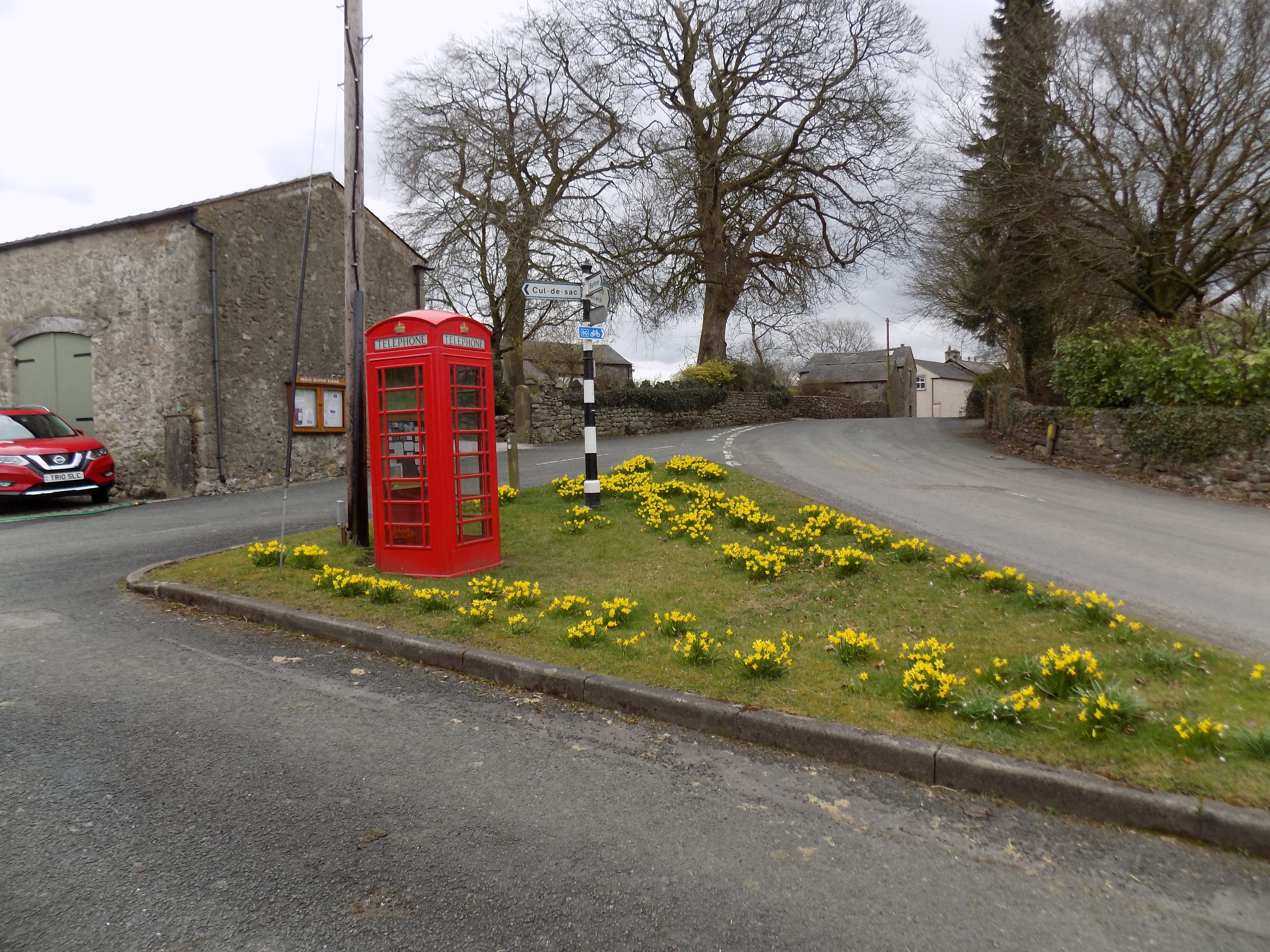 Priest Hutton is a nice little village, although I doubt whether many of the residents work locally. This seems to me not traditional second homes territory, but where the locally prosperous come to live – professors from Lancaster University, senior council officers, successful local business people. There is a charming village green with a traditional signpost and phone box. You should head towards the right at the green, but when the road next forks take the left hand branch. Continue to follow the road for another quarter mile or so and then turn right, just ahead of the last building on the right, on to a short track and through a gate. There should be a signpost here, pointing to the path, but yesterday John and I found the post lying on the ground, having snapped at its base where the wood had rotted. Perhaps by the time you get there it will have been replaced.
 You are now in pastureland and picking out the way ahead takes a bit of attention to the map. There is no visible path, but waymarks can be found at most of the gates and stiles. Cross the first field to a stile in its far left hand corner and then strike out across the next field, not quite parallel to its left hand side but not too far away. This is a gentle climb made a bit worse by the muddy clay of the field, but not really a challenge. After a while the hedge bends back towards you and you continue to follow it down the other side of the hill through an avenue of trees into the little cluster of buildings – too small to be classed a village – at Green Bank.
The path used to continue here on the far side of the road, and this is what the map shows, but there are signs up saying the path has been closed. I think a bridge across the stream in the dip here may have collapsed, or been deemed unsafe. Instead, turn right along the road for no more than a hundred yards or so and then left just in front of a modern farm building. There is another fallen sign here at the side of the road which you may find has been re-erected. Follow the wall of the farm building (you may have the uncomfortable feeling that you don’t belong here, but it is a public right of way) and at the end turn left on to a track which winds down a gentle slope to a bridge under the railway embankment. You will know you are in the right place if you can see the bridge.
Spring pasture
Pass under the bridge and immediately turn right into a short lane leading to a wide open pasture. Ahead of you there is a vestigial track around the left hand side of some rising ground. Follow this track to a gate and into the next field. Now the track has gone, but you can walk along the line of the hedge on your left until you reach a pair of stiles with a tiny bridge over a stream between them. Pass through the stiles into the next field which has the stream on your left and the railway on your right. Cross the field as you like, heading for the opposite corner, where you will find a stony track, with a storage yard on your left and the Lancaster Canal directly ahead. This is Capernwray, where there is another caravan/camping park with many static caravans (see my previous blog).
To your right the railway crosses over the canal on a viaduct. To your left the canal crosses over the tiny River Keer on an aqueduct whose construction, by the canal engineer John Rennie, is marked with a plaque. You could easily fail to notice the aqueduct altogether. Turn left, over the aqueduct, along a metalled road by the side of the canal for a couple of hundred yards until you come to a bridge. There is a curious area on the left here, surrounding what looks like an empty house, which has been very firmly walled off with large reinforced concrete slabs. These look a bit more serious than the usual precautions around an unsafe structure. Building site? Quarantine? Dangerous dogs? Fracking? (I feel sure I would know.) Neurotic privacy? Secret installation? Make up your own mind.
 Cross the bridge, turn right and follow the canal towpath back to your starting point at Borwick. This last leg of the walk is just a little dull unless there are boats to admire on the canal. Yesterday there were only the houseboats by the railway viaduct at Capernwray, and little sign of activity among them. But at least there were some ducks, and John could throw a stone to make a splash in the water, which he always finds satisfying.
Thanks again to John for the photographs.
——————–
Ministry of Flat Walks 05 : Eaves Wood
1 April 2018
To follow this walk, open a new tab on your browser and input this web address: https://bit.ly/2H4ECFa.
It is quite a stretch to describe this one as a flat walk. There are some flat sections, and others where the slope up or down is gentle enough to cause no serious difficulty, but there is also one short uphill stretch enough to leave me quite out of breath. However, I have managed it, slowly and with patience, without assistance. So it can be done.
Much of the area around Arnside and Silverdale is designated an Area of Outstanding Natural Beauty, and is criss-crossed by footpaths much favoured by local walkers. It is a bit of a puzzle to me that Mum and Dad did not come here more often from their weekend home at Woodgate. With the riches of the Lake District at their doorstep perhaps they did not see the need. For us in Cark, Arnside is only a few miles distant across the estuary of the River Kent as it flows into Morecambe Bay, although the journey by road via Levens Bridge and Milnthorpe is quite a bit further, taking 30-40 minutes on a good day.
John and I have been on several walks in the area, and I believe John has also been back here on his own. We tried this one again yesterday. It is 3-4 miles in total, taking a bit less than two hours including recovery time after the hill.
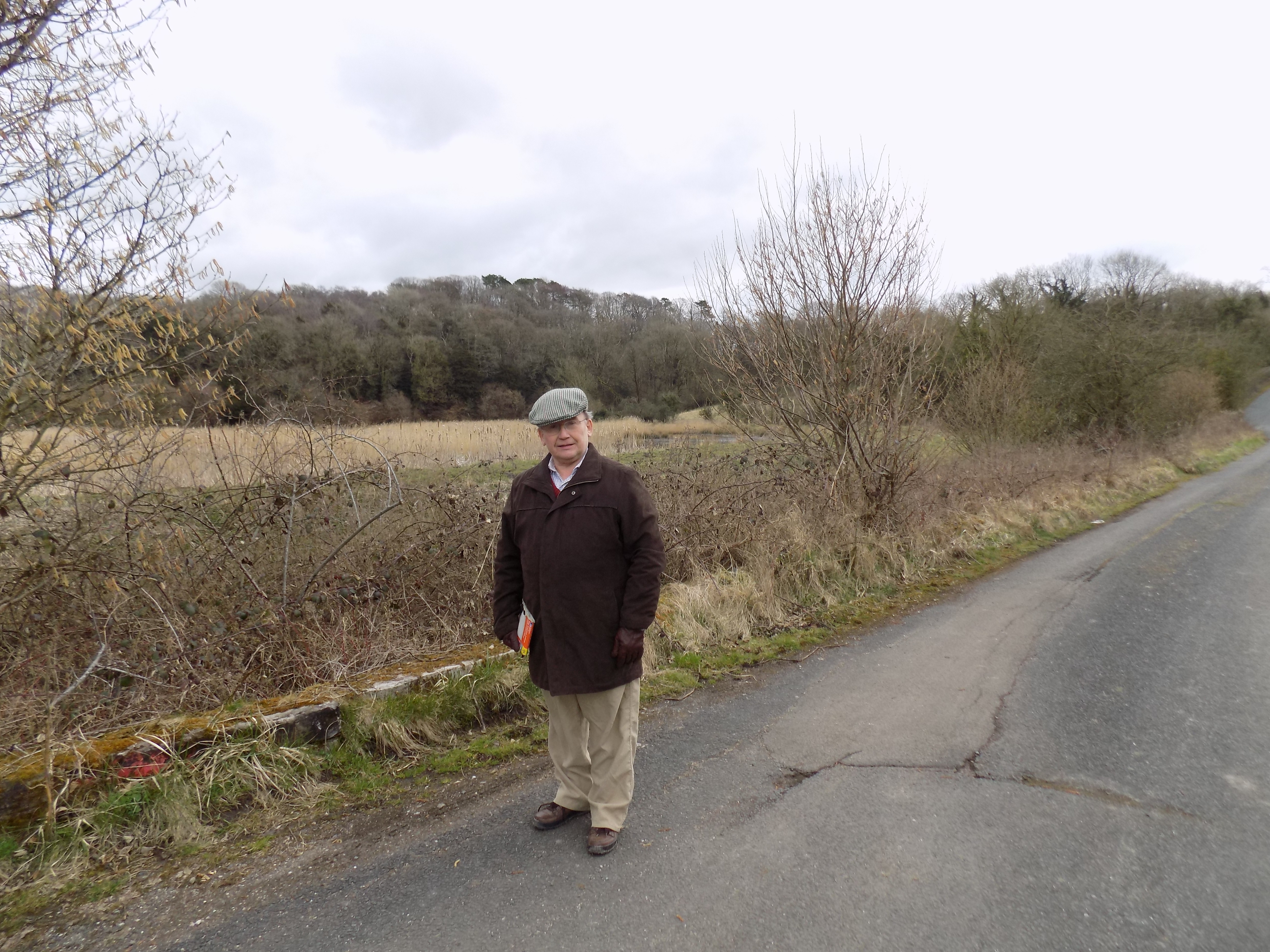 To follow in our footsteps, you should park your car where the road forks at Waterslack (east side of the map) just north of the bridge over the railway. Walk north along the minor road parallel to the railway. The road is a cul-de-sac and has no traffic to speak of. You pass a couple of houses, and just beyond them on the right hand side is a shallow reedy mere with real bulrushes, exactly like the pictures from the story of Moses in children’s books. You can just see them in this photograph if you look really closely. The map doesn’t show the mere, only a series of drainage ditches, but I promise you that it is there.
The road is metalled up to this point, and suddenly takes a sharp left turn across a gated level crossing into a disused limestone quarry. This is Middlebarrow Quarry, an oddly blank space on the map. (Were the surveyors refused entry?) John went exploring here but there is not much to see apart from a few warning notices, a stagnant pool at the bottom of the quarry and a striking but ugly escarpment at the edge of the diggings.
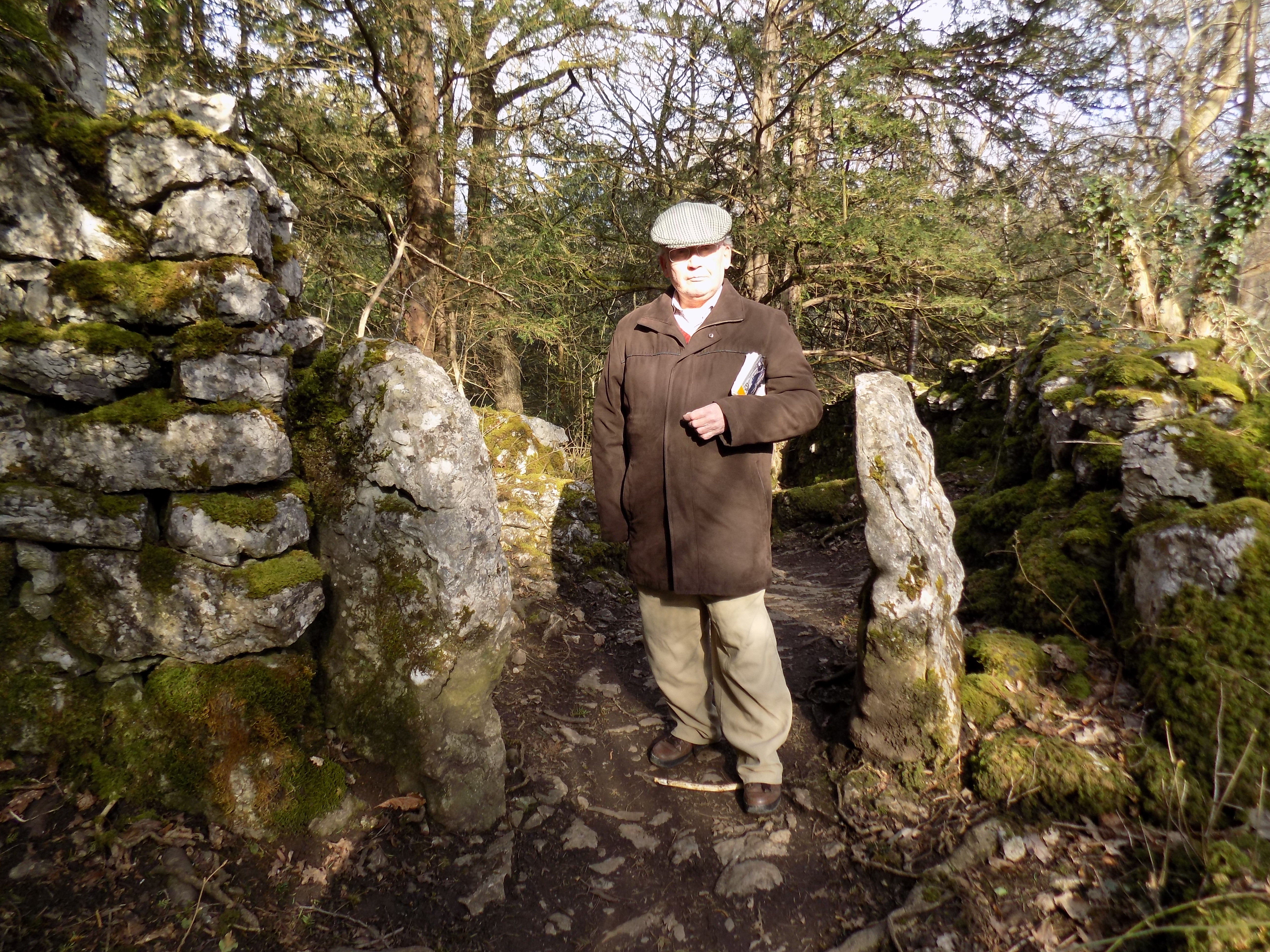
Your path does not enter the quarry, but turns north parallel to the railway on its west side, through a patch of scrubby woodland. There are warning signs to cyclists that this is a footpath and they should dismount, though I would not care to cycle along the path anyway: it is not paved but a beaten track with a mixture of mud, gravel and exposed rock, which I imagine would be an uncomfortable ride on a cycle, and hazardous to your tyres.
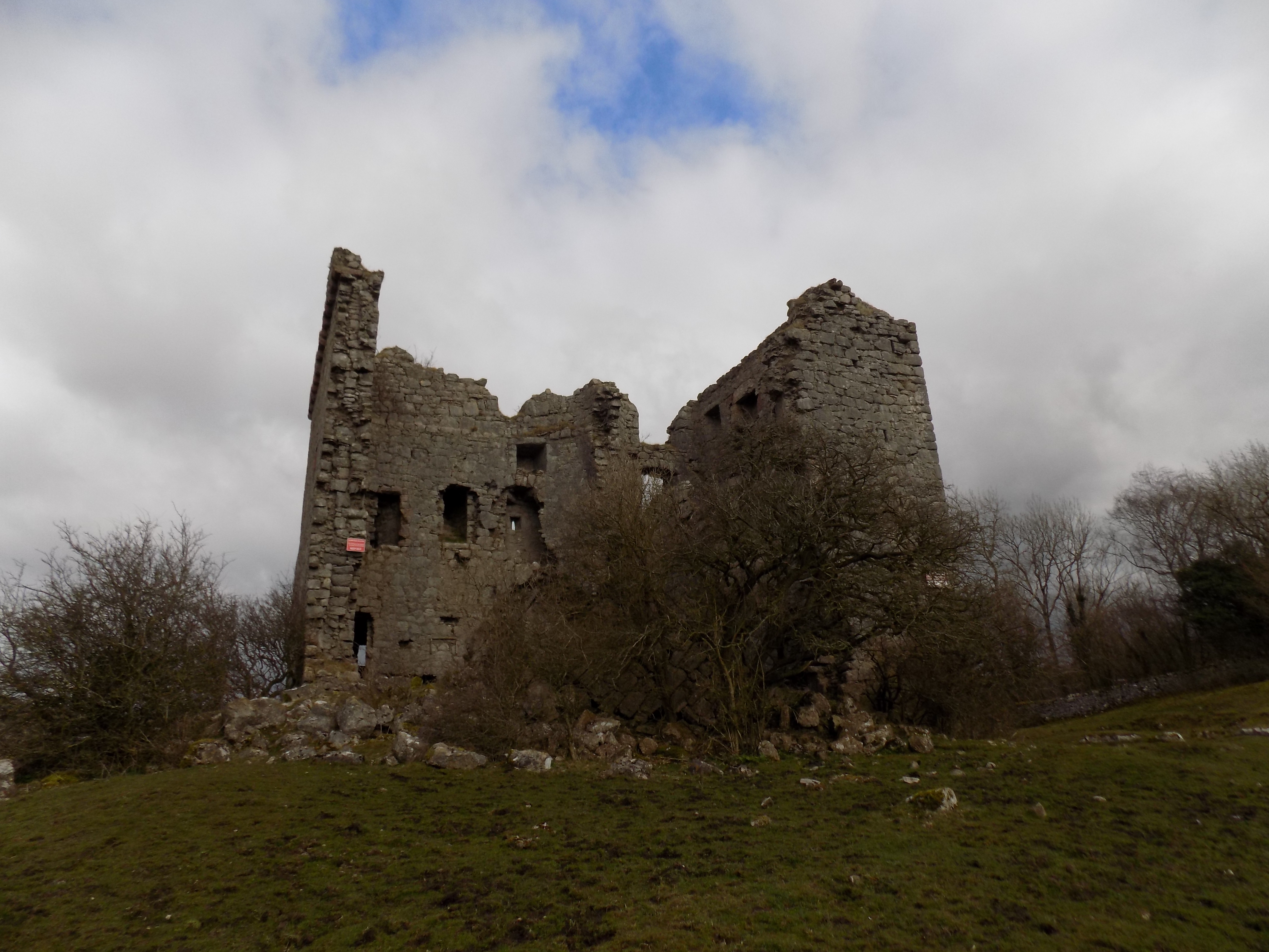 You continue along here for barely a quarter of a mile to a fork in the path, where one branch continues to follow the railway out of the woodland across a meadow, while the other turns westward through the wood on its northern edge. Take this left hand path and continue, now climbing gently uphill, for another half mile or more. Eventually the path emerges from the trees at the foot of a steeply sloping meadow, at the top of which stands Arnside Tower, a Grade II listed, ruined Pele tower from the late fifteenth century.
I do not recommend trying to climb directly to the Tower up the side of the hill. It is steep, slippery and muddy. The track you followed through the woods unfortunately almost disappears at this point, but if you circle around the right (north) side of the tower, climbing gradually, you eventually come to a well-made path that climbs southwards from Arnside Tower Farm (see map) up the edge of the field towards the Tower. This is a bit less of a struggle. The Tower itself is overgrown and unsafe, but there is quite a good view from here. John wanted to stand and wait to see a train on the railway below, but it was windy and cold, and I eventually dissuaded him. We heard the train later; we would have needed to wait for another 20 minutes before it appeared.
 Just beyond the Tower is a ladder stile which you must climb, and now you have two choices: to carry on straight ahead, over the shoulder of the hill (confusingly called Middlebarrow Plain on the map, but it is no kind of plain that I would recognise), or to turn right along a walled farm track. We chose the track which after a few hundred yards further emerges into a large, well-appointed caravan and camping site. These are caravans only in name: many are more like wheeled bungalows, and you do wonder how in the world they arrived here along the narrow lanes. Perhaps they were brought in kit form and assembled on site.
There are now several of these sites in locations that we know on the fringes of the Lake District. Near us there is one at Flookburgh and another just north of Holker. This one at Silverdale is paired with another, equally large and well-appointed, at Arnside. A day later we came across another at Capernwray, just north of Carnforth. The site developers have planned them well not to be too intrusive on the landscape, and I don’t begrudge the residents their chance to visit the Lakes, but the thought of living as a whole family crammed into one of these tin boxes, with the most dubious sanitary arrangements, seems to me deeply off-putting. They do not even offer the caravanners’ supposed advantage of mobility; these caravans are clearly going nowhere.
Anyway. On the far side of the caravan site you reach a road, just at the boundary between Cumbria (Arnside) and Silverdale (Lancashire). This is a very odd piece of local government mapping which I had not previously known; surely it would have made more sense to run the county boundary along the River Kent, between Grange and Arnside. As it is the folks in Arnside must feel a bit detached from the rest of their county.
 You follow the road south, noting Silverdale Cricket Club on your right: another of the pretty local cricket grounds we have found. The road quickly comes to a left-turning L bend, and shortly beyond there you will find a path forking to the left. Follow this path, crossing another minor road, and admire the wealthy houses with what must be stunning views across Morecambe Bay. I guess these are homes to some of Manchester’s millionaires (but not the footballers; they all live in Cheshire). According to the map this part of Silverdale is called Elmslack, though I have never seen or heard the name in use.
On the far side of the minor road the path passes through a gateway which looks exactly like the entrance to one of the houses; don’t be fooled. There is a footpath sign, but you could easily miss it. Eventually you come out on the edge of the wood and rejoin the direct path across Middlebarrow Plain which we rejected earlier. The rest of the walk is straightforward. This woodland path, hard dry earth with a carpet of dead pine needles, runs steadily (but not steeply) downhill through the southern fringe of Eaves Wood to an ungated pedestrian level crossing over the railway. On the far side is the same cul-de-sac along which we started the walk. And so back to the car.
You could choose a different starting place for this walk, or do it clockwise instead of anti-clockwise, trading the steep short climb up to Arnside Tower for a less steep but much longer hard slog up along the southern edge of Eaves Wood. On the whole I think I prefer anticlockwise. It’s painful, but over quickly.
Many thanks to John for the photographs.