Ministry of Flat Walks 19 : Cark to Cartmel (and back again)
23 February 2019
To follow this walk, open another tab in your browser and input this web address: https://bit.ly/2SVrDyt.
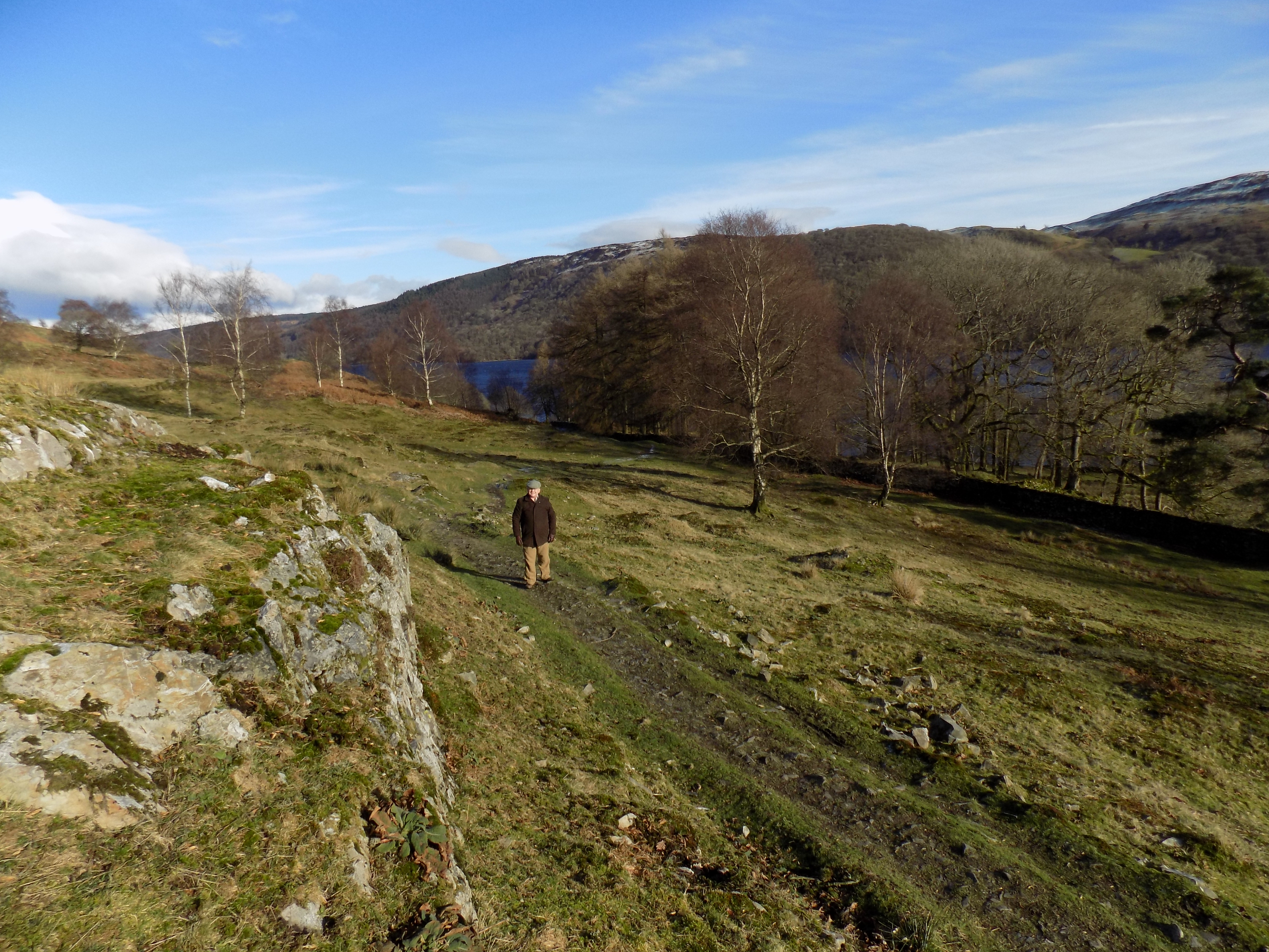
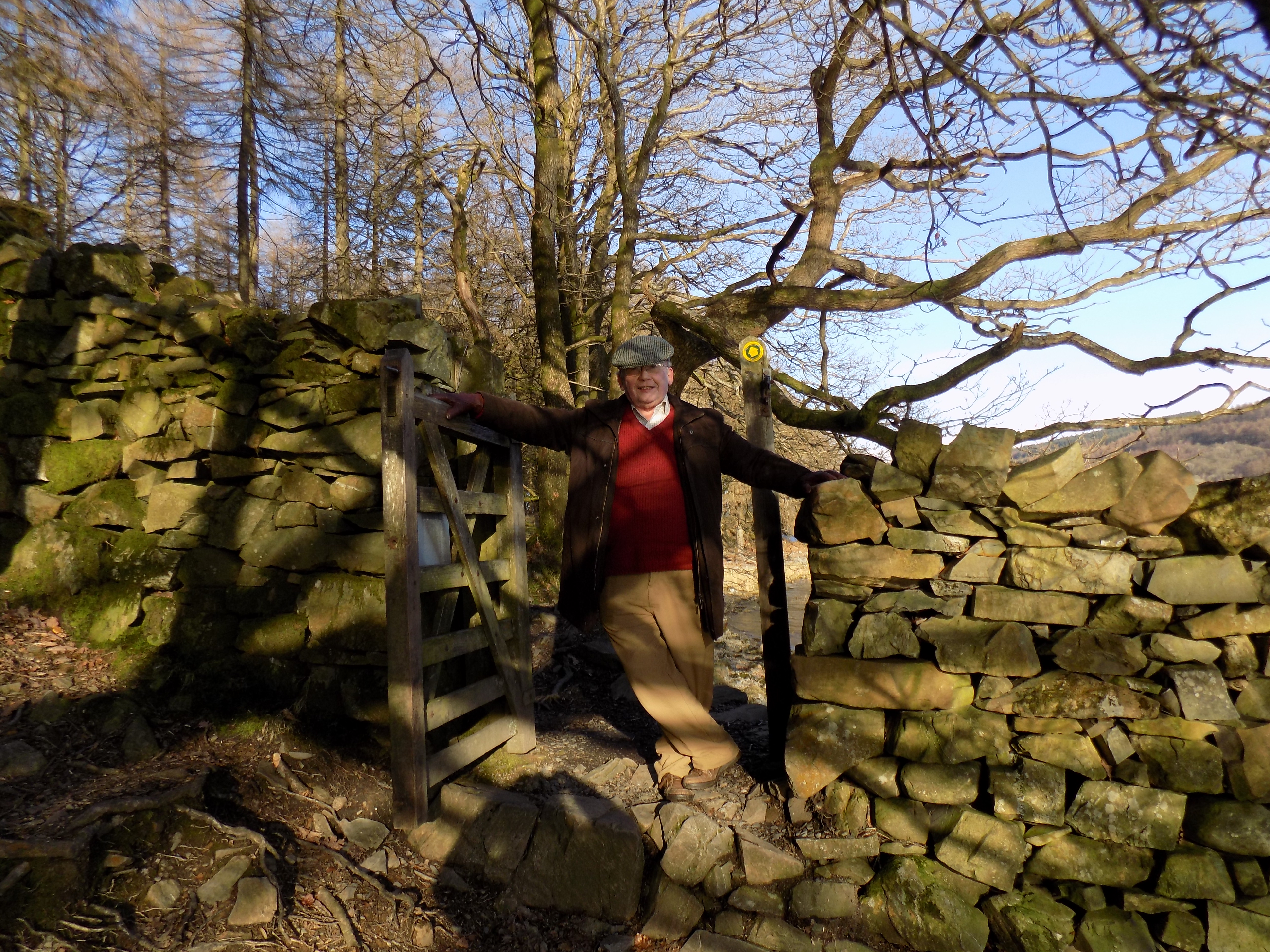
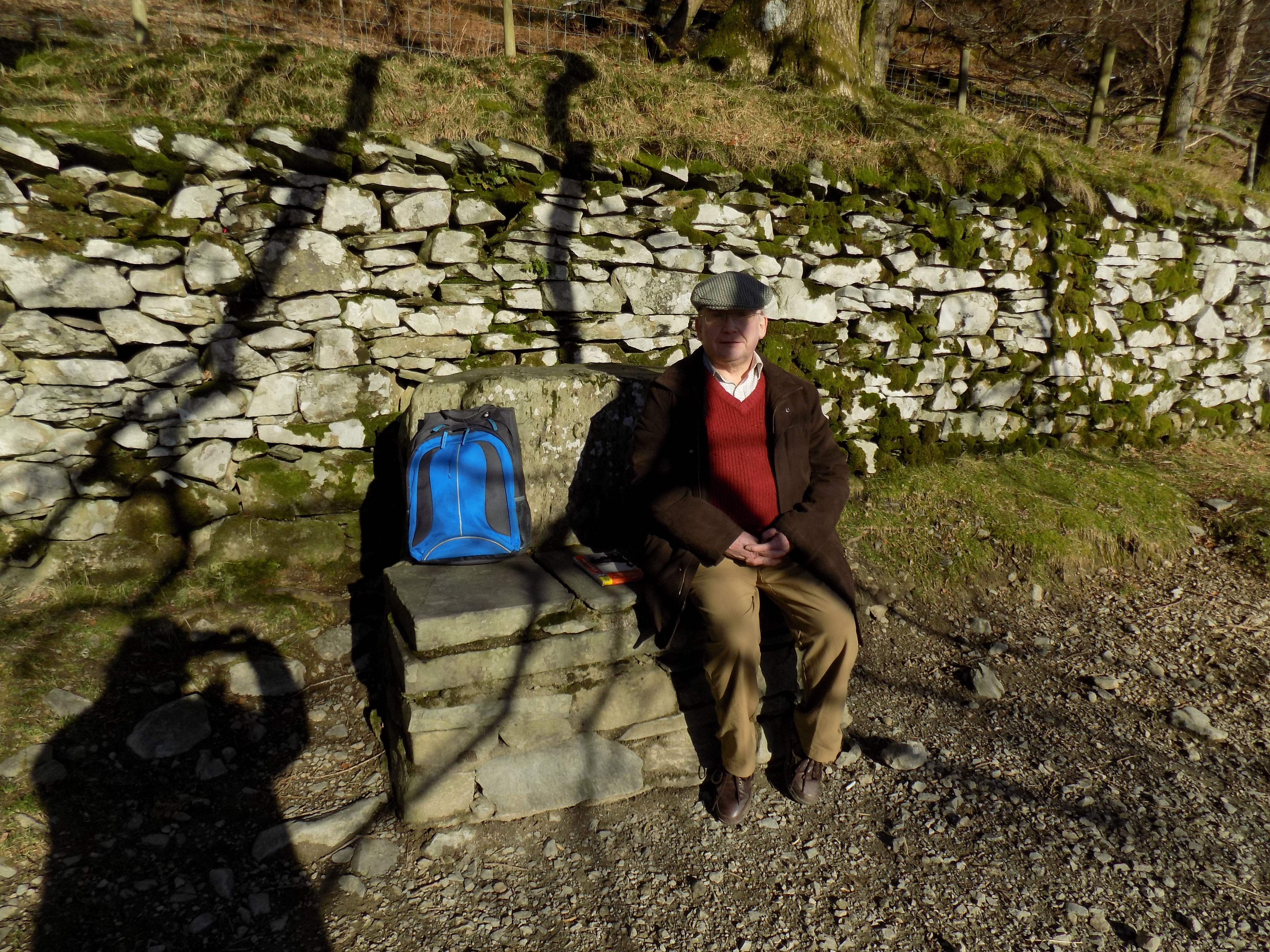
This walk starts at our front doorstep, almost directly facing the railway station in Cark village (bottom left of map), and proceeds to the picturesque village of Cartmel (top centre). When John and I first bought the house in Cark we asked the vendor about local walks, and this was the one she pointed out to us. Very often we do a simple there-and-back walk, but this afternoon we chose a circular route, and that is what I will describe.
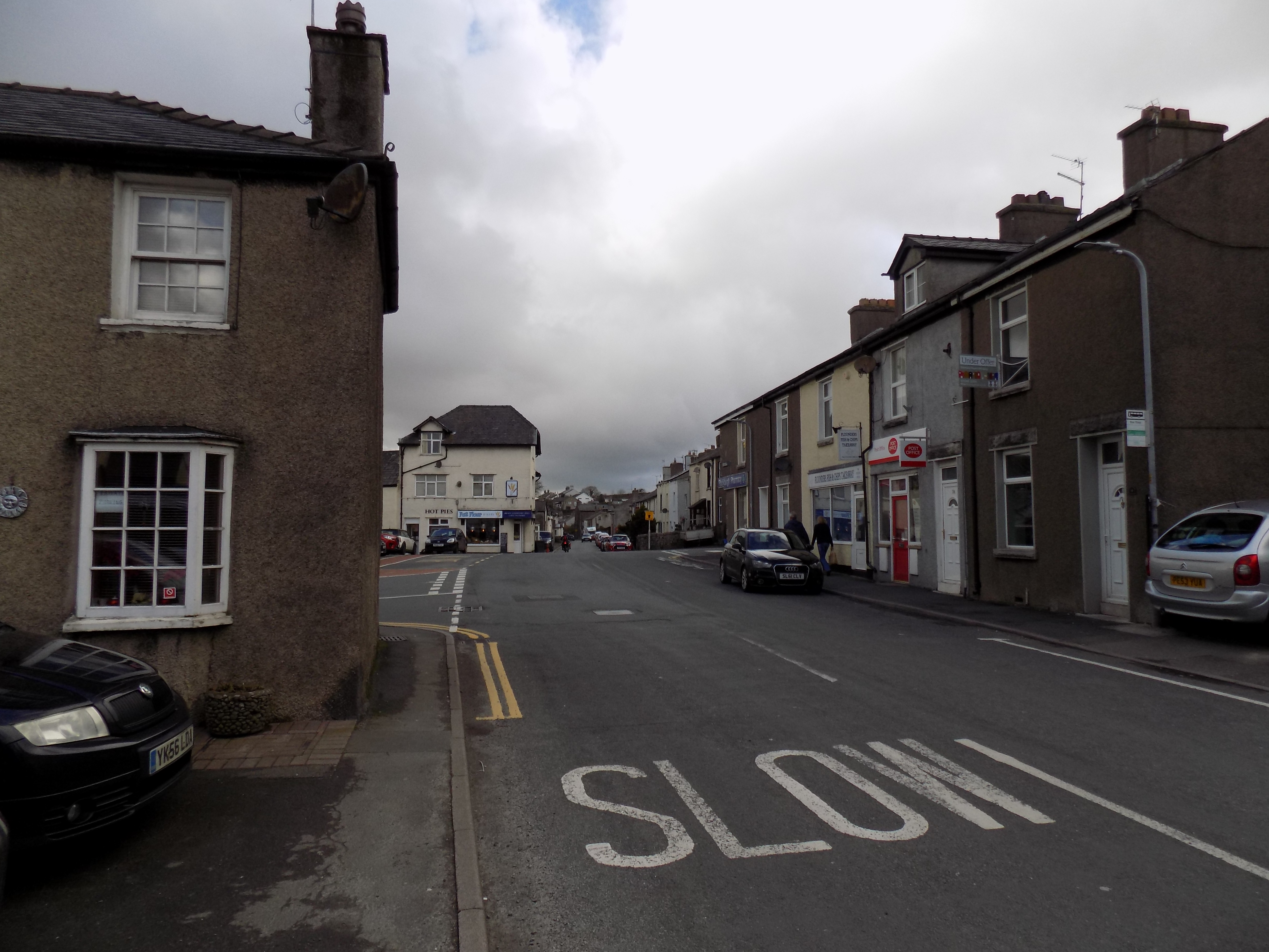
From the start you turn southwards into the centre of Flookburgh. The two villages are almost inseparable. Arguably we live in Flookburgh, not Cark; the Post Office certainly thinks so. But as our house is just across the road from Cark railway station I reckon that we are in Cark, and would draw the boundary between the villages at the church which lies 200 yards south of us.
The histories of the villages are quite different. Flookburgh was originally a fishing community, and to some extent still is, though the fishermen now use tractors rather than boats to harvest cockles and shrimps from the nearby waters of Morecambe Bay (scroll the map southwards to see this). Flookburgh shrimps are a well-known local delicacy. Most of the buildings, especially around the central square, are a slate grey, and give the impression of a working-class community.
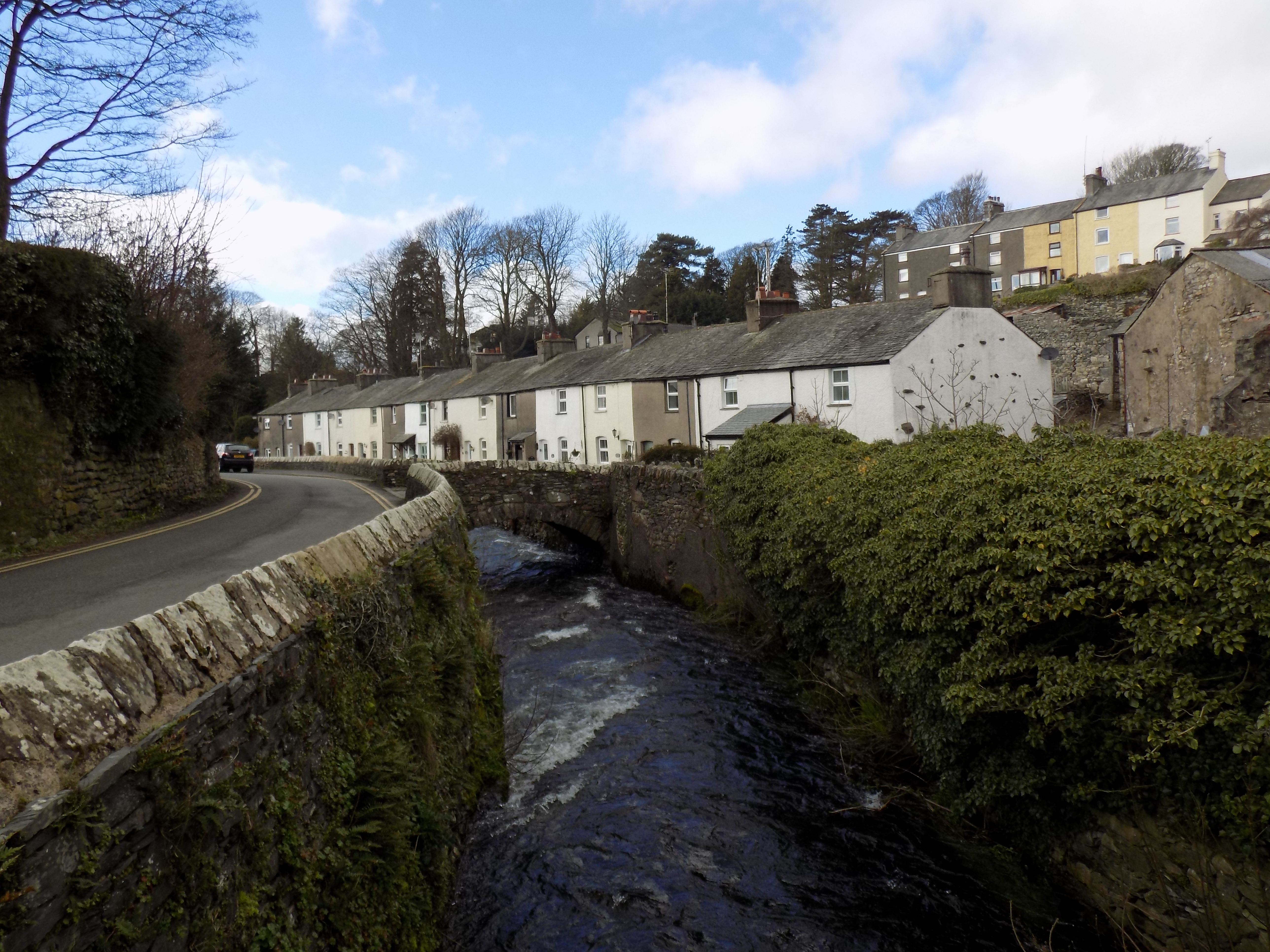
Cark is somewhat more diverse. For a brief period around 1800 there was a cotton mill in the village, and though it has long gone the workers’ cottages still line the river. The local stately home at Holker Hall is less than a mile away and I believe some of the local cottages were once occupied by estate workers – for all I know they still may be, although there are also now a lot of second-home owners, like ourselves. The predominant colour here is the whitewash typical of rural communities.
Turn left in the centre of Flookburgh, and just before you come to the Crown Inn (now closed, and showing no sign of reopening) turn left again up a minor road. At first on your left is a small estate of newer houses, but after you cross the railway bridge you are in open countryside. Traffic here is sparse. The road now climbs gently up to the group of buildings shown on the map as The Green. The large building ahead of you as you approach is owned by the local vet, who each year at Christmas puts up a spectacular show of Christmas lights around his house and outbuildings. The lights are designed to suggest a funfair, and are best seen from the main Cark–Cartmel road, to the west. When John and I first saw them we could scarcely believe our eyes; we really thought a fair had come to town, and set up in a very odd place.
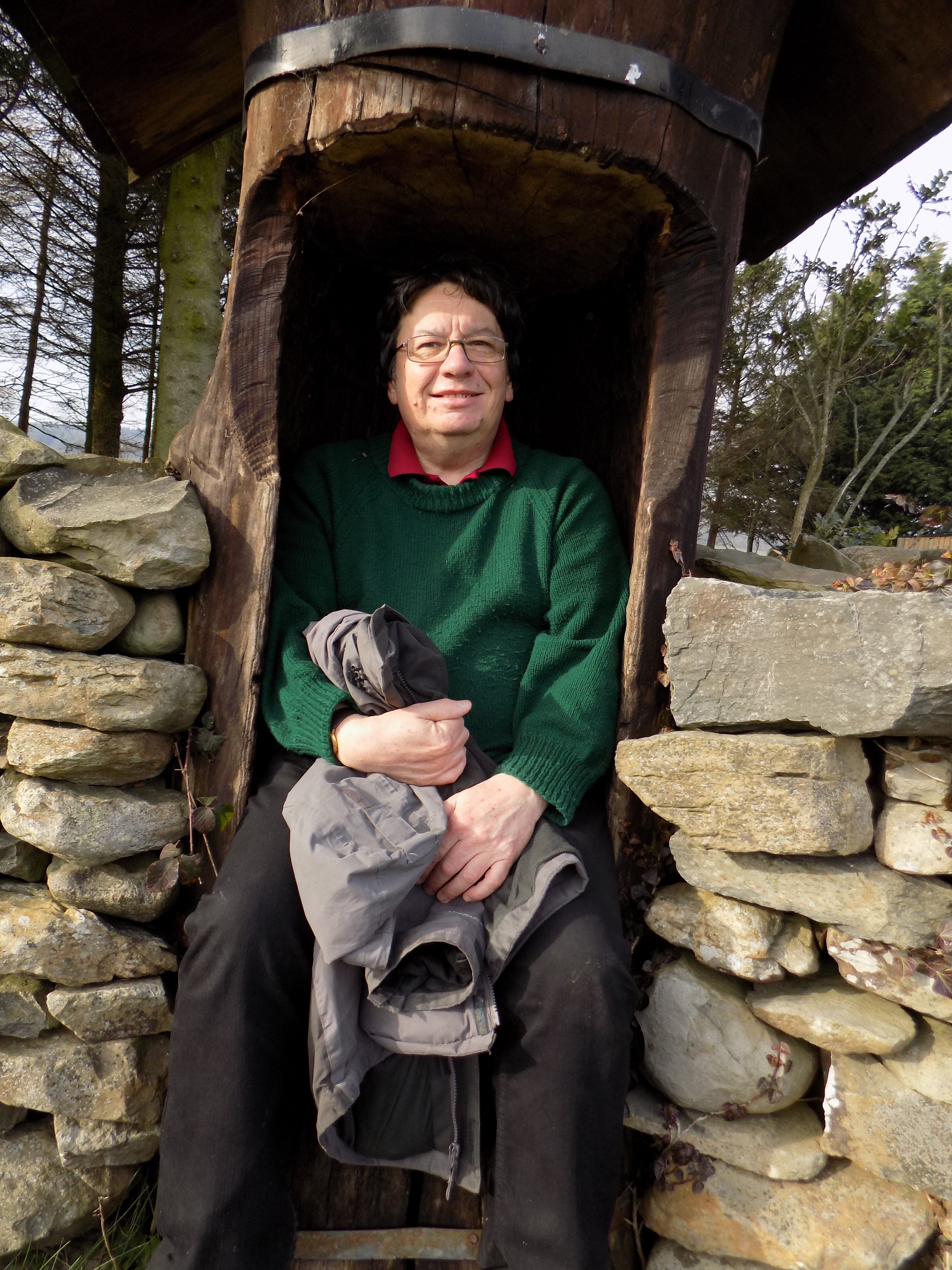
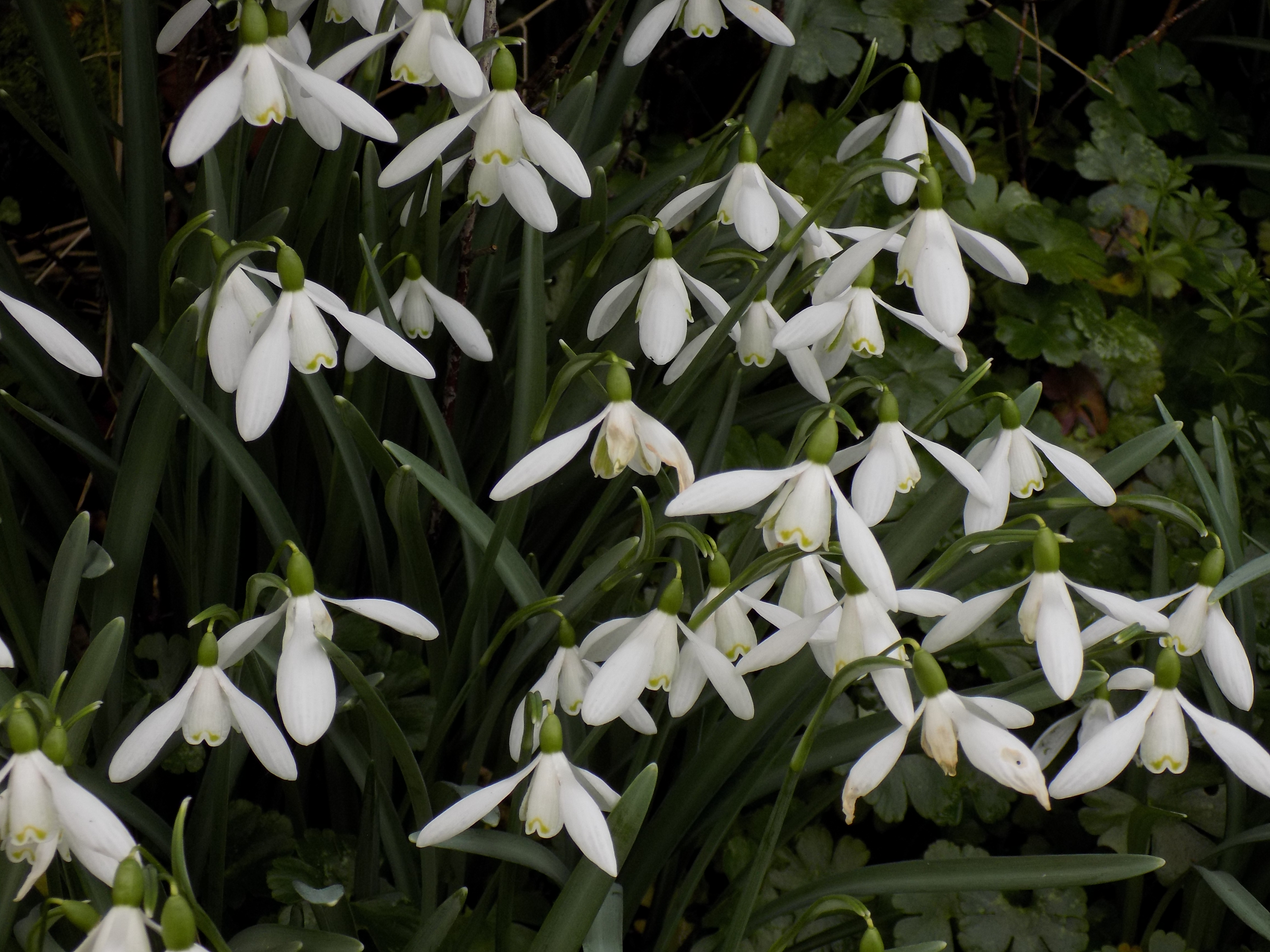
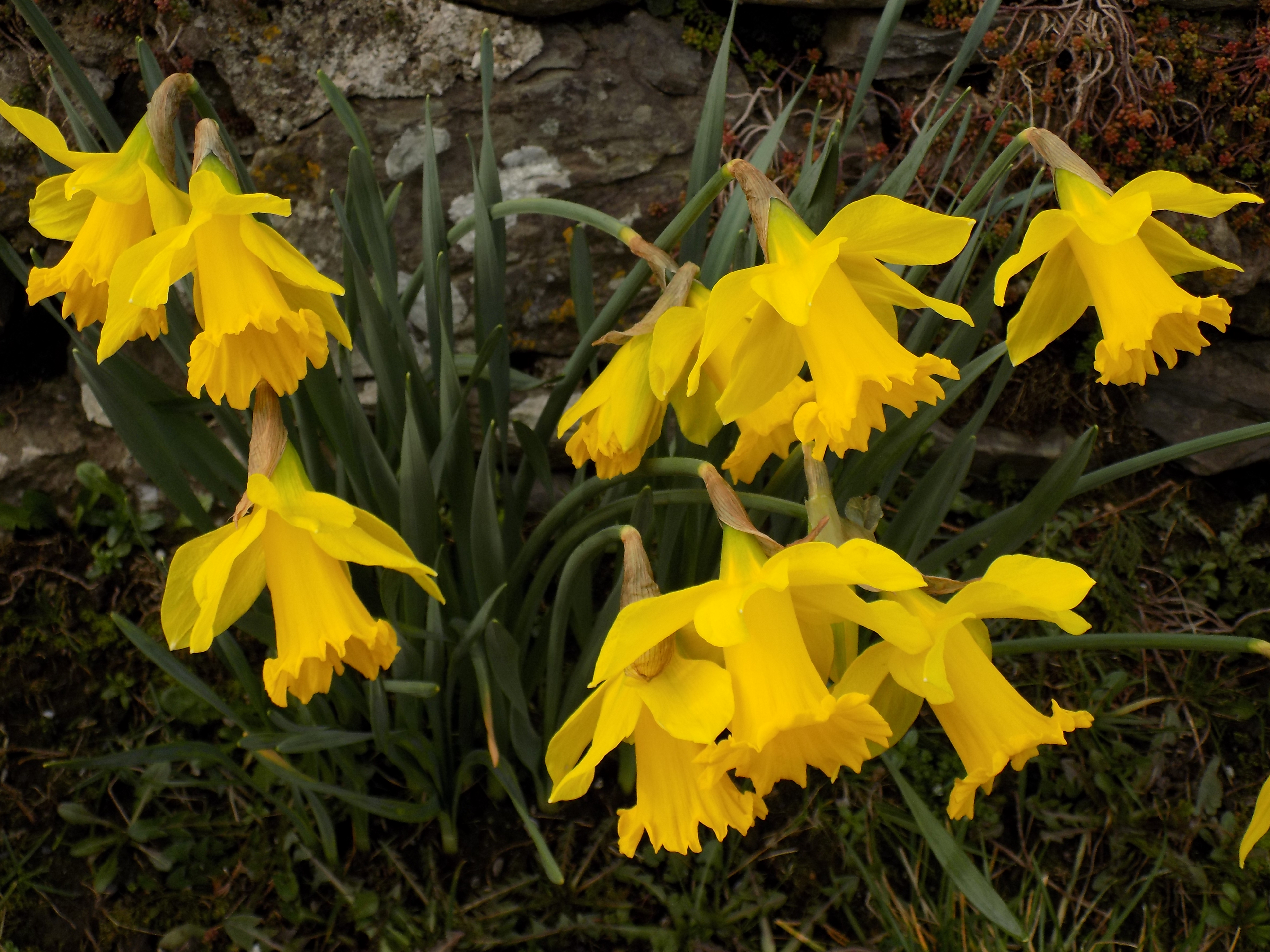
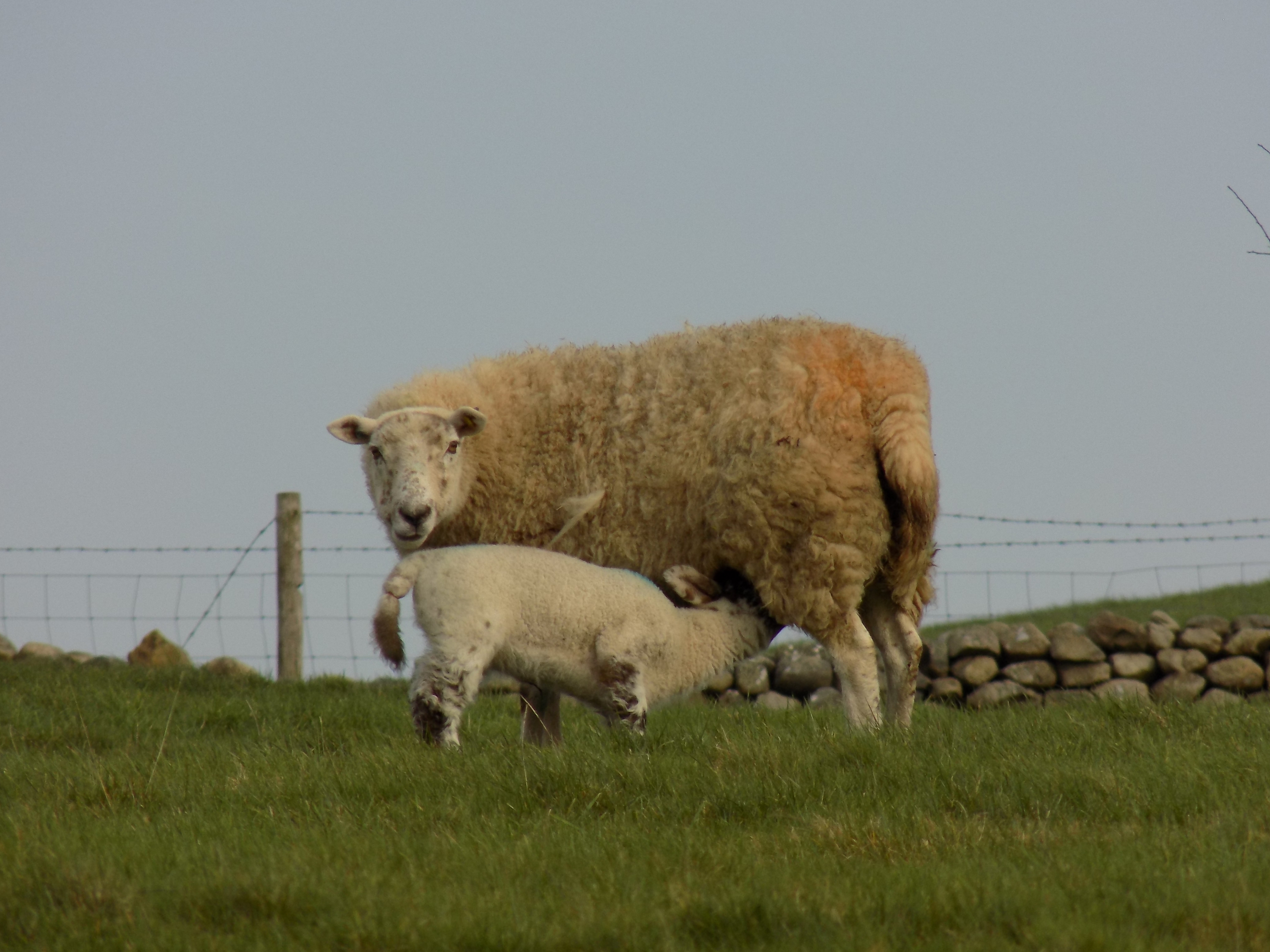
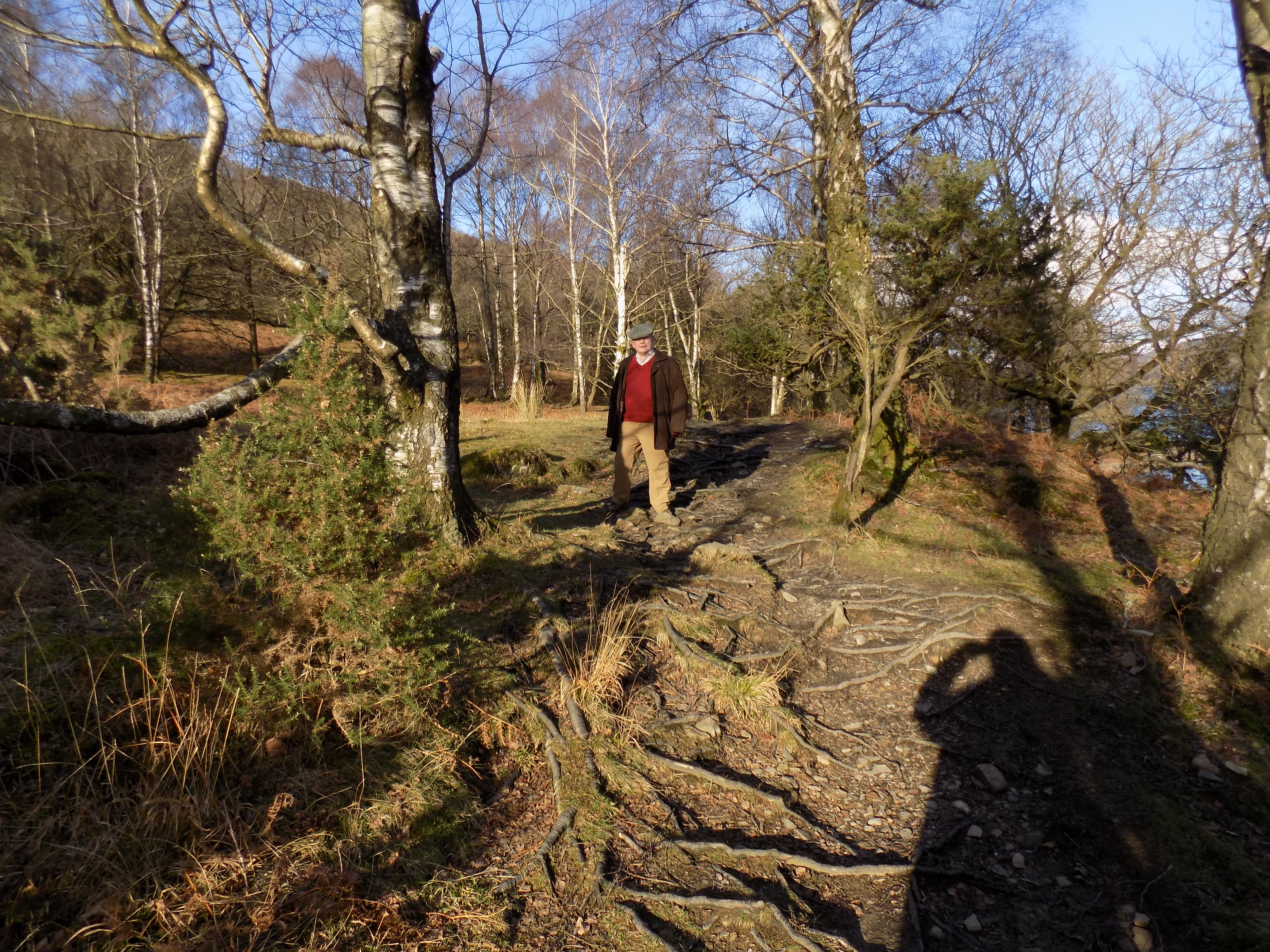
Turn right in front of the vets, and then left on to another quiet lane leading to Birkby and Cartmel. Although it is not yet the end of February, spring seems to have arrived: on our walk today there were lambs in the field to our right and daffodils, as well as snowdrops, in the hedgerows. The lane continues to climb gently up to the group of farm buildings at Middle Birkby, about half way to Cartmel, but the gradient is slight and not difficult. On the left at Middle Birkby is a sheltered alcove which I think the farmer must have used at some time to leave milk churns for collection. It is a cosy little nook.
From here you follow the lane to a junction with the main Cark–Cartmel road. Go straight ahead, following this road to the crossroads marked as Headless Cross. Take care, as this is a busy road and you will unavoidably force oncoming traffic on to the wrong side. For anything more than the occasional vehicle, best to press yourself back against the hedge and let them pass while you stand and wait.
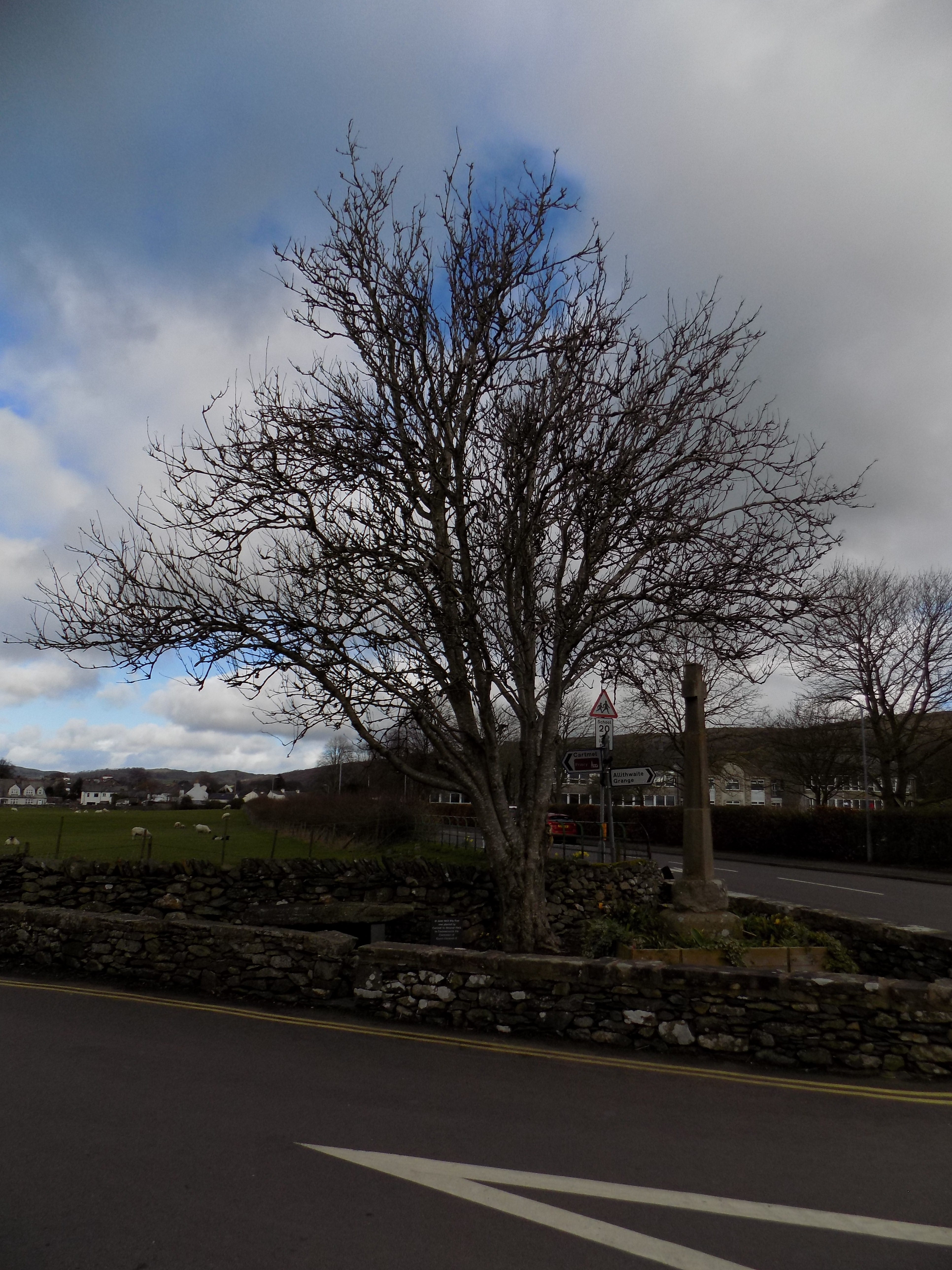
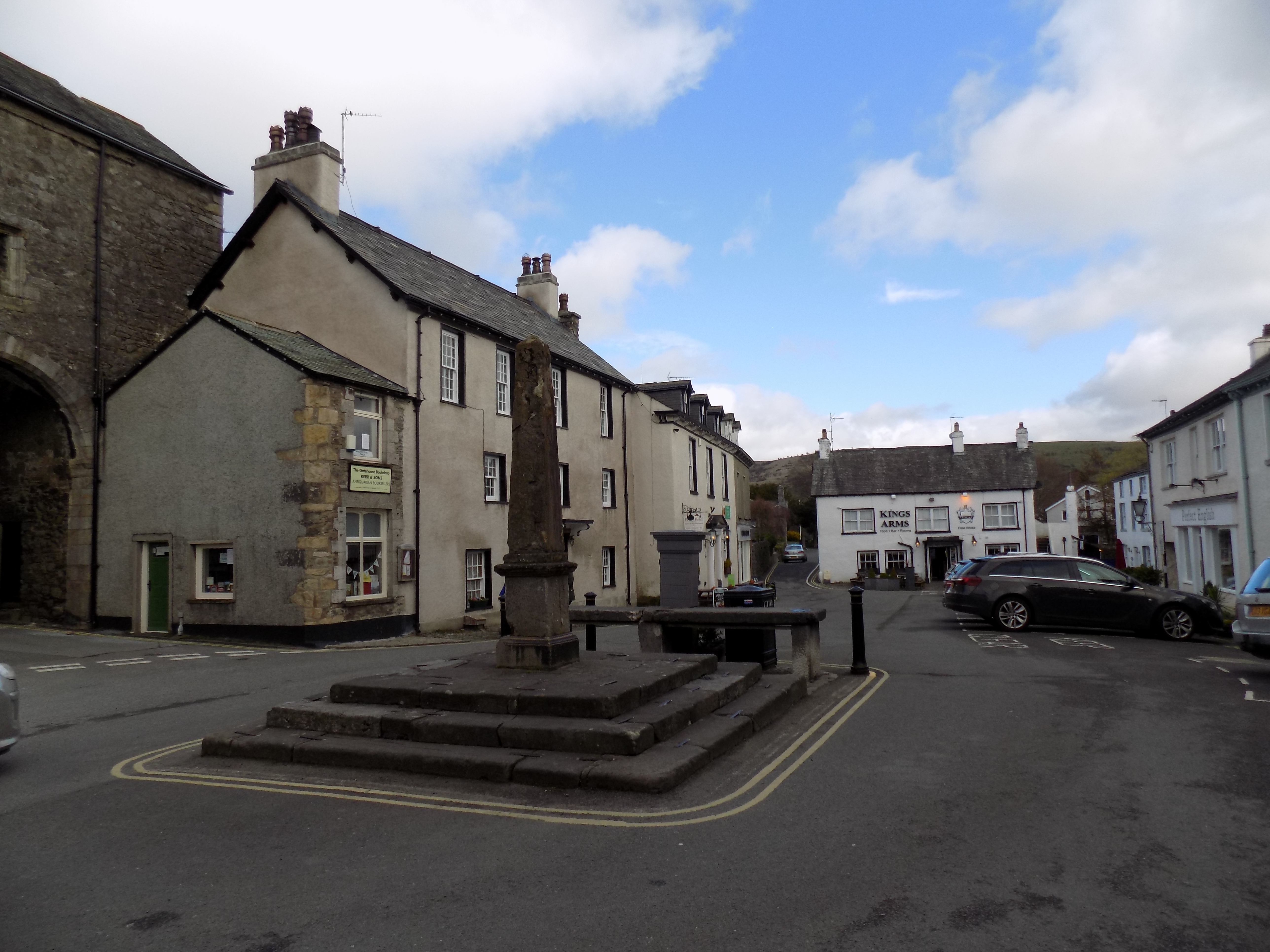
John and I cannot find any trace of the original headless cross, but there is a memorial here and also a tree planted by the local Brownies to commemorate the Queen’s coronation. It has done well. Turn left and follow the road into Cartmel village, where you can find the famous Priory, several pubs and other eating places, a brilliant cheese shop, an expensive (but good quality) second-hand book shop and various gift shops.
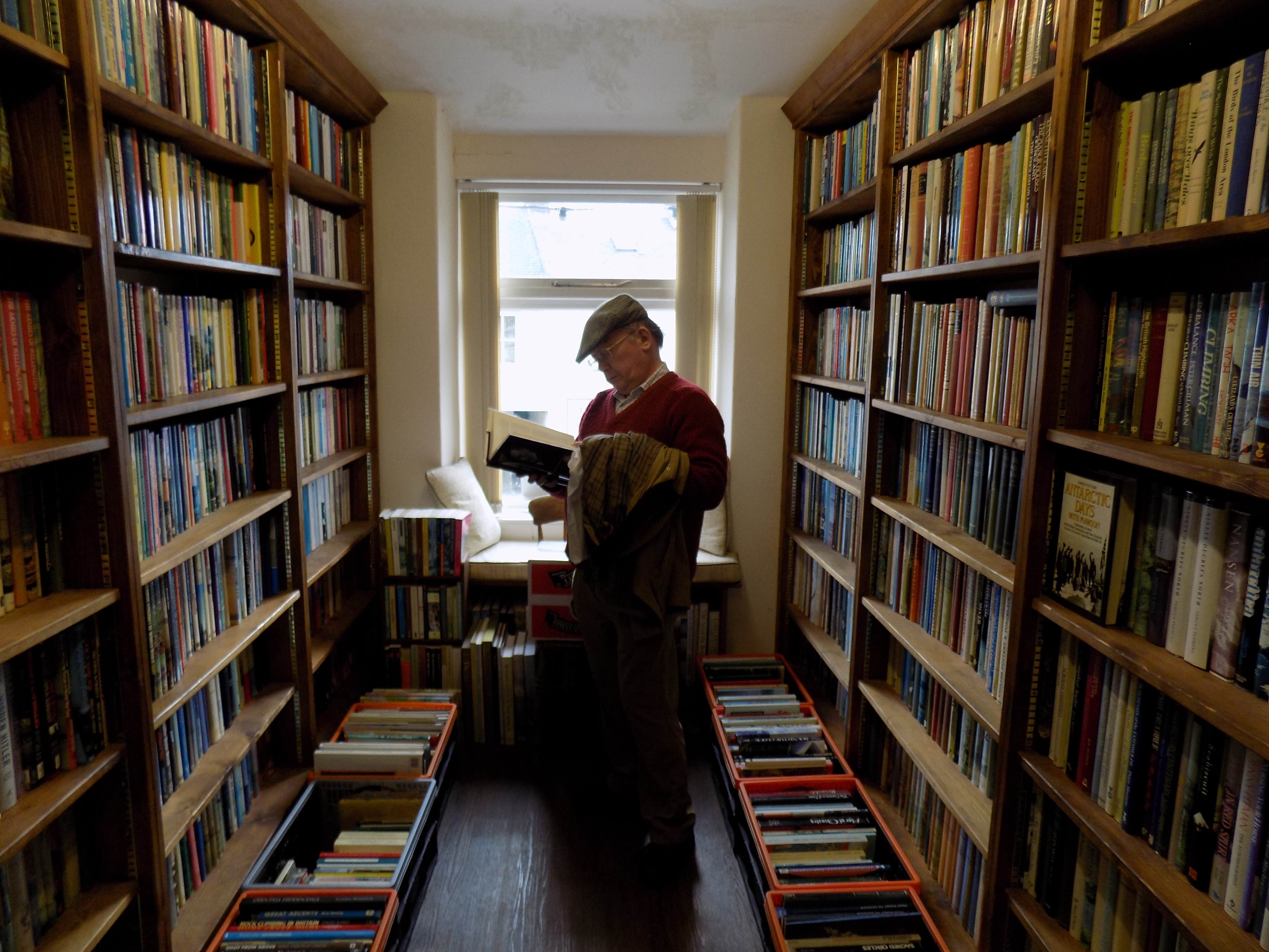
The bookshop is not always open, but when it is, as it was today, we can rarely resist. They even had a sale today: all the upstairs books at 50% of the marked price. John bought one and I bought two. We guessed, and the assistant confirmed, that the sale was to clear some room for more books.
There is a small square in the heart of Cartmel, usually filled by parked cars, with various roads leading away. Two of these roads are on the side facing you when you enter the square. Of these, take the one of the left, along a narrow lane between walls and on to a large car park which stands in the middle of Cartmel race course. John and I don’t have much patience for the races: nothing happens for half an hour, then the horses are past you in a flash, repeat five times. But the race meetings are great days out for the local community and plenty of people come from far and wide to attend.
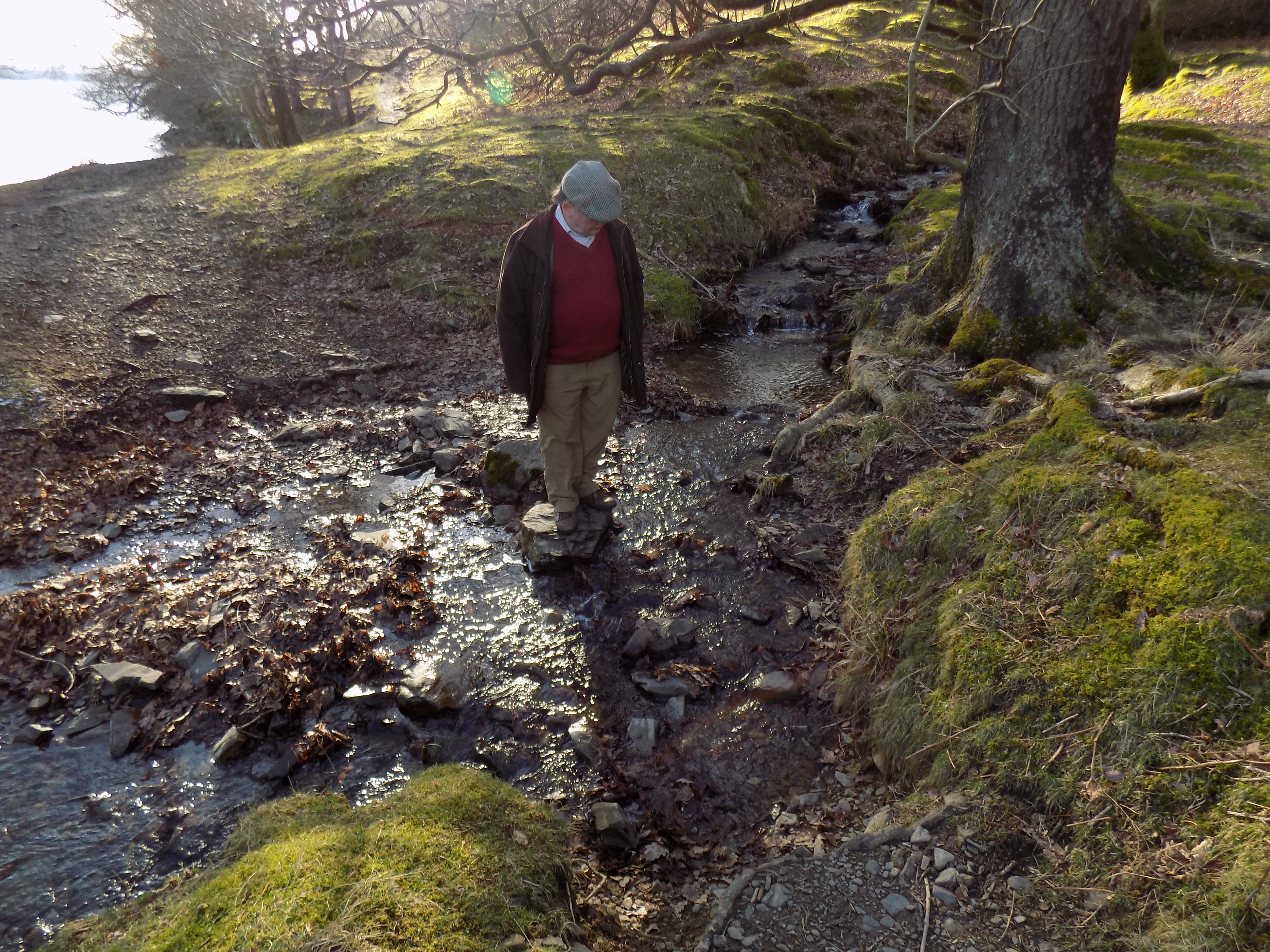
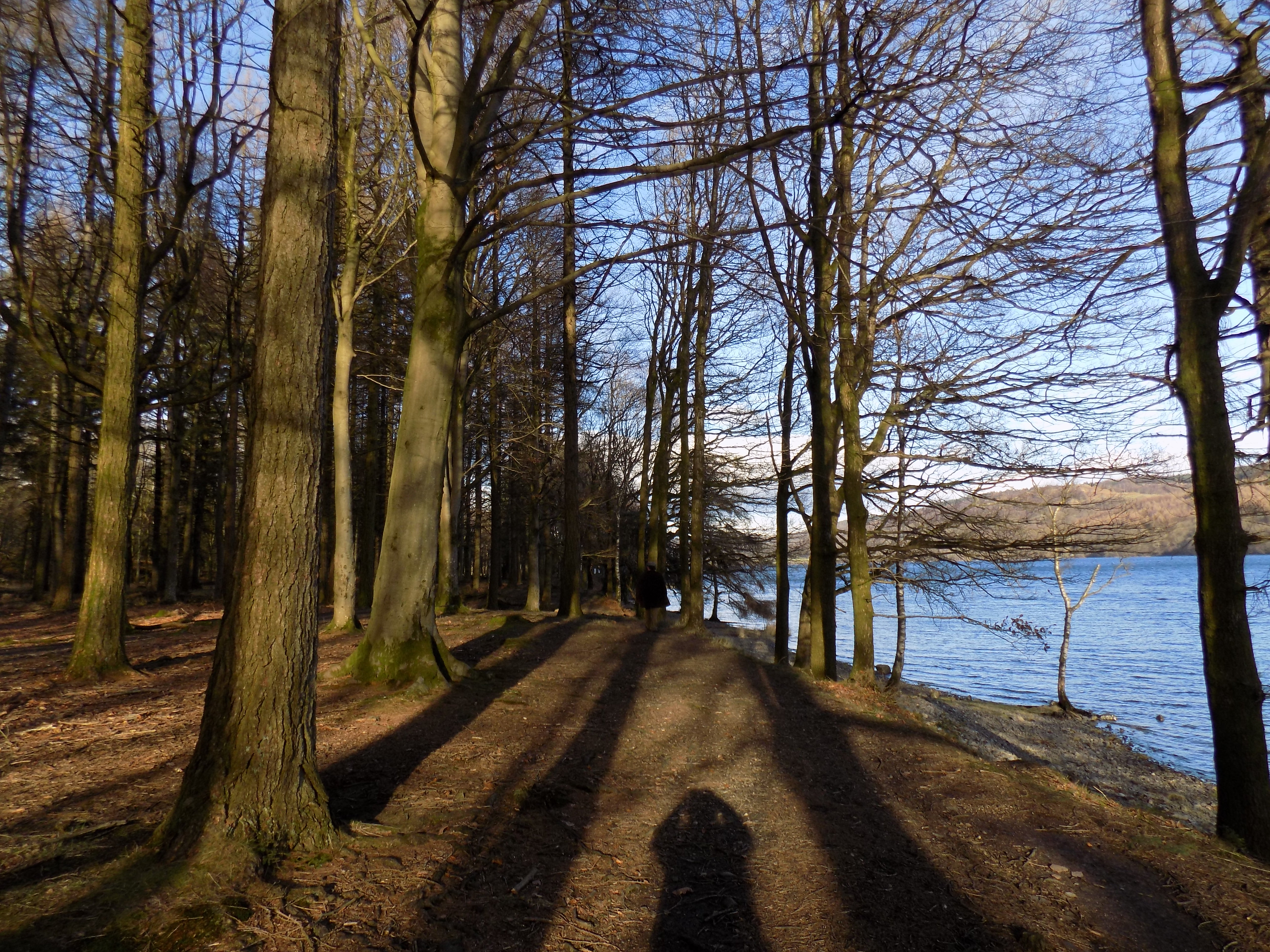
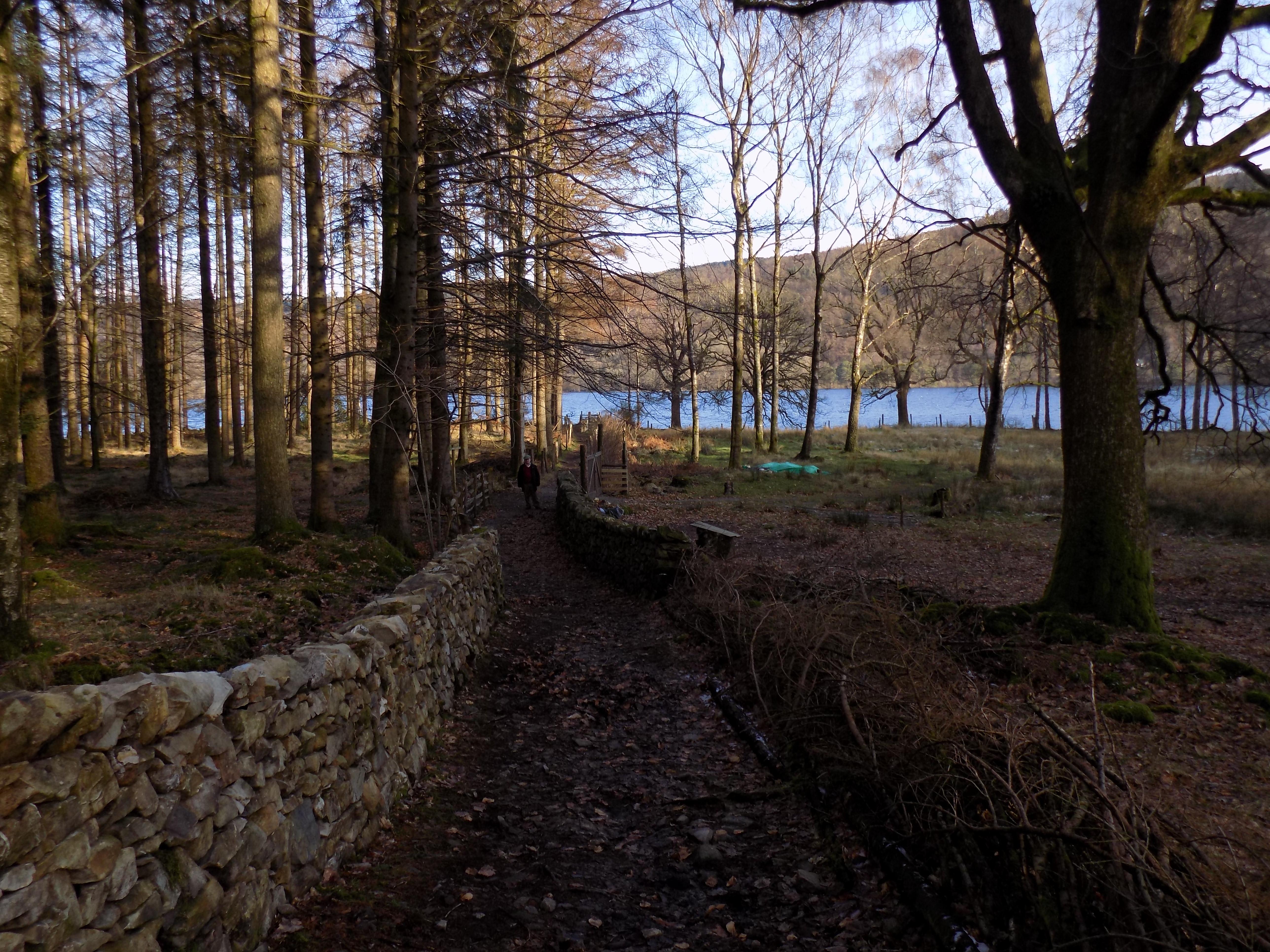
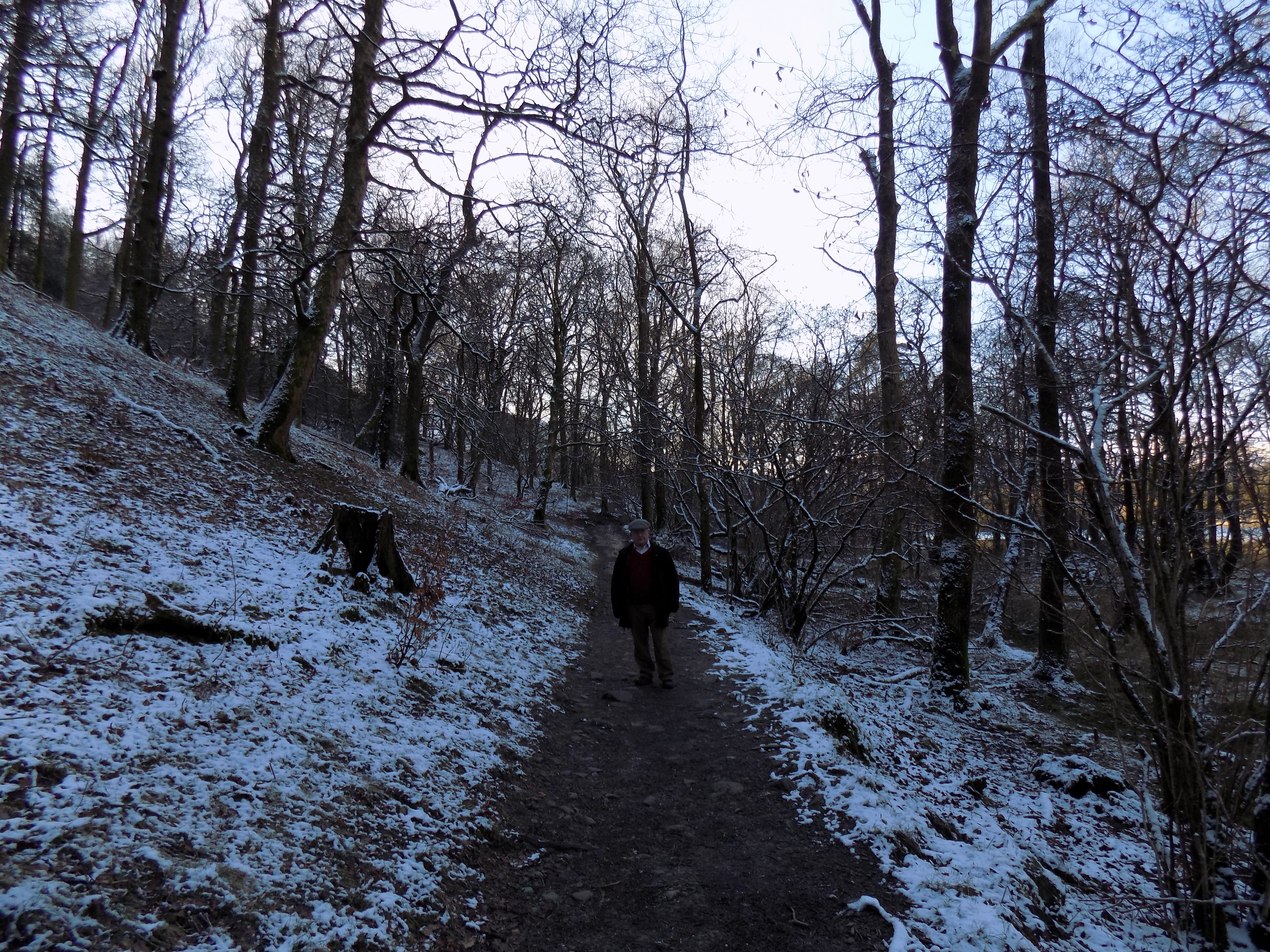
Beyond the car park, go through a gate, across the race track on the other side, through another gate and into an open field, which is used for parking space on race days but is otherwise usually empty. On the far side of the field is another gate leading into a rough country lane and, beyond that, into a tall shadowy wood. This is the route we follow on our there-and-back walks, and I think this is the part we both like best, as it is very quiet and despite the shadows not at all gloomy. The track leads round a broad bend, up a short hill and comes to a fork in the road which from this point onward is again a metalled surface. Take the left hand fork and follow this farm road back, past Low Bank Side farm and down a hill to rejoin the Cark–Cartmel road just north of Cark village.
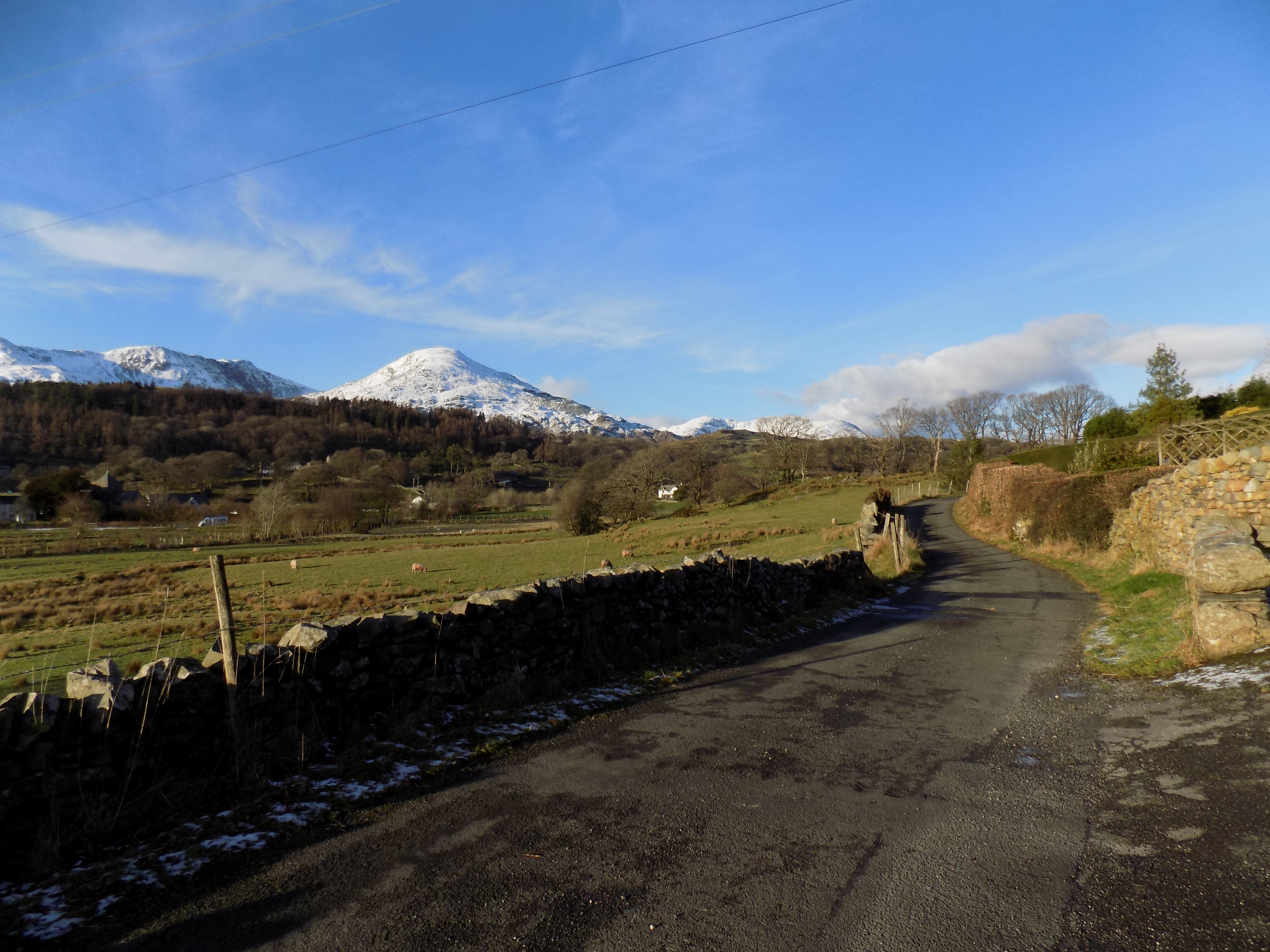
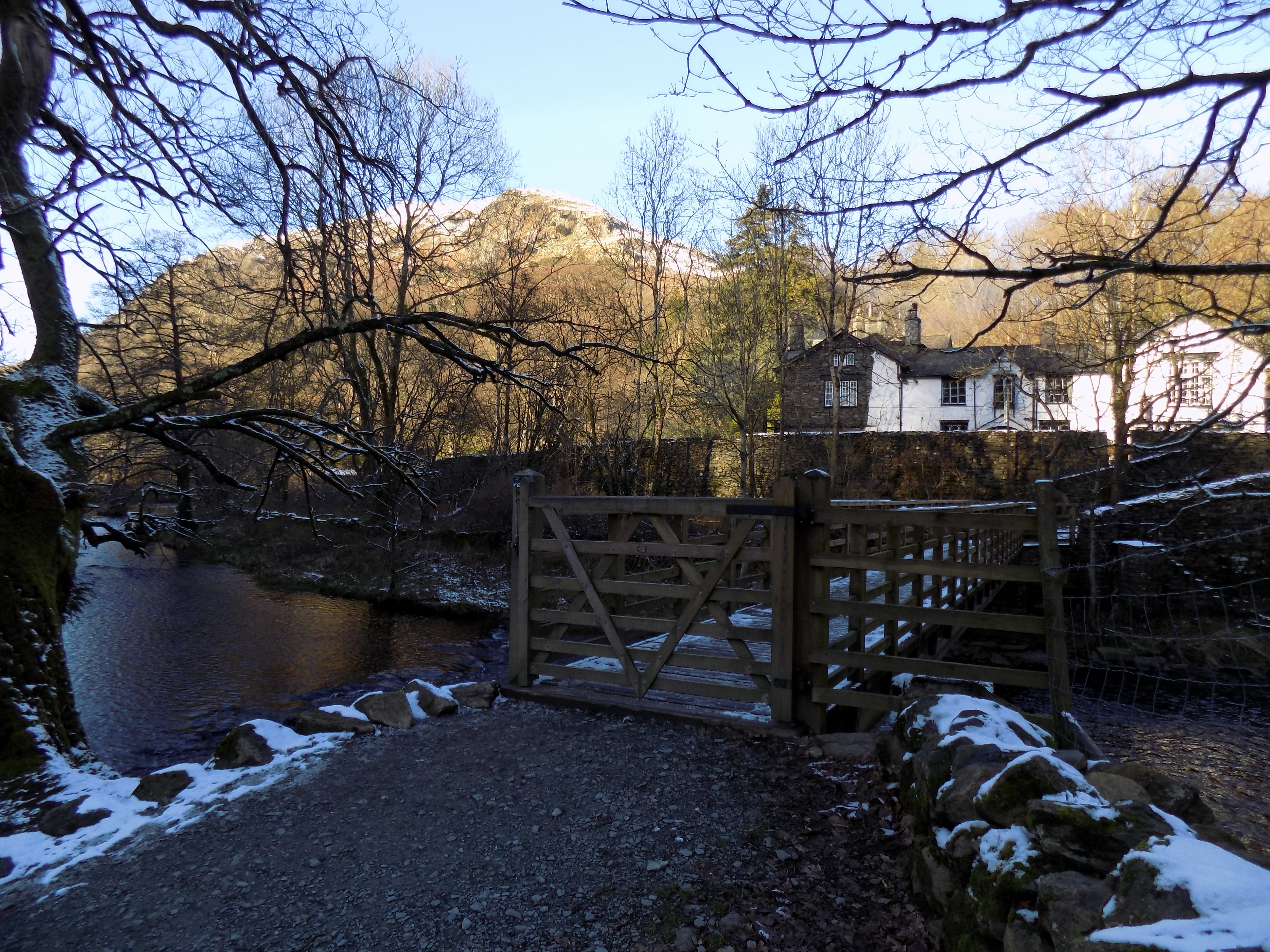
Follow this road down another short hill into the centre of the village. Turn left on to the road to Grange, cross the bridge over the River Eea, and follow the road back to our front door. The there-and-back walk is about four miles, but the route we followed today is slightly longer: say, four and a half.
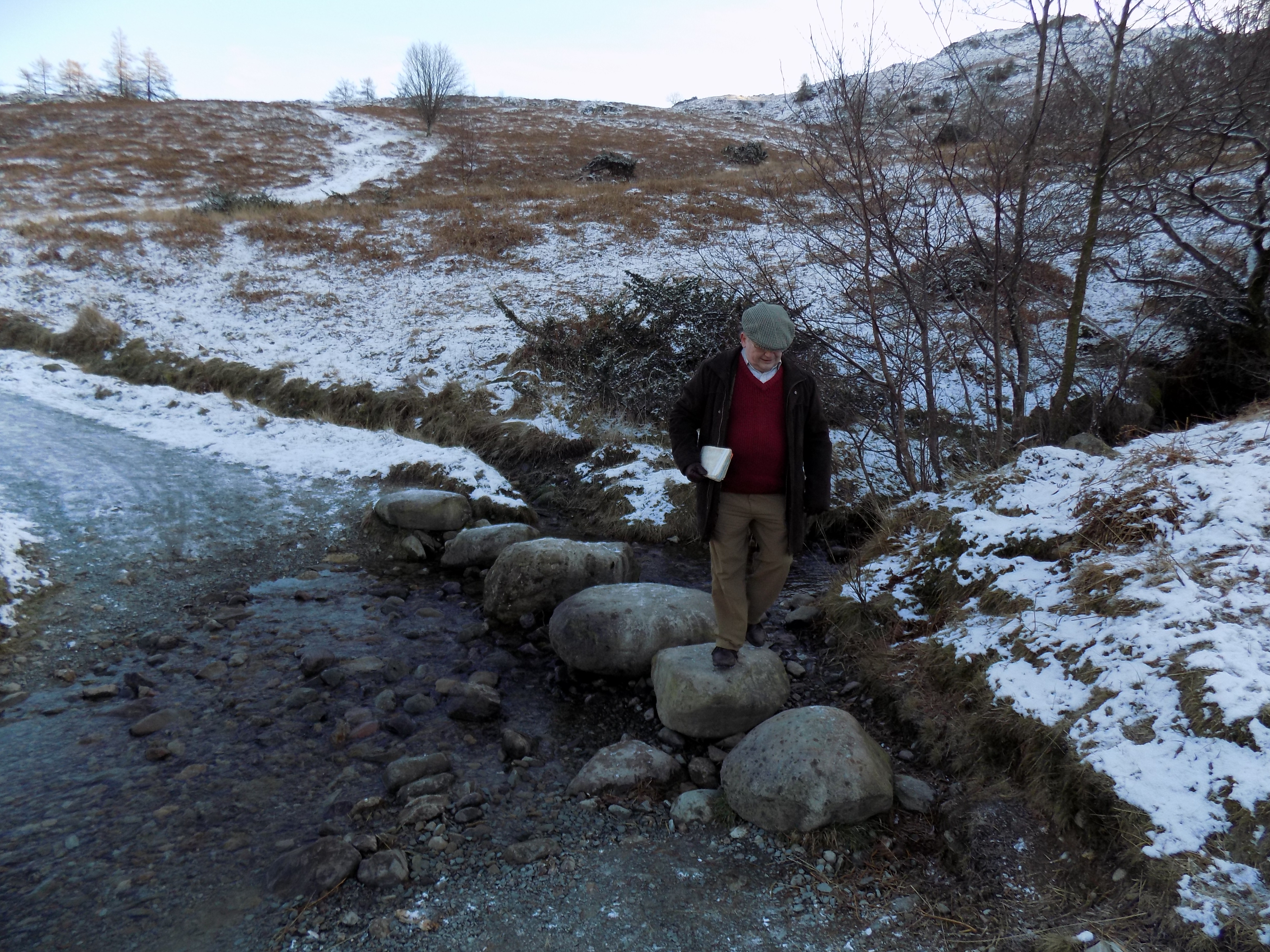
Another variation of the route is possible, but you need to scroll the map a little northwards to follow. Coming from Cartmel, after crossing the open field do not go through the gate but turn right on to a path which clings to the edge of the field, then crosses a brook on a flat slate footbridge. This path leads up to Walton Hall farm where you turn left on to a minor road for about 200 yards before another left turn on to a marked bridleway. Now climb steadily through a long stretch of woodland before meeting a track which comes in from your right. This track is marked on the map with green blobs. Continue straight on until you come to the end of a metalled minor road with a turning place and space for a few parked cars. From here you can walk down the metalled road to rejoin the B5278 at Holker or take a sharp left and zigzag back down the side of the hill to come out at the fork in the road just beyond the shadowy wood.
This variation is definitely not flat: the climb along the bridleway is steep enough to leave me panting, and it continues for several hundred yards before levelling out. But I have managed it on occasion. I always think of this as the adder walk, because on a gate somewhere in the woods there is a sign saying Beware Adders. We have never seen an adder in this area, and of course they are much more scared of you than you need be of them, but it is probably a good idea not to leave the path or, if you do, to be very careful where you put your feet.
This blog was updated on 17 March to incorporate the photos. Many thanks to John for providing them, including several which he took specifically for me.
——————–
Mamma Mia!
22 February 2019
Last week Georgina gave me a DVD of the film Mamma Mia! (possibly a late Valentine’s present) and challenged me to watch it. So I did. Twice. She was quite surprised; perhaps you are too.
Mamma Mia! started life as a song by the Swedish pop group Abba and was first released in 1975. It was subsequently adopted as the title for a stage musical featuring Abba’s songs, one of the first of the so-called jukebox musicals. The show was written by British playwright Caroline Johnson and directed by Phyllida Lloyd. It has been a tremendous hit worldwide and is still running in the West End. This success led inevitably to the film version, also scripted by Johnson and directed by Lloyd, which was released in 2008. That too has proved to be a great hit despite a sniffy reaction from many critics.
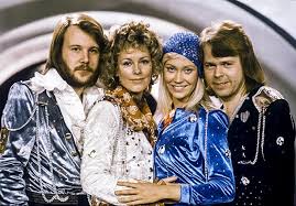
Now, I know, or at least knew, almost nothing about Abba, except that they won the Eurovision Song Contest with Waterloo, and had a highly successful career with a series of chart-topping songs that have rather more musical interest than the standard three chords and a chorus. I would recognise some of the tunes, but I know scarcely any of the words. A few years ago, the church choir in which I sing was invited by one of our members to a post-Christmas party. The children of the family had been given a game in which you had to sing along with karaoke versions of Abba hits and scored points for how well you matched the original. Everyone in the choir had a go, and most did surprisingly well, except me: I didn’t want to be a party-pooper, but truly I had absolutely no idea.
So. Georgina has been quite successful (as you will realise, if you have been following these blogs) in persuading me to abandon my blanket prejudice against musicals. But I have no idea why she thought I might like this one. The musicals I have most enjoyed have been purpose written for the stage or screen. The Mamma Mia! show and film, by contrast, shoehorn a series of Abba songs into a context for which they were not intended. Even the title song doesn’t really fit.
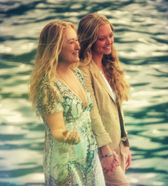
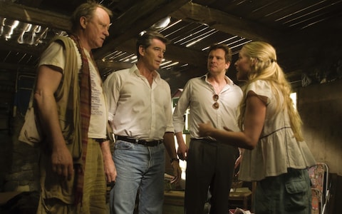
Anyway, on Monday this week I sat down in the evening and watched the film straight through. It wasn’t bad at all. The songs are undeniably catchy and achieve a surprising variety of tone – Abba’s composers, the two men in the group, do not seem to have been content to rest on their early laurels. The film is very strongly cast, with Meryl Streep as Donna and Amanda Seyfried as her daughter Sophie. Seyfried genuinely looks as if she might really be Streep’s daughter; it’s quite uncanny. Also in the cast are Julie Walters and Christine Baranski as Donna’s friends Tanya and Rosie, and Pierce Brosnan, Colin Firth and a Swedish actor called Stellan Skarsgård as the male leads. It helps that Seyfried is an excellent singer and Streep is better than competent. The men aren’t so good, but as most Abba numbers were written for female voices, that doesn’t matter too much.
The set-up is very simple. The action all takes place on the fictional Greek island of Kalokairi where Donna, with Sophie’s help, keeps a villa for paying guests. Sophie is about to be married, but has no knowledge of her father. She has discovered that it may be one of three men, and unknown to Donna has invited them all to the wedding. I won’t give away the plot, but as you can imagine there is a certain amount of comic misunderstanding and confusion, and a happy ending.
This is a classic feel-good movie. Nothing very bad happens. Baranski and Walters are well known for their comic skills, and the three men manage to keep an obvious urge to ham it up under control. If there is any hamminess it comes, rather surprisingly, from Streep – one moment of eye-rolling really should have been cut. One or two sequences are a bit sexy, but not too much; an all-ages certificate was obviously important.
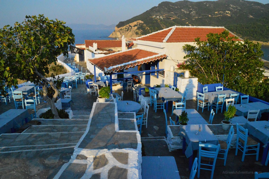
Above all, the Greek setting is gorgeous. Location filming was on a real Greek island, Skopelos, where apparently the sun shines all the time, the skies and seas are blue, the beaches golden and the scenery beautiful. There is a real holiday feel to it all. Disliking this film would be like disliking sunshine.
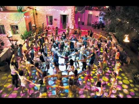
A Greek chorus, not as in Aeschylus or Sophocles, turns up in various more or less surreal ways to provide backing voices when the music requires them. There are also a couple of seemingly spontaneous (but no doubt closely choreographed) dance sequences, including what I thought the movie’s best scene, about half-way through, when on the night before the wedding a party happens in the villa courtyard. The guests all dance to the sounds of the Abba song Voulez-Vous? But Sophie is stressed out by the situation she has created which she doesn’t know how to resolve; the beat of the music, the swirling dance and her own confusion overwhelm her and she faints. It’s the film’s most sheerly dramatic moment and beautifully done. Who knew that Voulez-Vous? (not one of Abba’s greatest hits) could be so powerful?
Altogether, acceptable lightweight entertainment. But I must have had a better reason than that to watch it for a second time.
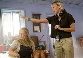
The DVD has a host of extra features (including a sing-along version which I did not try out). One of them is a full commentary by director Lloyd. DVDs often include these commentaries; very often they are disappointing, full of unamusing anecdotes, self-regarding and not at all illuminating. But occasionally they are better than that. So the second time through I played the film with Lloyd’s commentary switched on..

Lloyd started as a director of straight plays. She spent time at the Bristol Old Vic and the Royal Exchange in Manchester, then did guest productions at the National Theatre, the RSC and the Donmar. More recently she has gained a reputation as an opera director and has worked with most of the main British opera companies. So she was a pretty safe choice to direct Mamma Mia! on stage. But she had no experience at all in film when she was asked to reimagine the show as a movie. Her commentary gives a real insight into how she learned on the job.
I was a bit critical earlier of Streep as a performer, but it is clear that she had a very positive influence on Lloyd as director, offering ideas and, just as importantly, reassurance. The respect appears to be mutual. Lloyd later went on to direct The Iron Lady, a biopic of Margaret Thatcher with Streep very surprisingly in the title role; this cannot be a coincidence, though it is unclear who took the initiative. The film was coolly received by critics and audiences, but Streep went on to win the Oscar for her performance.
Lloyd was clearly ready to learn from her stars and from her crew, including the designer and cinematographer. She very wisely allowed the comic talents of Walters and Baranski room to express themselves. Along the way her commentary also reveals various secrets of the production such as the seamless interweaving of studio and location footage, how the night scenes were shot by day and processed to appear as nighttime, and how the beach was underlaid with a concrete slab (which I devoutly hope was later removed) to support the performers in a dance scene.
And beyond this, what Lloyd shows is how musical comedy has to be taken seriously. She herself is obviously not humourless, but she takes her job as director very seriously, aiming at – and largely achieving – a consistency of tone and a degree of emotional truth. The performers are given some freedom, as any good stage director will do, but no-one is allowed to steal the show. I imagine Mamma Mia! to be a girls’-night-out movie (though how would I know?), but at least it is a good one.
——————–
Cirque du Soleil
21 February 2019
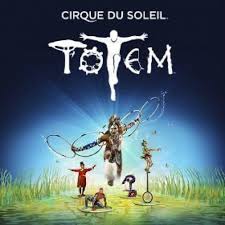
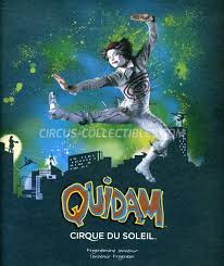
A few days ago Georgina and I went to see Cirque du Soleil’s latest show, Totem, at the Royal Albert Hall. Most of it was stunningly good, interspersed with a few less successful moments. Georgina loved it. She had not previously been to any of CdS’s productions, and was transfixed by the wide variety of mind-blowing skills on display. John and I saw one of their earlier shows, Quidam, a few years ago at the Echo Arena in Liverpool, so I had some idea what to expect. But Totem shows a step up in production quality.
Let’s take a step back. Cirque du Soleil was founded in Canada in 1984. It is, in style, a contemporary circus: there are no animal acts, but otherwise it features a range of traditional circus acts – trapeze, acrobatics, juggling, gymnastics etc – to very high standards of performance. CdS is no longer a single show but a production company with nearly 40 separate shows to its credit over the last 30 years, about 20 of which (including Quidam) have been retired. 10 of the current shows are on tour; the rest are resident, mostly in Las Vegas, a few in other places. All follow the same basic format, each production having a theme which supposedly links the separate acts on show.
I remember that John and I were very impressed by the individual acts in Quidam, but somehow felt that the show as a whole was slightly less than the sum of its parts. The promised theme was almost non-existent; perhaps we expected too much. Until Georgina expressed an interest, revisiting another of CdS’s shows had not been high on my to-do list.
Well, how wrong I was. If and when CdS bring another of their productions to London, I imagine Georgina and I will want to go again – particularly if it is staged at the Albert Hall. I hadn’t been quite sure, but in fact the Hall turned out to be an ideal venue. We had seats towards the back of the Circle (still by no means cheap!) which turned out to be a near-perfect vantage point. The sightlines are unusually good and we were easily able to see over the people in front of us. The show made extensive use of the arena space (where the promenaders stand at the Prom Concerts each year) as well as the main stage; we could see everything.
Where Totem really scores over Quidam is its superior use of sound and lighting. The music is performed live and includes a wide range of exotic elements, strongly rhythmical with much drumming in different styles, and including male and female vocals, often wordless. (I don’t know what had happened to the famous Albert Hall organ; it may have been covered by the backdrop. It certainly wasn’t in use.) The musicians were brought on-stage at the end for a well-deserved ovation.
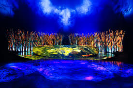
But no less deserving of applause are the lighting, set design and management. The performance area is approximately a figure 8 whose lower loop is the arena space. The upper loop of the 8 is a circular platform at the back of the Hall. On to this upper loop are projected a wide range of backgrounds – water, snow, rock, sand, waving grasses, stars and so on – which evolve seamlessly through the show. They are obviously back-projected in some way, since the performers on stage cast no shadow. I do not think we would have appreciated this so well from a lower vantage point.
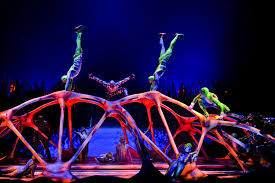
At the far side of the performance area is an element described as the “scorpion bridge.” It’s a good description. When closed, it is flush with the stage, like a metres-long trapdoor. But it can be opened, raised at the near end, projected forward into the performance area like a diving board, and at one point curled up exactly like a scorpion tail. Altogether, Totem shows CdS making far more use of the technological resources now available.
But of course it is the speciality acts that make the show. Here is a YouTube trailer for Totem, which saves me having to find words to describe what we saw: https://bit.ly/2GDoxc3. (We did not get to see the act which seems to involve performers balancing umbrellas. Apparently CdS does add or remove elements from the individual shows from time to time.) This is a very brief taste. Up to the finale, the music on the video is nothing like the music in performance; and you don’t really get any of the benefit from the staging or lighting. But Totem is a visual spectacle above all else. You will get far more of a flavour from seeing this trailer than from any words I might find.

Georgina and I agreed that we were most impressed by the trapeze duo. In a traditional circus the trapeze artists exhibit feats of daring, but this was more: the duo’s performance was more like a ballet pas de deux conducted in mid-air, stylish and beautiful as well as brave and skilful. At one point he lets her drop through his arms: truly gasp-inducing.
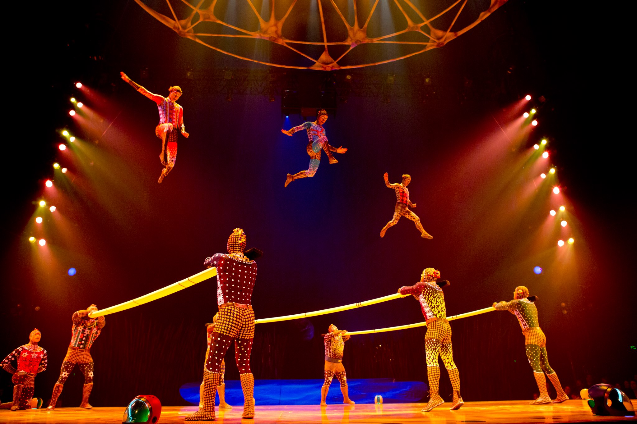
I was also very taken with the gymnastic acts that bookend the show: the pair of gymnasts on the bars, swinging round in perfect synchronisation as seen in the video, and the acrobats bouncing on springy boards and performing mid-air somersaults. The trailer only gives a weak impression of how good this was. I also liked the juggler with the glowing balls in what looked like a transparent cement mixer, but perhaps there was too much novelty and not quite enough visible skill in this for it to be a real show-stopper.
Arguably the most skilful act of all was a group of unicyclists who contrived to kick empty bowls to each other and catch them on their heads. The words and concept sound grotesque, but the performance really is amazing – such perfection of control and balance. This act was repeated at a recent Royal Variety performance, so there is a video: https://bit.ly/2ttgENM. I think we saw a longer version of the same act, but this is still pretty good. Oddly, though, despite the performers’ obvious skills it left me just a little cold: impressed, but unmoved.
The theme of Totem, very lightly applied, is the Evolution of Man. We mostly got to see this in the comedy episodes (largely clowning and mime) which filled the gaps between speciality acts, much the same as in the traditional circus. Unfortunately we found these unfunny and, indeed, largely incomprehensible. I did wonder whether we were just sitting too far away. But Michael Billington, in his review of the show, makes the same observation: https://bit.ly/2SlqyuY. And I expect he had a better seat than we did.
It’s interesting that the Guardian chose Billington, more at home with King Lear or Hedda Gabler, as its reviewer. While writing this blog I discovered that there is a history to this. A previous CdS show, Amaluna, was given a one-star review by Guardian critic Lyn Gardner, and CdS retaliated by withdrawing her Press invitation for a subsequent show. That was a stupid over-reaction by CdS, but it generated a storm of below-the-line comments on the Guardian website, and I am more sympathetic to the bloggers than to Gardner or to Billington (who was presumably sent because Gardner is persona non grata). CdS is a circus. The clue is in the name. The clowning is unfunny and the critics are right to say so; the theme is paper thin and they are right about that too; but the individual acts range from highly skilful to jaw-dropping, and they are wrong if they fail to give proper credit where it is due. I don’t always agree with Billington’s theatre criticism, but he is usually knowledgeable and fair. There are some amusing lines in his effort here but overall his snarky tone tells me that he missed the point.
Go if you can; but know what to expect.
——————–
Ministry of Flat Walks 18 : Great Langdale
3 February 2019
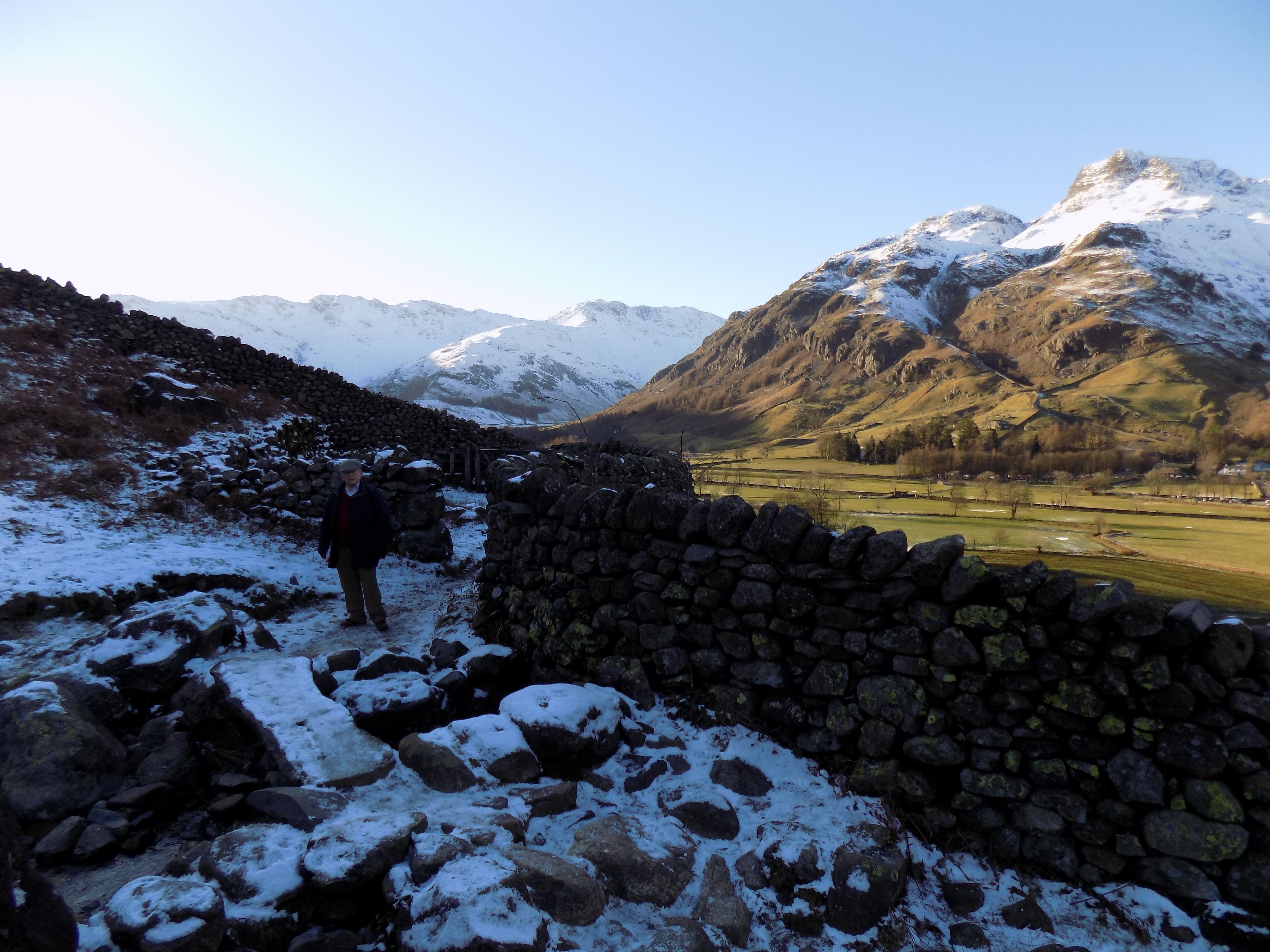
To follow this walk, open another tab in your browser and input this web address: https://bit.ly/2S6nnvT. The walk is barely three miles long, and not too hilly either – one guidebook estimates the total climb as 40 metres. However, this doesn’t mean it is easy, especially if conditions are icy, as they were when John and I completed it yesterday.
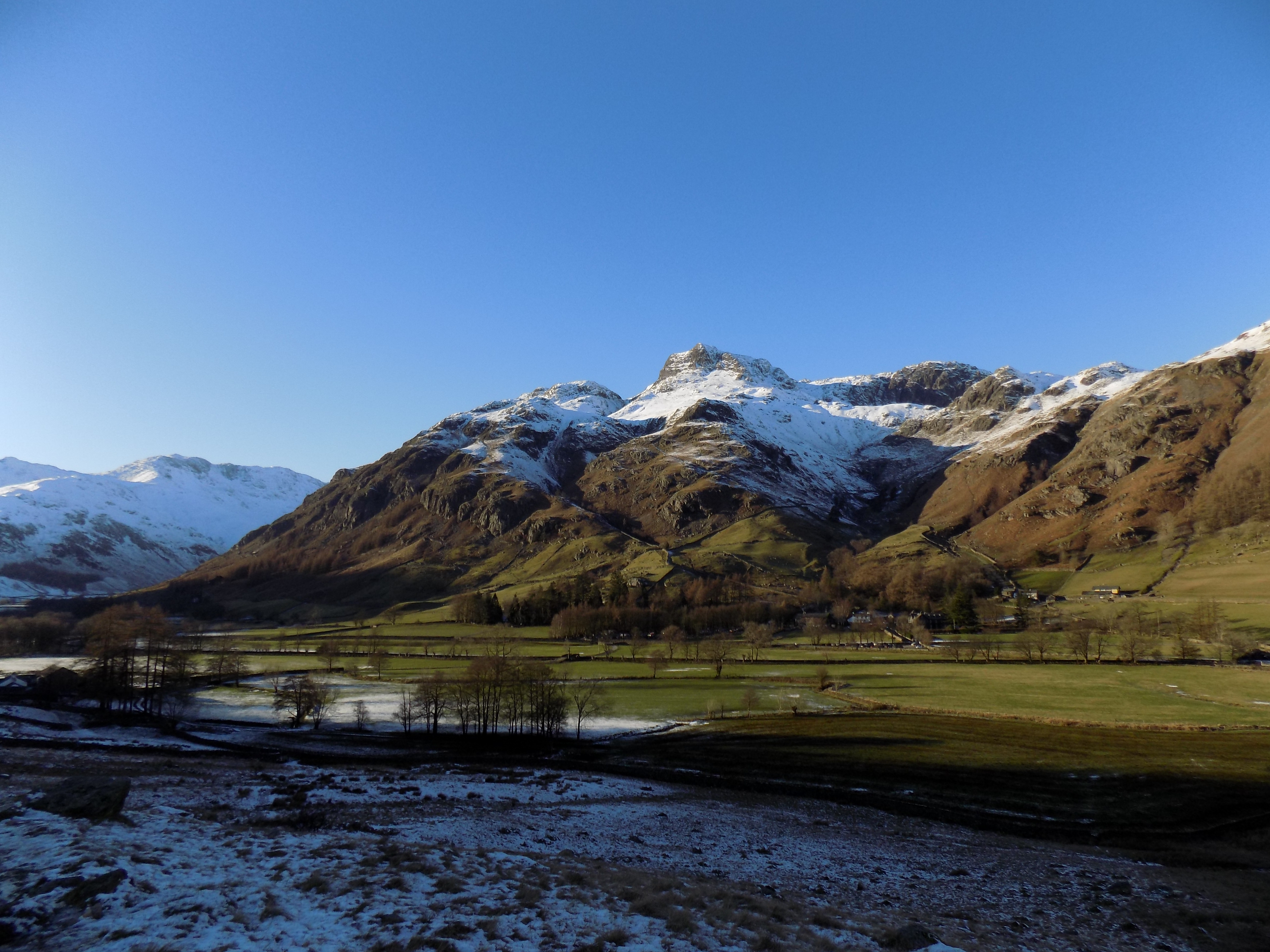
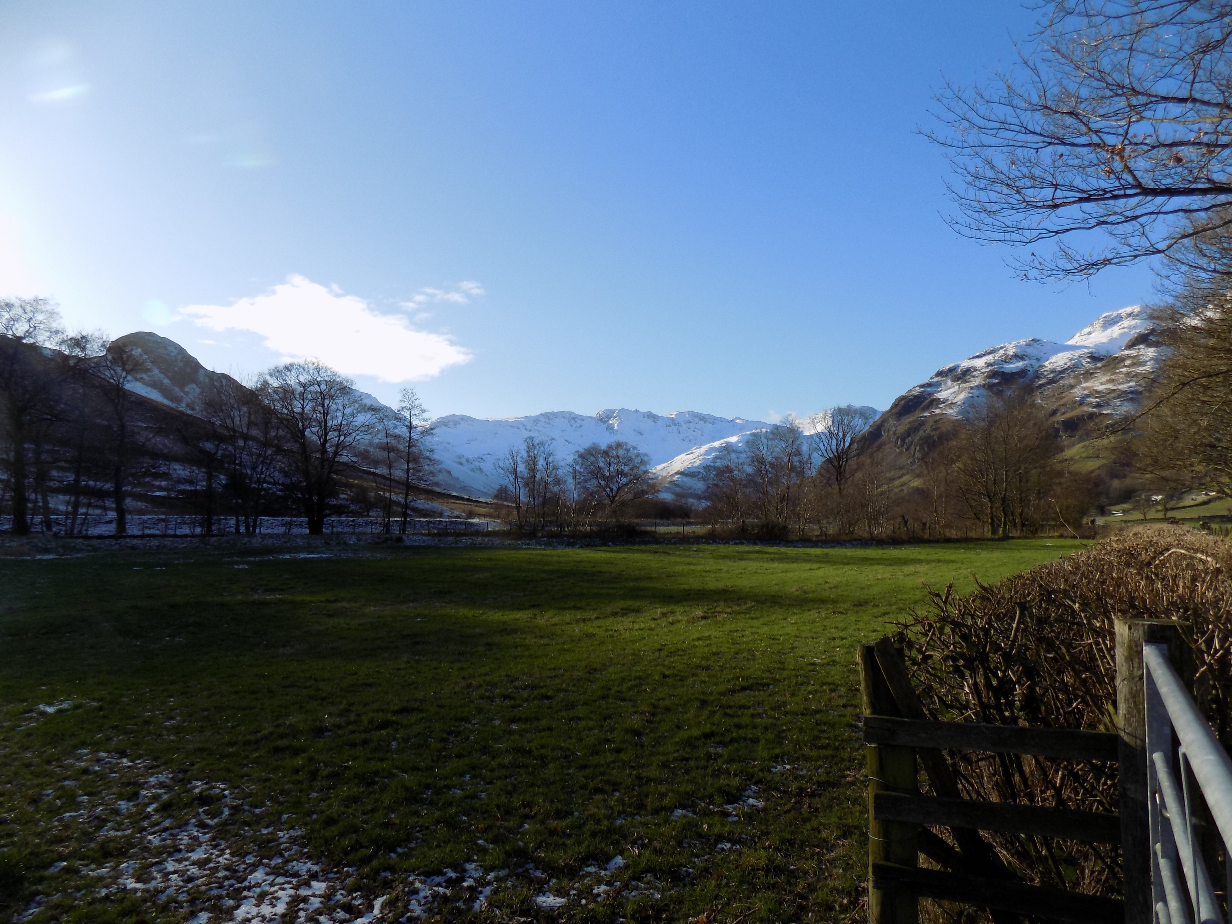
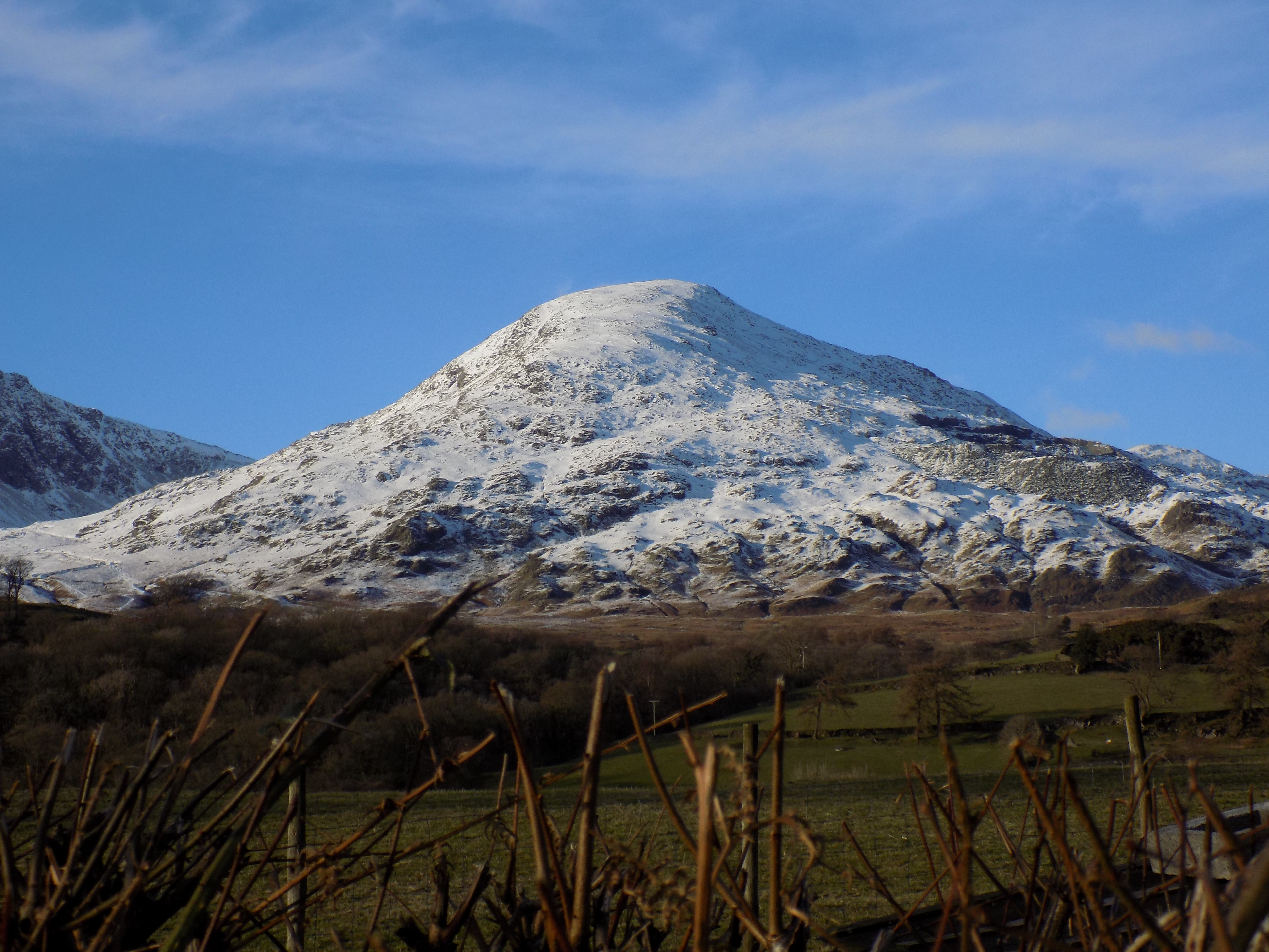
Great Langdale lies at the heart of the Lake District. It is a classic U-shaped glacial valley with steep sides and a level floor. Much of the Lake District is reminiscent of the Swiss Alps, except on a less massive scale, and this was never more true than yesterday in Langdale, with green grass on the valley floor and snowy mountain peaks all around.
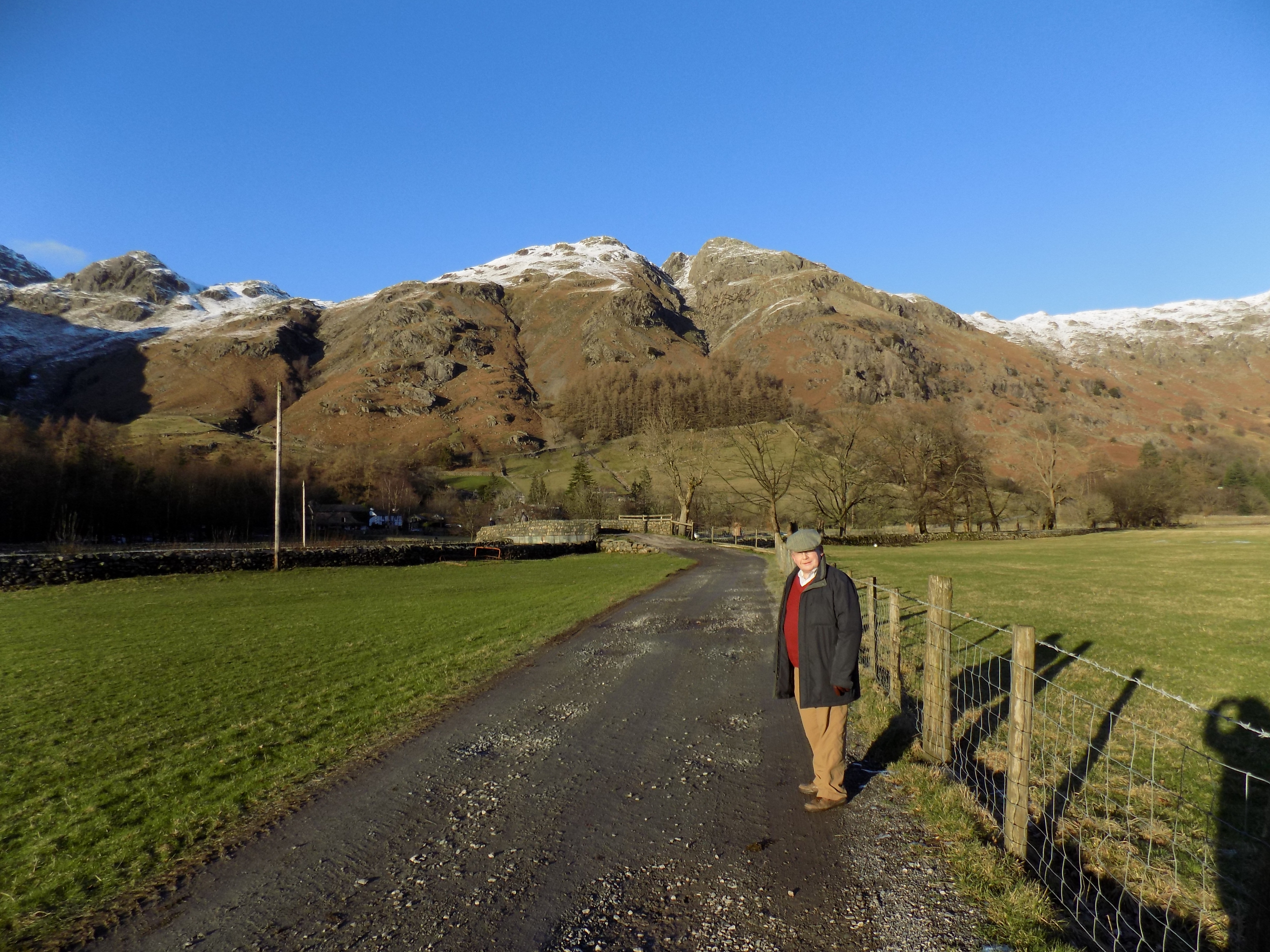
The road up Great Langdale starts at Skelwith Bridge, passes Elterwater on the left and goes through Chapel Stile, a pleasant village somewhat disfigured by three rows of horrid modern terrace houses – system-built, I suspect; I would be very cautious before I bought one of them. Location isn’t everything. The valley curves gradually to the left (ie southwards) and after about five miles you come to Dungeon Ghyll, where as well as the old hotel there are two large car parks, one on either side of the road, operated by the Lake District National Park Authority for the benefit of day visitors. I am told that the Authority earns most of its income from car parking fees, and I can well believe it.
Yesterday we parked our car in the car park on the left hand side of the road, which was not quite full. A sunny Saturday, even in early February, draws out the day trippers from as far away as Manchester, and they were to be seen in their red parkas, walking boots and bobble hats up and down the valley. In the sunshine the temperature was brisk rather than really cold, but in shadow… brrr.
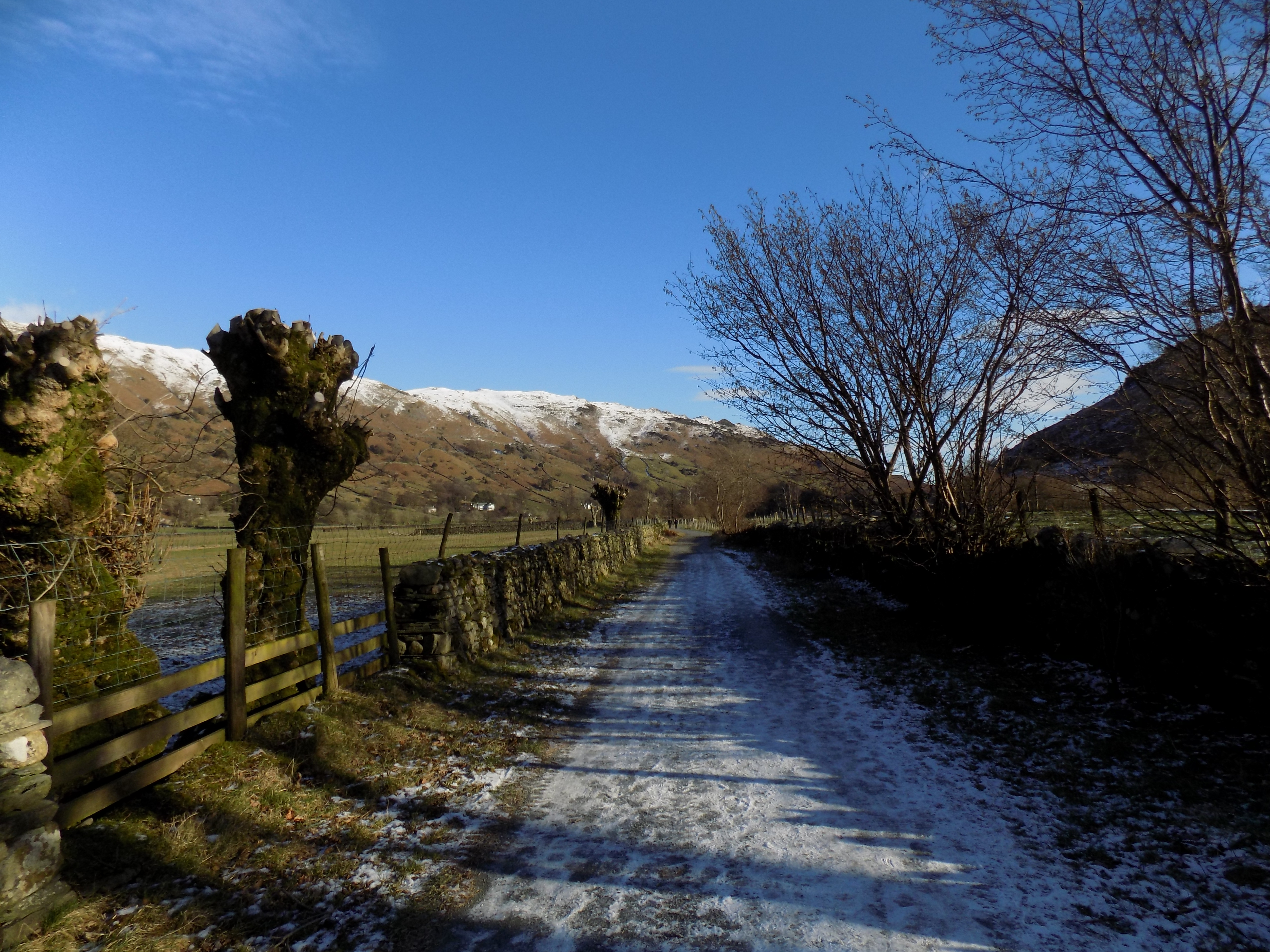
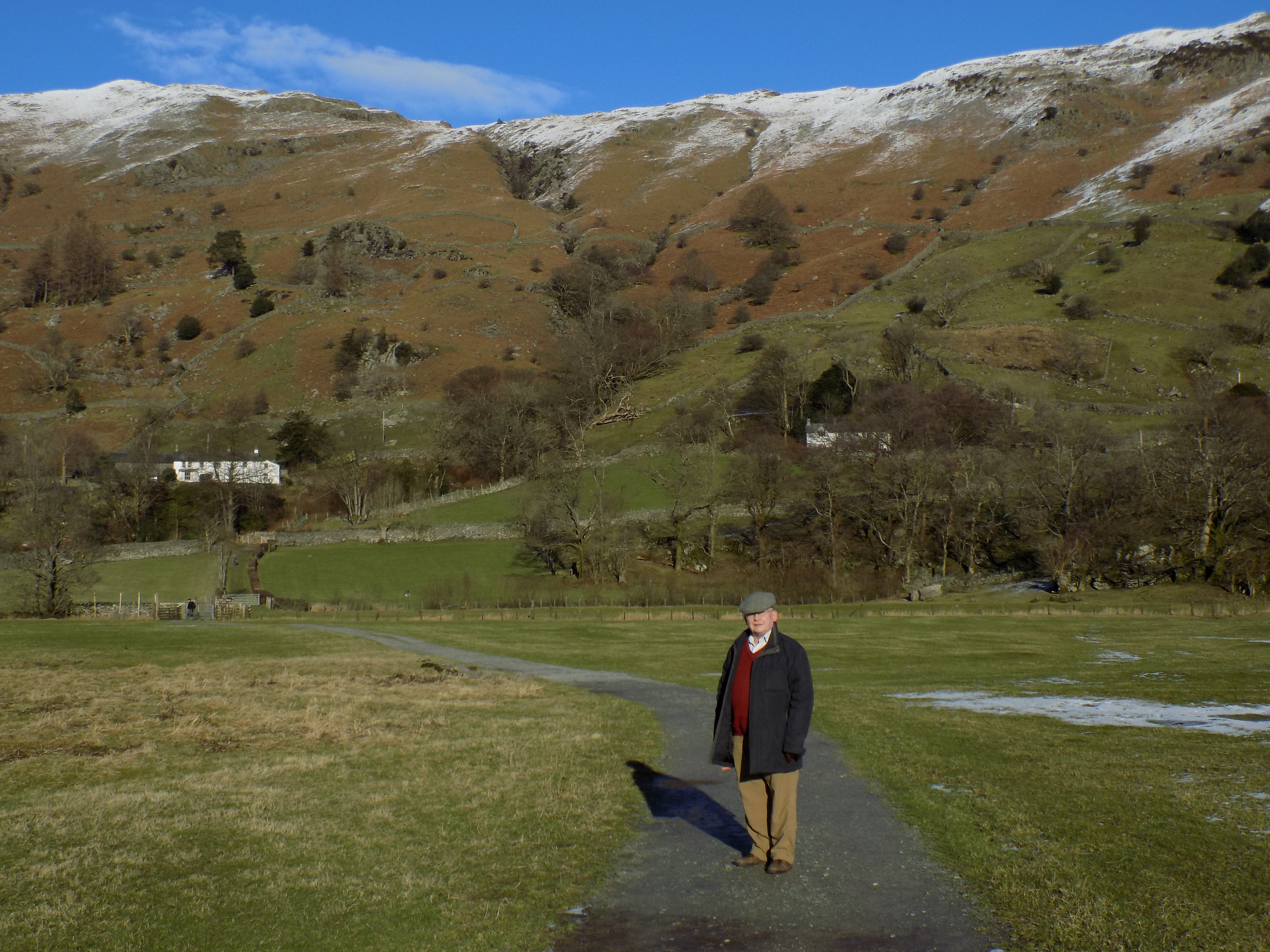
The first part of our walk took us through the sunshine back down the valley, off the road but along a public byway. On the map you can see it easily, a long row of green crosses. A byway is open to vehicles as well as pedestrians, but no-one in their right minds would drive anything less robust than a tractor along here, and in fact we did not meet a single vehicle. Despite the early afternoon sun, low in the sky, John was able to take plenty of photographs both up and down the valley, and they amply illustrate the U shape. This first stretch of the walk is very easy, snowy in parts yesterday but consistently firm and grippable.
The slightly older map which I had taken with me suggested that at the far end of the byway it would be necessary to rejoin the road for a few yards before turning on to a path leading south. But the National Park Authority has been busy here, and there is now a surfaced path, following the line of a ditch, which avoids the road. You can see this half-way down the right hand edge of the map, just below and to the left of Robinson Place.
Turn right at the end of this linking path on to a well gravelled track across an open meadow and up to a wooden bridge over the beck. Just beyond the beck is a signpost which confusingly points only to the left (towards Ambleside) and back the way you came. Ignore this and continue straight ahead to Oak Howe, another old farmhouse which looks to have been converted to a holiday home.
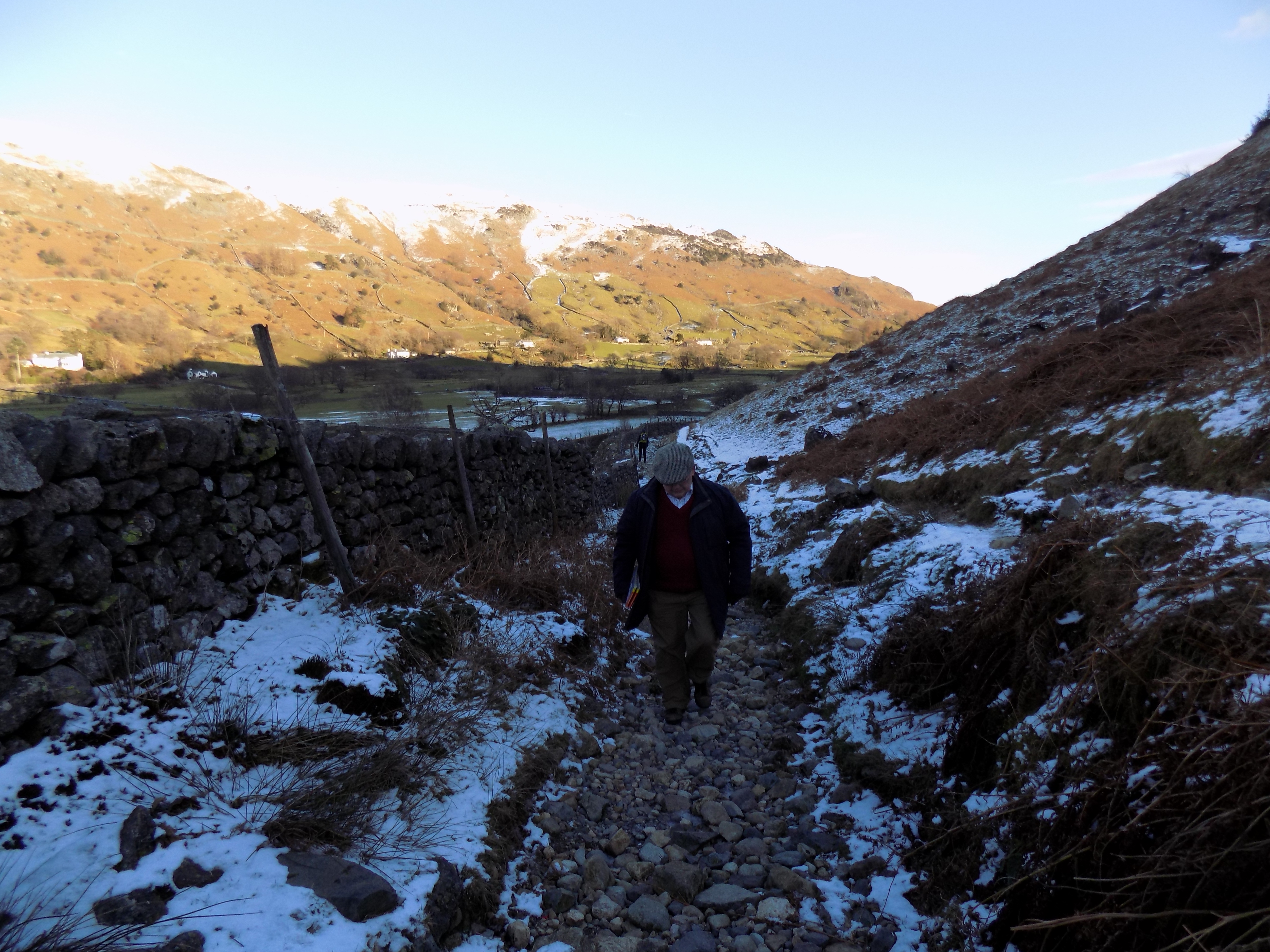
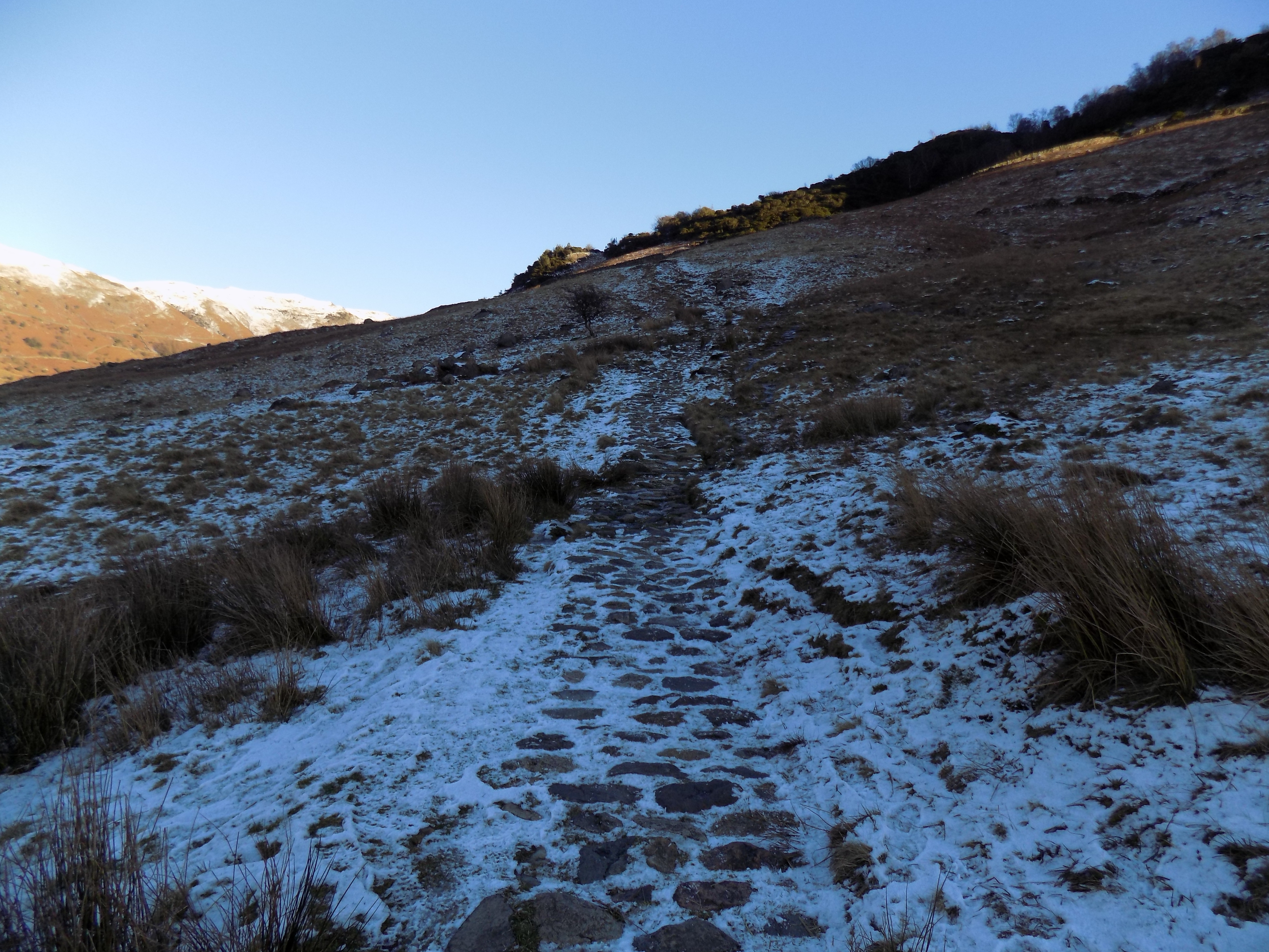
At Oak Howe, just beyond the house, there is another signpost, and here you should turn right on to a footpath. At this point you will be forced to slow down. The line of the path is clear, but the footing is rough: a mixture of mud, loose gravel and stones, and exposed areas of bedrock. It is quite uncomfortable to walk across, so make sure you have good walking boots or shoes.
This path winds its way back up the valley, clinging to the southern slope. Yesterday, in the shadow, it was cold, and made all the more tricky by ice and snow. As on the previous day’s walk, there were a number of places where water running down the hillside had followed the line of the path and been frozen into sheets of ice which were extremely treacherous. Neither of us fell, but we both slipped on several occasions. We found the best strategy was to walk on the up side of the slope, where the rough tufty grass had been stiffened by freezing to make a somewhat more secure foothold. In the grass, crystals of snow remained separate and crunchy, not coagulated into smooth ice. It was clear that other walkers before us had had the same idea, as there were plenty of footprints in the snow.
The path winds up and down along the foot of the hillside, with stone walls to the right and steep slopes to the left. After about a mile it climbs a little higher and comes to a stream cascading down the hillside, which is bridged by a single large slab of slate. Yesterday the slate was covered in ice. I successfully inched myself across, with little baby steps, but John deemed discretion the better part of valour, and stepped across a little higher up, preferring to get his feet wet rather than risk falling flat. His was probably the more sensible option.
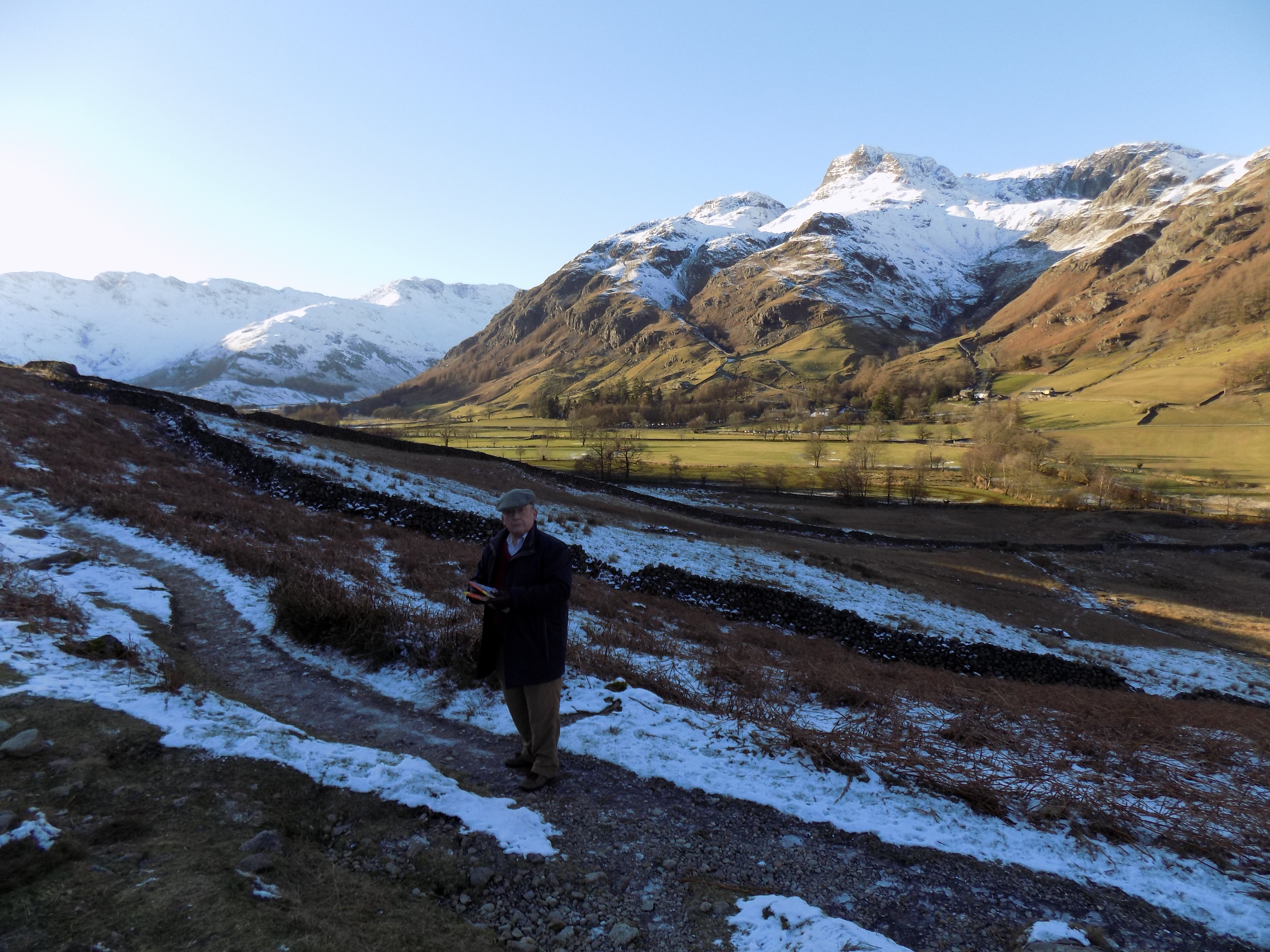
From here there is a gate in the wall and a well-made path running gently back down to the valley floor. Normally speaking, this section of the walk should be easy. The path consists of large flat stones laid together to make a walking surface like crazy paving, though with cracks between the slabs wide enough to stick your hand (or foot) into. The slope is nothing to worry about. But yesterday some of the stones, not all but it was not easy to tell which, were covered in ice, a trap for the unwary footstep. So instead we took our time across the crumbling icy ground just to the side of the steps.
At the foot of the slope is a farmyard which you enter through a gate. Yesterday the sheep smell (a mixture of damp wool, sheep manure and mud) was very strong and reminded me of a holiday we spent no less than fifty-five years ago at Cwm Pennant in North Wales. I think this must have been the smell of the farm where we stayed in a self-catering cottage. David was fascinated by some new-born kittens, and I played cricket with Dad on a patch of grass, using a tennis ball – I remember hitting the ball into the manure heap. Not for nothing do they say smell is the most evocative of all the senses.
Passing the muddy farmyard, you follow a well-made drive and turn right at the main Langdale road to reach the car park a bare hundred yards further along. The whole walk took us less than two hours, and would be even less with better conditions under foot.
I am fairly sure this walk could be extended at either end: down the valley, towards Chapel Stile and Elterwater, or up the valley, past the end of the road to the weir on Mickleden Beck. You can scroll the map to right or left to see the possibilities. In both cases I think the walk could be done with very little need to venture on to the main road, and without much climbing except perhaps on the way through the woods on the southern side of the valley towards Elterwater. We should probably try this for ourselves some day when it’s not so cold and we have more time. There is also a bus which runs from Ambleside up past Elterwater and Chapel Stile to Dungeon Ghyll; you could catch the bus one way and walk back.
Thanks to John who once again provided the photos for this blog.
——————–
Ministry of Flat Walks 17 : Torver Common
2 February 2019
To follow this walk, open another tab in your browser and input this web address: https://bit.ly/2DOItWM. The route is not at all flat, but it is too much of a favourite to be overlooked here.
John and I did this walk yesterday. We know it so well that I didn’t even need to take a map, as I nearly always do. However, last time, I had a nasty fall on the rough path by the side of the lake. Some kind people came up behind; they propped me up and gave me chocolate. We went straight back to the car and I ended up in the urgent care centre at Westmorland Hospital. I carry the scars on my forearm to this day. So yesterday we took some extra chocolate with us, just in case.
The A5084, entering the map on the southern edge at Sunny Bank, is the main northbound route to Coniston. It forks right from the A5092 at Lowick Green, about eight miles to the south. The A5092, in turn, branches from the A590 Kendal to Barrow road at a roundabout at Greenodd, east of Ulverston. We think of this route as the west side of Coniston, to distinguish it from the minor road on the east side which is more picturesque but narrower and more tricky.
After crossing the bridge at Sunny Bank, the A5084 turns away from the lake and climbs for a couple of hundred yards before swinging to the right. Just beyond this right hand bend is an open area cut into the bank on the right hand side of the road with room for about six cars to park. This is the ideal starting point for the walk and is where we parked yesterday.
There is a sign at the start of the path: Torver Common. At first the path is a rutted track, leading through one gate and up to a second. Go through the first gate, but when the track goes through the second, don’t follow. Instead, edge to the right. You are now on a rough but clearly defined footpath. The lake should be in view, and the path gradually drops down the hillside towards it, emerging just above the floating jetty at Sunny Bank. This jetty is supposed to be one of the calling points for the Coniston pleasure launch, but needs repair and is currently out of service, with no sign of when it will be back in use. That is rather a pity for Coniston-based visitors, who could otherwise use the launch to reach Sunny Bank and walk back along the shore of the lake.
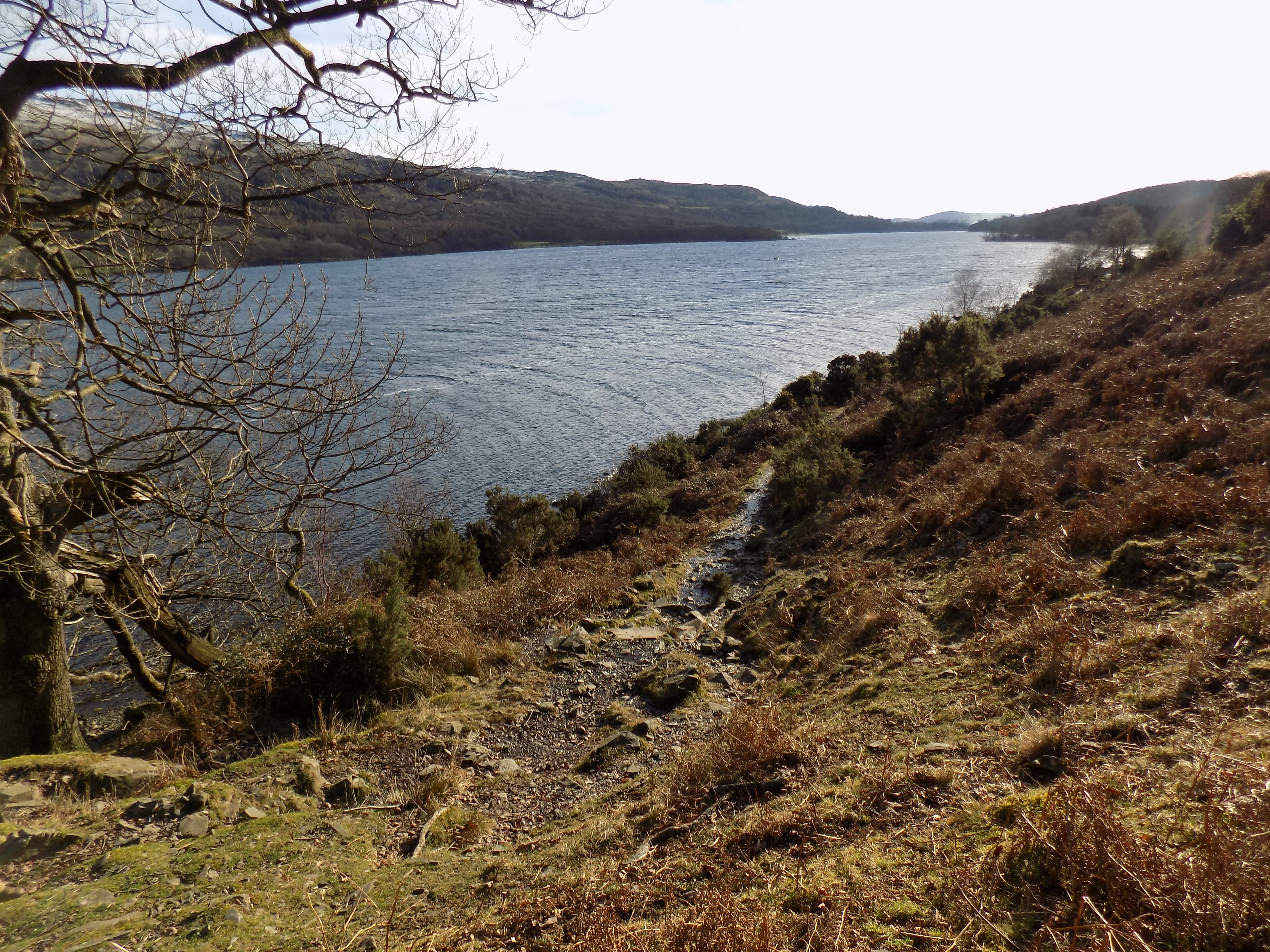
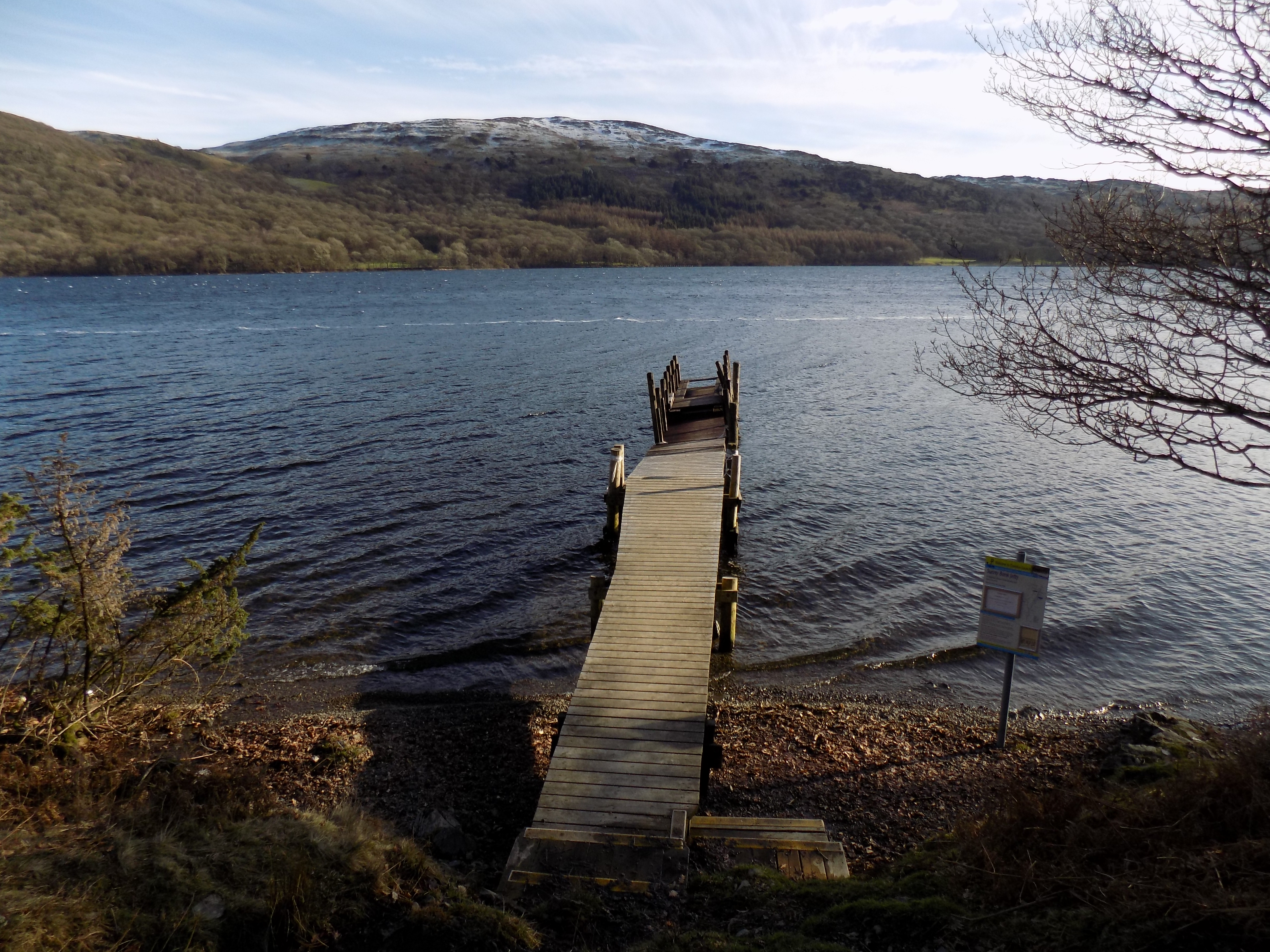
For the next mile or so your route continues along this path, with the lake just below you on your right. The views from this side of the lake are not so spectacular, as the higher fells are behind you; looking across the water, the east side is mostly woodland, without many distinguishing features. But Coniston has always been one of our favourite lakes, partly because it is very quiet. The only motor vessels permitted are the tourist launches, and yachtsmen tend to stay at the north end of the lake – there is quite a large marina now just below Coniston village. But I doubt whether many people were out yachting yesterday. Far too cold. All we saw were a couple of canoes.
The path climbs up and down, but there are no very long ascents or steep gradients. The footing, however, is often difficult: tree roots, loose stones, bare slippery rock, some muddy sections and a couple of streams which you have to cross as best you may – no bridges. Yesterday we faced the added hazard of ice in a few places which the sun hasn’t reached, although there was nothing like the snow we had contended with on the previous day.
Eventually the path drops down to a gate in a stone wall. The wall extends all the way down to the water, and a white-painted five-bar wooden fence stretches out for five or six yards into the lake, presumably to prevent grazing animals from wading through the shallows from one side of the wall to the other. On the far side of the wall the going becomes easier for a while as you enter a wood. The ground is packed earth, strewn with dead foliage and broken twigs. For a short while the path is barely discernible, but so long as you keep close to the lake on your right you should have no trouble.
On the far side of the wood is a clearing which is protected by a mesh fence topped with barbed wire. I am curious to know what it is that needs such vigorous protection. Keep this clearing on your left as you continue. On the far side of the clearing is a path which leads off to the left, up through the wood. Just ahead of you is another floating jetty, named for Torver although the village is the best part of two miles away.

The lakeside path continues from here all the way to Coniston village, turning inland near the end. Today, however, we had neither time nor inclination to go that far, and instead turned left past the clearing and deeper into the wood. The path, initially level, starts to climb, gradually at first but becoming steeper, and passing through several gates. At one point a path appears to branch off to the right, but it leads nowhere. Instead, bear left and up. The footing becomes more difficult and you will find yourself walking up a gully which has in effect become the bed of a stream, shallow and easy to wade through so long as you take care not to slip on the wet pebbles. As you climb the hill, the pebbles become larger and the footing more treacherous; you will be glad to reach the gate at the top.

By now the trees have thinned out. There is open common land on the left, and pasture on the right beyond the gate. From here the path becomes much easier. It is still very slightly uphill, but the footing is now mud with embedded pebbles and a trickle of water down the hill towards you. Yesterday this trickle had frozen, and we could actually see the ripples in the ice. It was extremely slippery and we dodged from one side of the path to the other, trying to stay on grass or gravel. There is a wall to your left and a fence to your right.
After a couple of hundred yards you come to the first farm building, and the path becomes a farm track which leads into a minor road. Turn left here and follow the road until it reaches the A5084 just south of Torver village. Turn left again here.
This is the least attractive part of the walk, almost a mile on a main road without pavements. Traffic is not usually too heavy, but there can be lorries, and oncoming vehicles may need to wait as they come towards you if anything is coming from the other direction – the carriageway is not wide enough for two cars plus a group of pedestrians. So be aware that walking here creates a hazard for others as well as yourselves.
The road at first rises gently, with several bends, across the hillside. One of the bends has been straightened out, bypassing thirty yards or so of the old road. There is a bench here where you can take a rest, facing back towards the mountains, with the cone-shaped Old Man of Coniston to the right. Soon after this, the road turns sharply left at a blind corner and you come, most unexpectedly, to a specialist garage selling and repairing Land Rovers. It is a remarkable place to find a motor business, but the garage has been here ever since we first drove along this road back in the 1960s, so I suppose it must be doing well. After the garage the road continues downhill and you soon arrive back at the starting point.
Looking at the map you should see that leading south from the A5084 at Torver is a public bridleway (green dashes) past Moor Farm to Mill Bridge, a mile further down the road. I wonder if following this route would reduce the need to walk along the main road, though at the cost of adding a few hundred yards’ extra distance. Oddly, we have never tried this, and we didn’t feel like doing so yesterday, but if we ever do and it turns out well I will amend this blog. Thanks to John for the use of his excerllent photographs.
——————–
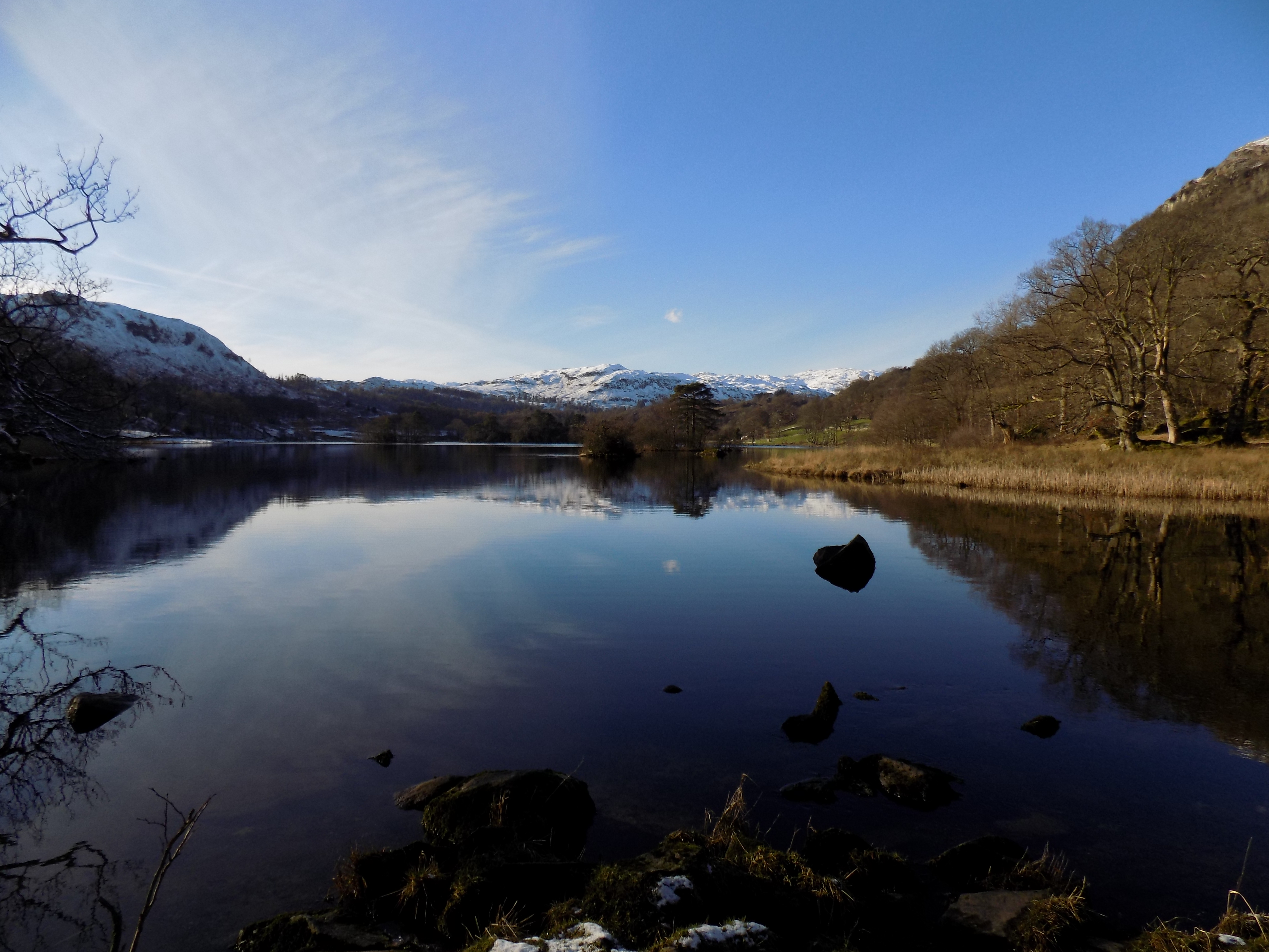
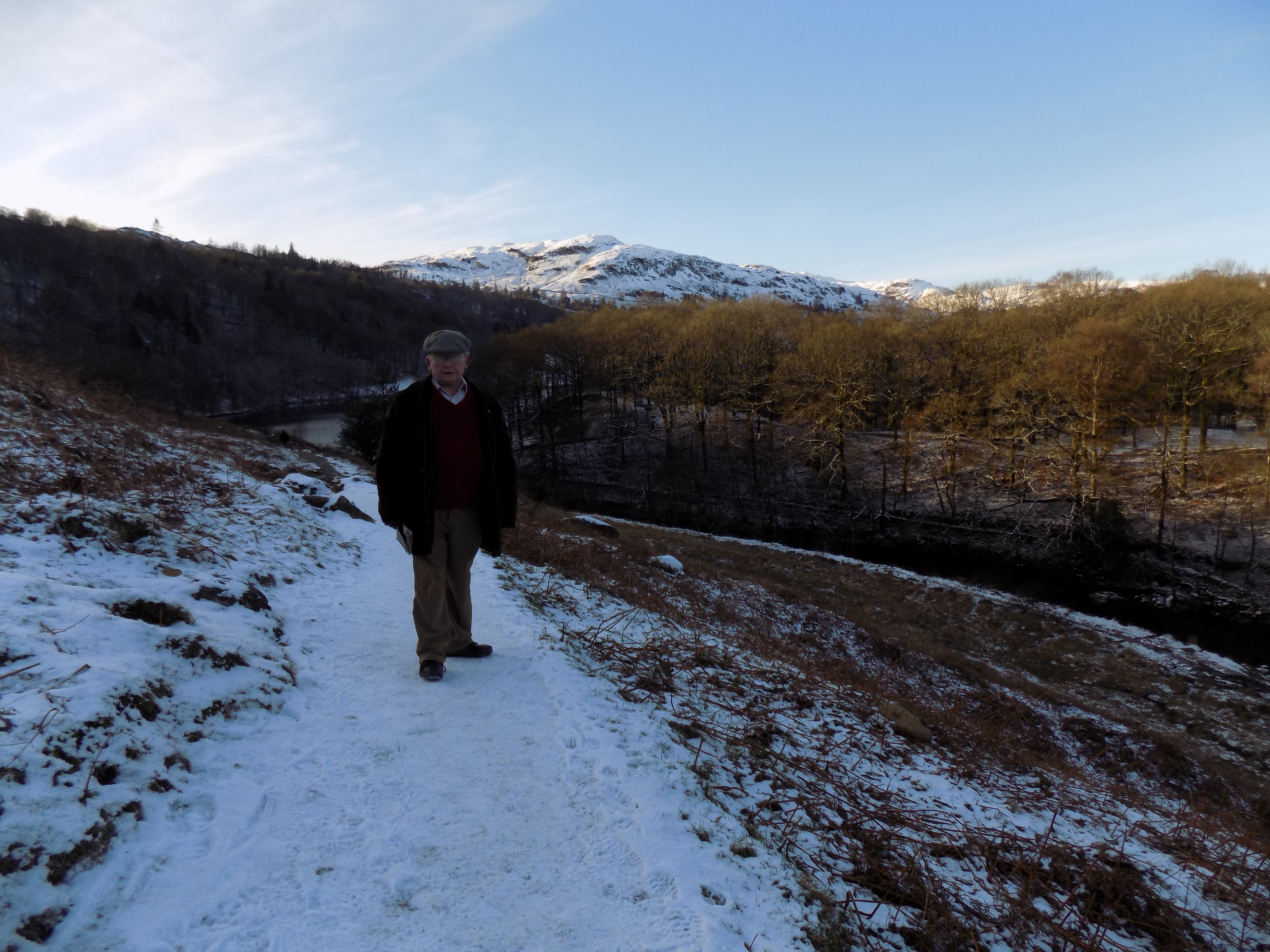
Ministry of Flat Walks 16 : Rydal and Grasmere
1 February 2019
To follow this walk, open another tab in your browser and input this web address: https://bit.ly/2TnzJME. You will need to scroll a little to the left to see the last part of the walk, which will take you all the way around two of the Lake District’s most iconic lakes, Rydal Water and Grasmere. This is such a popular area that you are well advised to stay away at summer weekends or during school holidays, though you need not go so far as to wait for winter. Confusingly, Grasmere is the name of both the lake and the village; I will try to make clear each time what I am writing about.
This really isn’t a flat walk at all. But John and I managed it yesterday, by taking our time; and there are ways of cutting out most of the steep bits, although to my mind they take away some of the interest. The full walk is about five and a half miles long, and took us about three hours to complete, including time waiting for John to take photographs. Some of his photos accompany this blog, and I’m sure you will agree they were well worth the effort. Thanks again, John.

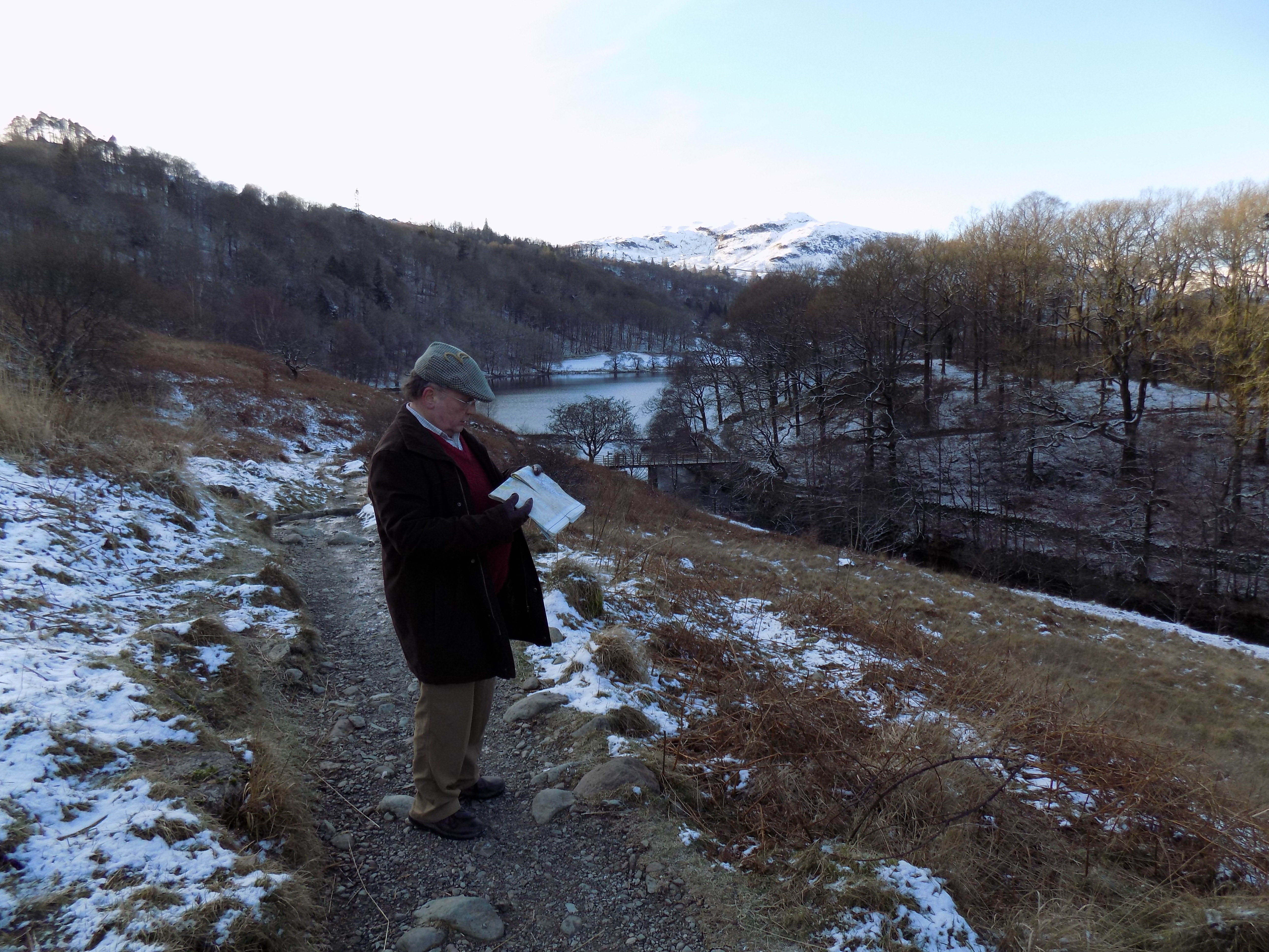
You can start the walk from a variety of places: from Grasmere, where there are public car parks, or from Rydal, where you can park on the minor road that climbs the hill next to the church, or in one of the car parks just off the A591 between Grasmere and Rydal. Or you can park where John and I did today (that’s our car in the picture), on the minor road at How Top, south east of Grasmere village and just below White Moss Common. Parking is restricted on the minor roads around Grasmere village, but at this point the restrictions come to an end and we were able to park by the roadside. There is a signpost here at the side of a weedy pond.

From here, walk up the paved lane (No Through Road) signposted to Alcock Tarn and to Rydal by the Coffin Road. Today it was very snowy. At the top of the hill the path to Alcock Tarn turns away to the left. You can see the tarn near the top edge of the map; it looks to be quite a climb. Instead, bear right here and follow the lane, which soon levels out and passes a couple more hillside houses before petering out into a rough track. This track is known as the Coffin Road: it was by this route that the dead of Rydal were once taken to their final resting place in Grasmere churchyard.
There is very little risk of losing your way here, but look out on your right for the path that drops sharply down to the main road. You might be tempted to climb up this path if you started from one of the car parks on the A591. I did this once, a few years ago. It is a steep climb, almost a hands-and-knees scramble: not recommended.
The Coffin Road clings to the hillside and at one point takes a sharp dip, with a wall just on your right. A less well-worn path avoids the dip, and you should take it if you can, as otherwise you will have a short sharp climb up the other side. Beyond the dip there is a gate, and after here the path improves, being gravelled almost all the way into Rydal village.
There are some ups and downs, but nothing very severe. At one point the path crosses an open meadow with stunning views across Rydal Water to Loughrigg Fell. By the side of the path here are a couple of stone benches where you can sit and rest. We stopped and had our picnic here. In the winter sunshine it wasn’t as cold as you might have imagined.
After another few hundred yards the path enters a muddy lane, with hillside to the left and a stone wall to the right, and soon emerges on to a paved minor road, where you turn right. The road runs steeply downhill into the tiny village of Rydal, with Rydal Hall on your left and Rydal Church near the foot of the hill on your right. When you reach the main road, cross over and again turn right. Follow the pavement here for a couple of hundred yards and turn left on to a path which drops down to a wooden bridge over the River Rothay.

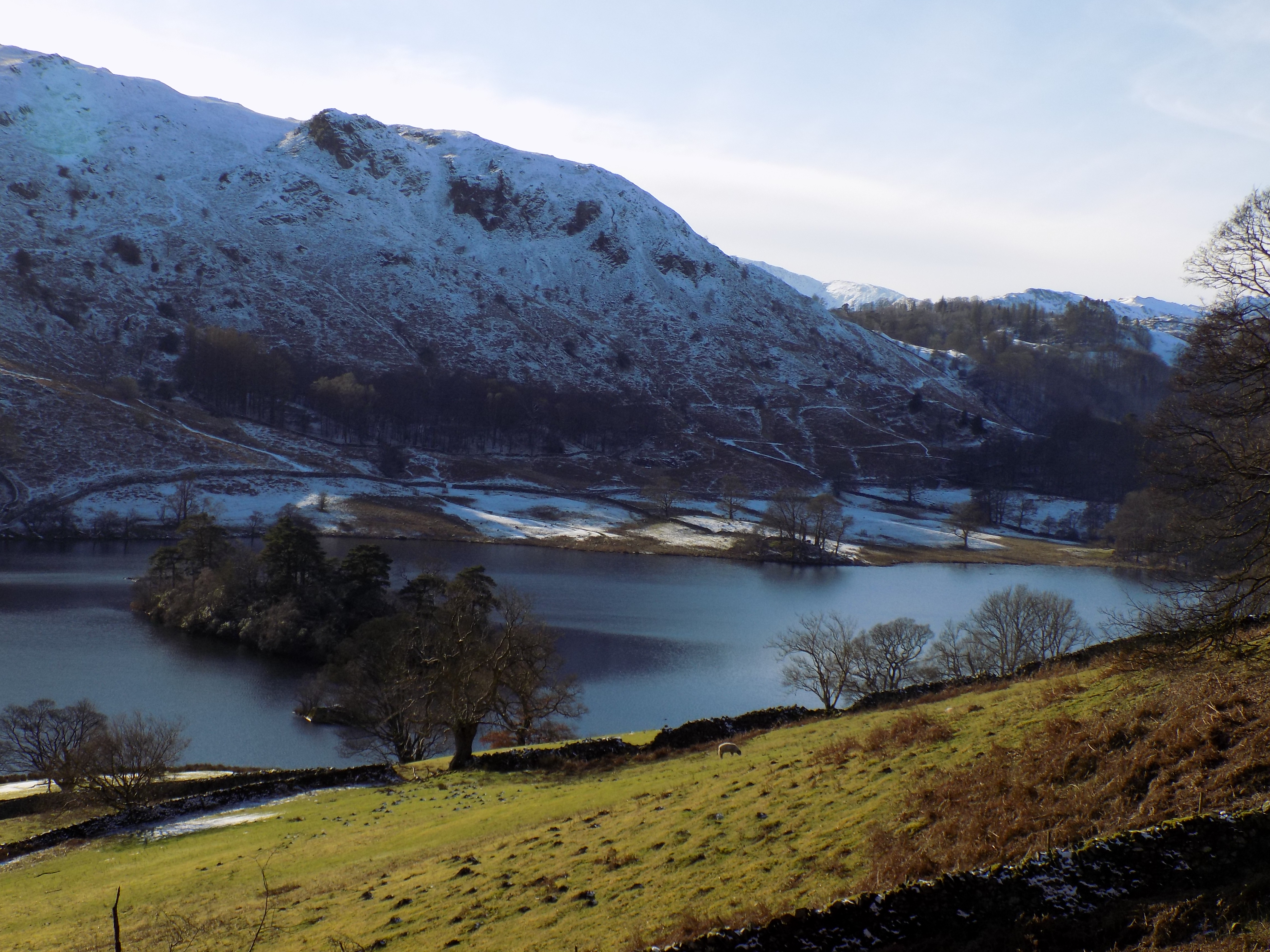
Cross the bridge and turn right, towards Rydal Water. The path passes briefly through some straggly woodland before emerging on the shore of the lake. There are some handsome views here, across the lake up to Nab Scar and Heron Pike, or ahead towards Grasmere, or back towards Rydal village. Yesterday was particularly beautiful in the clear bright winter sun, with some slopes covered in snow and others clear. The hillsides are mostly the orange-brown of last year’s bracken, but with dark patches of leafless trees, the dark green of evergreens and white snow all reflected in the clear lake surface.After a while the path leaves the shoreline and climbs gently towards some trees. At a signpost, a path off to the right leads down to a bridge over the river between the two lakes and back to the A591. You can go this way and turn left along one of the riverside paths and rejoin our walk further on; this would add distance, but avoid an annoying climb. Otherwise, if you carry straight on from the signpost, the path climbs over the brow of a hill before dropping down to the lake shore at the south end of Grasmere. Near the top of the brow another track branches off to the left and continues climbing. You can go this way if you want (marked Loughrigg Terrace on the map) but it adds height and distance for not much benefit.
This section of the walk was particularly tricky yesterday since it was icy as well as rocky and steep. We had to resist the temptation to look up as we walked, for fear of losing our footing: a strong temptation, since the view now opens up northwards across the lake towards Grasmere village and the fells on either side.
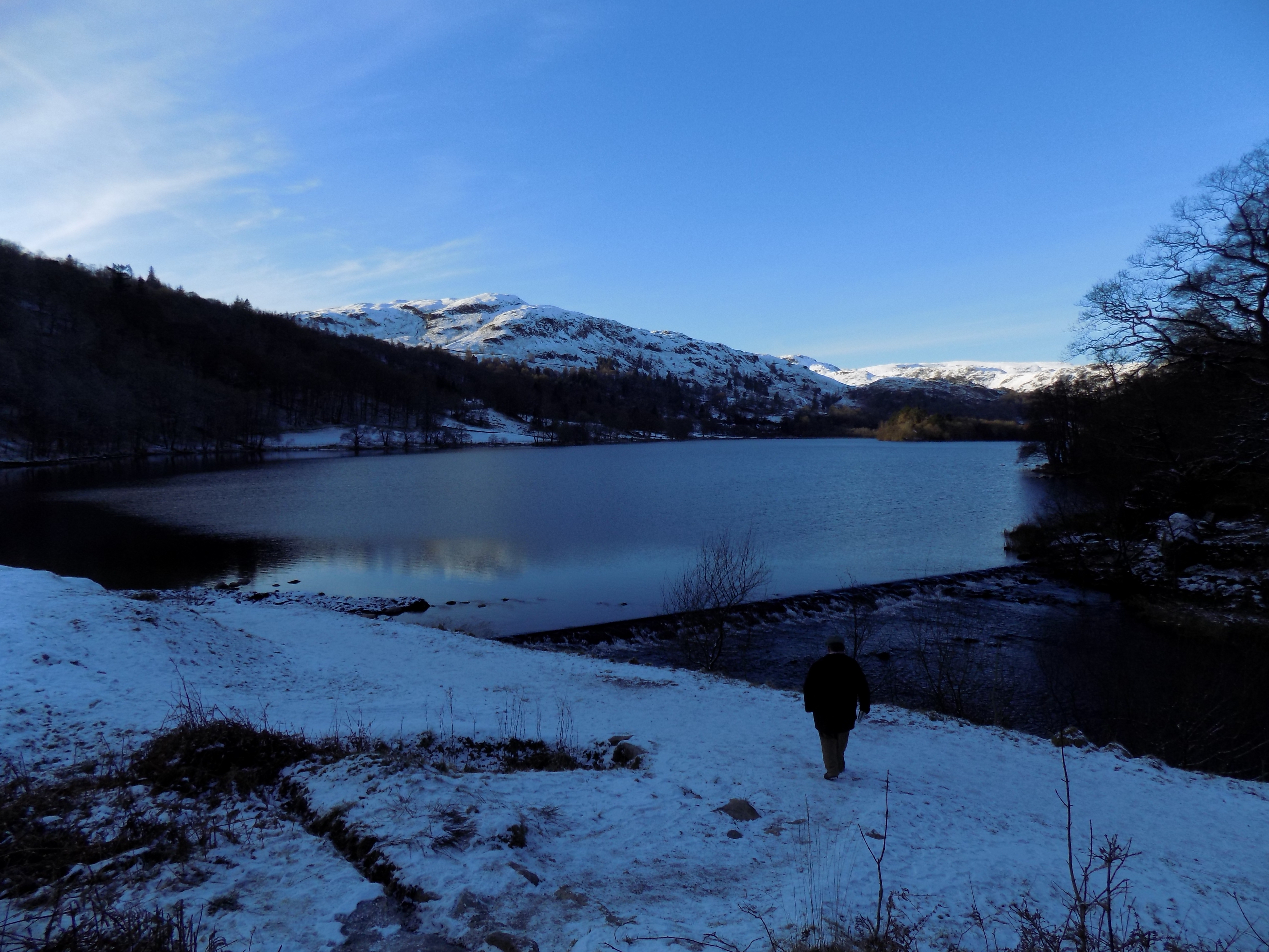
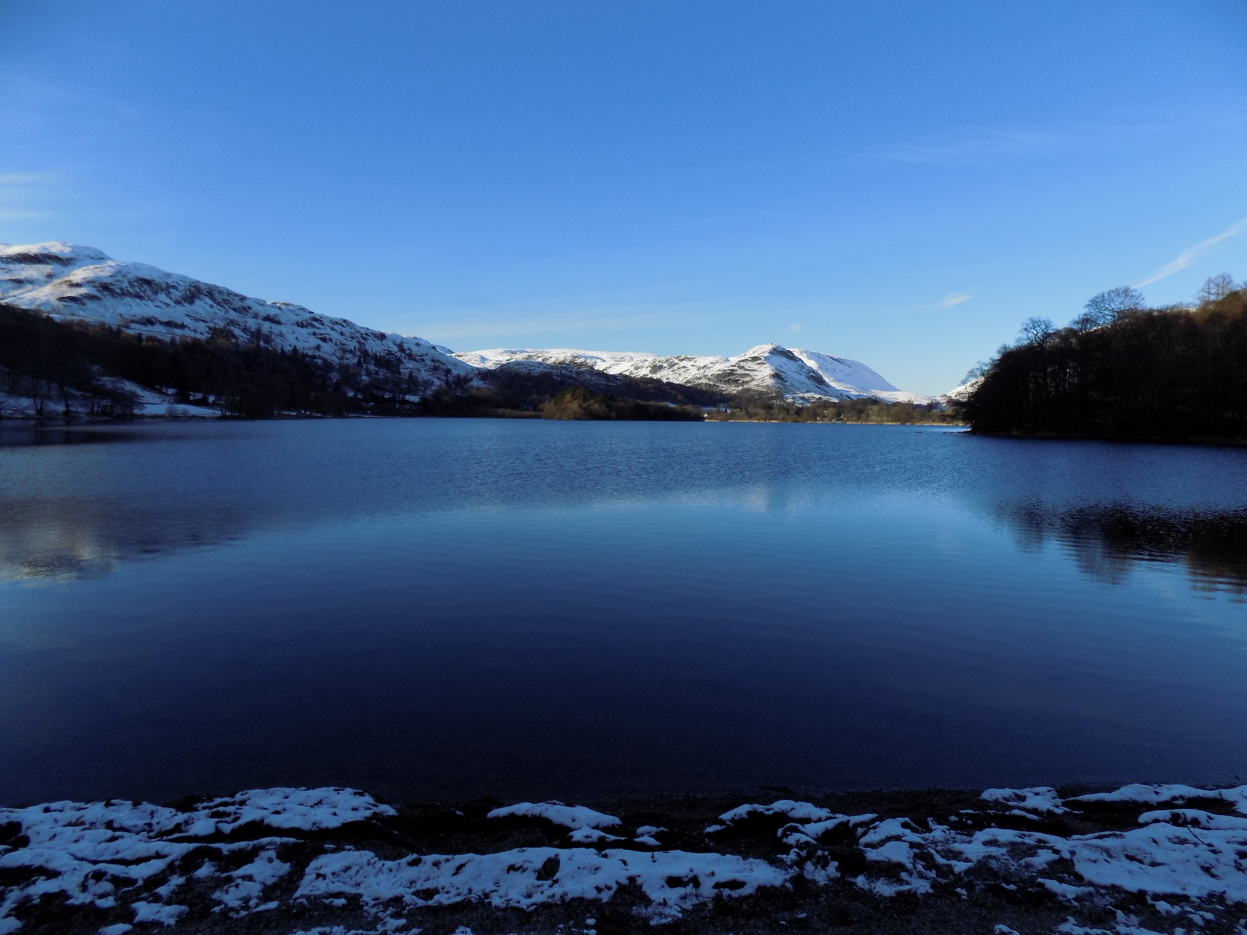
The path drops down to the lake shore, rejoining the riverside path, and continues along the lake side, through a band of trees and then on the edge of a meadow, for another half mile or so. The views over the lake are pretty good here, and in yesterday’s sun and snow were just stunning.
It is several years since I last walked this route, and I had hoped that the path might by now have been extended along the side of the lake all the way to Grasmere village, but no; it turns sharply away from the lake, climbs the hillside (not too steep, but very frustrating) and from here you must follow the minor road all the way into Grasmere village. Yesterday there was very little traffic, but later in the year this road, which crosses the fells from Langdale, can become quite busy.
The rest of the walk is easily described. In Grasmere village, take two right turns, first in front of a hotel, and then in front of the church, which by the way is a Grade 1 listed building and worth a visit of you have time (we did not). Grasmere is full of shops and cafés catering to visitors, but yesterday it was almost deserted and most of the businesses were closed.
Now follow the road to where it meets the A591 at a mini-roundabout. Cross the main road and take the lane with a 6’6” width restriction on the far side of the junction. Passing Dove Cottage on your left (also worth a visit, but be sure to go off season), you climb a hill and return to our starting point.
The hills around White Moss Common and the Coffin Road can be entirely avoided of you opt to follow the main road. There is a footpath, mostly at the edge of the road, occasionally ducking a few feet away from it, all the way round between Grasmere and Rydal villages. But this is a busy, noisy road. Most of the views are hidden by walls and trees, and you will altogether not gain much pleasure from going this way; not to mention being poisoned by the traffic fumes. You are much better struggling up the hills, which are manageable if you don’t rush at them.